The Tumen River, a river in northeastern Asia, originates at the eastern foot of the main peak of the Changbaishan Mountains on the border between China and North Korea, and flows from south to north through the four counties of Helong City, Longjing City, Tumen City, and Hunchun City in China, the Hassan District of North Korea's Liangjiang Province, Hamgyong Province, and Russia's Primorsky Territory, and flows into the Sea of Japan at the border between Russia and North Korea.
The total length of the main stream is 525 kilometers, the length of the Sino-DPRK boundary river is 510 kilometers, and the Russian-DPRK boundary river is 15 kilometers. The total basin area is 33,168 square kilometers. The total drop of the river is 1297 meters, and the average slope drop is 1.2%.
The Tumen River was originally an inland river in China, and before the 15th century, the two sides of the Tumen River were the territory of the Jurchen ethnic minority in China. After the establishment of the Ming Dynasty, by appeasing the Jurchens, local administrative organs were set up on both sides of the Tumen River, and the south bank of the Tumen River was once the territory of the Ming Dynasty.
In the middle of the 15th century, the six towns of Huining, Funing, Zhongcheng, Wencheng, Qingyuan, and Gyeonggheung were set up along the south bank of the Tumen River, marking the beginning of the Tumen River as the boundary river between China and North Korea.
As the only passageway for China into the Sea of Japan, the Tumen River also passed the Treaty of Yaohun and the Treaty of Beijing under the threat of force of Tsarist Russia, and the coastal areas of the Tumen River estuary were assigned to Russia, and China lost its right to the sea.
Historically, the three northeastern provinces of the mainland were all coastal areas near the sea, and up to now, in addition to Liaoning, which still has access to the sea, Heilongjiang and Jilin have lost their access to the sea and become inland provinces.
The reason is because of the corruption and incompetence of the modern Qing government, and in 1858 and 1860, it signed the "Sino-Russian Treaty of Yaohun" and the "Sino-Russian Treaty of Beijing" with Tsarist Russia, which humiliated the country.
The Sino-Russian Treaty forced China to cede more than 600,000 square kilometers of land and lost access to the Pacific Ocean. The Sino-Russian Beijing Treaty not only lost more than 400,000 square kilometers of territory, but also lost the original sea outlet to the Sea of Japan.
Until 1860, China had been a littoral state in the Sea of Japan.
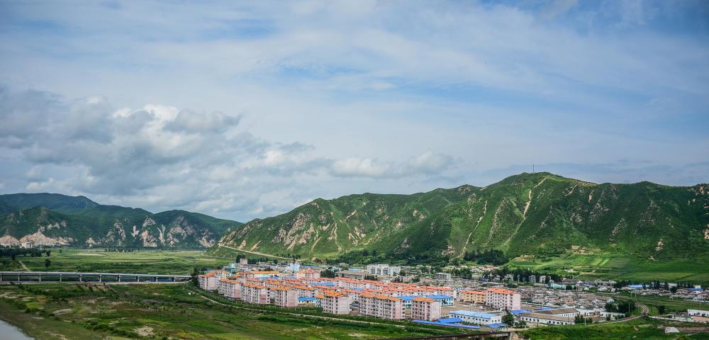
About 70 kilometers south of Hunchun City in Jilin Province, there is a village called Fangchuan Village, which is located on Jiangxinzhou on the Tumen River, which is the border between China, North Korea and Russia, and the end of China's northeast mainland, only 15 kilometers away from the Sea of Japan.
In this place, you can "look at the three kingdoms at a glance". Standing in the village to the east pole overlooking, people can see the waves of the sea, although the sea is close at hand, but the Chinese can only look at the ocean and sigh, just because of this 15 kilometers, the northeast has lost an important outlet to the sea, the geographical advantages have been completely lost, so that economic development has been seriously affected.
Looking at the current administrative division map of China, you will find that Jilin is the smallest province in the northeast. However, in the early years of the Qing Dynasty, the area of Jilin Province was many times larger than it is now, not only including today's Jilin Province, but also parts of Heilongjiang and Liaoning, and more importantly, because of its proximity to the Sea of Japan, Jilin's coastline was particularly long, so the maritime trade in Jilin was very developed at that time.

During the Qing Dynasty, an important reason why the northeast region fell into long-term economic decline and could not develop was that
The Manchu Qing Dynasty regarded the northeast as its "land of dragon rejuvenation",
A series of relevant management measures have been introduced for the northeast region.
The prohibition of Han Chinese entering the reclamation and development of the land led to the sparse population of the northeast, the slow economic development, the lack of border defense, and the situation of "having no border defenses", which objectively created favorable conditions for the territorial expansion of Tsarist Russia
。
Due to the long-term influence of traditional Confucianism, China's traditional tradition has been adhering to the concept of "under the whole world, there is no royal land", resulting in many places without borders at all, as long as the Chinese civilization is orthodox, everyone is a family. Under the influence of this concept, many land-cutting treaties signed by the Qing government finally had major problems in the demarcation of the boundary.
In fact, after the signing of the Sino-Russian Beijing Treaty, China still has sovereignty over the mouth of the Tumen River. However, due to the pedantic behavior of the Qing Dynasty supervisors at that time in surveying the border with the Russian side, the outlet of the Tumen River was lost.
At that time, the Qing government sent Cheng Qi, the minister of Chincha, to the border to jointly draw up 12 land boundary markers with Russian representatives.
In the originally defined boundary, the beginning of the land cut is on the east bank of the Tumen River Estuary, the land along the north bank of the River Estuary is still owned by the Chinese side, and the border between the two countries is about 20 miles away from the River Mouth.
Thus
Even though China and Russia signed a treaty, the Tumen Estuary at that time still belonged to China.
However, in the process of demarcating the border between the two countries, unexpected accidents occurred.
The Qing government's name for the demarcation of the border was Cheng Qi, who was then a waiter in the hubu warehouse. He had a hobby and liked to smoke opium. Just when the two sides agreed to jointly map the location of the boundary monument, the adult smoker was addicted, coupled with the heavy rain and muddy roads at that time. therefore
He actually ignored the important matter of demarcation of the boundary monument, and ran back to Jilin City alone to go to the smoking addiction.
At this point, the demarcation of the border was entrusted to the Russians. Taking advantage of this opportunity, the Tsarist and Russian boundary surveyors unilaterally drew a boundary map, assigning the Hanqi coast that was supposed to belong to China to Tsarist Russia, and the Russians even placed the penultimate "soil" monument in China, more than 40 kilometers away from the Sea of Japan.
Because of this demarcation, Tsarist Russia annexed the Hanqi coast and the village "Mokowei" located here, which was later changed by the Russians to the current "Poseyet Bay", and at this point, China lost the mouth of the Tumen River.
Fortunately, later, the left deputy capital of the Duchayuan, Yushi Wu Dahui, discovered this situation, risked his life to write to the Qing government, and argued on the basis of reason at the negotiating table, pushed the "tu" stele outward, and snatched back the jingxin town of Hunchun, otherwise, now Chinese could not even see the sea.
After the negotiations, Wu Dahui replaced all the tattered wooden plaques left by Cheng Qi, re-erected 36 stone tablets, and erected a bronze boundary stele with the inscription:
The territory has a table and a dimension, and this column can be immobilized!
13 big words. Compared with the Manchu Qing ministers Yishan and Chengqi, who were in high positions,
Wu Dahui's behavior is indeed admirable and worthy of being a national hero.
Now we return to the early Qing Dynasty, because the loss of the sea passage caused huge losses to the economic development of Jilin Province.
In 1886, Wu Dahui, the Minister of Beiyang of the Qing Dynasty, signed the Treaty on the East Boundary of Hunchun between China and Russia with the Russian Minister, which clearly stipulated that Chinese ships could not be obstructed from entering and leaving the Tumen River.
Therefore, at that time, Jilin Province could still reach the Sea of Japan along the Tumen River, although there was no port construction on the seashore at that time, but Jilin ships could enter and exit the Sea of Japan, and a large number of specialties could also be transported by sea for foreign trade.
However, due to the outbreak of the Korean War, the Soviet Union built the Tumen River Railway Bridge in the name of transporting military supplies to Korea. It now seems that the purpose of the Soviet Union in building this bridge was not simply to transport supplies. The bridge is 530 meters long and is an 8-hole, 60-meter steel-framed iron bridge.
The height from the bottom of the bridge to the normal water surface is 9.6 meters, of which only 3 holes can be used as navigable holes. Because the bridge is too low from the water, only small boats can enter and exit, and large ships cannot pass at all. In addition, there are more than 10 piers about 1 km upstream of the railway bridge, and the whirlpools they form create some sandy beaches in the river channel, causing siltation at the mouth of the sea.
In 1991, China and the Soviet Union signed the "Agreement on the Eastern Section of the Sino-Soviet Border", which stipulated that the Soviet side agreed to the chinese vessel (flying the Chinese flag) to sail back and forth along the Tumen River through the sea, and in 1992, with the approval of the two countries, China restored the right to sea on the Tumen River. However, due to the low height of the Russian-North Korean Bridge and the siltation of the river, only small boats of less than 300 tons can pass, and the Russian side has also proposed harsh conditions, only allowing seasonal fishing boats to go to sea, and not allowing commercial vessels to go to sea.
Therefore, through this bridge, it is easy to curb the export of foreign trade in China's Jilin Province, and Jilin Province has also raised the question of whether the bridge can be rebuilt to be able to pass large ships. However, Russia and North Korea seem to have reached a tacit agreement on this issue, and they agree that the status quo should be maintained!
Maintaining the status quo also means continuing to block trade with China's Jilin from the sea, thus achieving the purpose of restricting the economic development of Jilin Province, which can be said to be very obvious.
epilogue
History has proved the truth that "if you fall behind, you will be beaten"!
Taking history as a mirror, if a nation wants to gain the opportunity to develop and rise, it must realize the importance of consolidating border defense, strengthening national defense construction, and building a strong army. Although China has loved peace since ancient times and has never sought foreign expansion, we must not tolerate any acts of aggression.
History has passed, the humiliation left behind can only become an eternal pain in the heart, and it is hoped that with the strength of China's national strength, when the dream of the rejuvenation of the Chinese nation is realized, the mainland can reproduce the style of the Han and Tang Dynasties!