The light of history is faint, but it exudes the seductive glow of food that we need to see.
In the previous text, we said that today, the apples that people enjoy originated from wild apples in the northern Xinjiang region, so when I wrote this text, I suddenly thought of the light emitted from the skin of the apple and the seductive fragrance emitted by the apple. Take a deep breath, in the long aftertaste, the apple of history was not only seen and smelled by me, but also the feminine and brilliant nature of the sun, and the vague and feminine call of the senses, especially the stomach.
About the song
"The Shepherd of the Cocoto Sea" is a song: "The rain of that night did not keep you, the wind of the valley accompanied me to cry, and your camel bell seemed to still ring in my ears..." Singing the love story of the shepherds and beekeepers on the cocoto sea grassland, who truly loved each other but were helpless to separate in their wandering life. The beekeeper finally left and married into Ili. It was said that it was a rainy night, and as she walked, she listened to the shepherd singing this song, and her face could not tell whether it was rain or tears.
The sad story will make people have too many questions in the sadness and loss, and I hope that this poignant love story can have a little bit of consummation. So someone asked me, "Can a beekeeper marry into Ili?" "I said yes. Why? I have seen such a thing, Aksai Kazakh Autonomous County belongs to Jiuquan City, Gansu Province, located in gansu, Qinghai, Xinjiang three provinces (districts) intersection, is the only Kazakh ethnic minority autonomous county in Gansu Province, 3 years ago, when I was interviewing here, I met a Kazakh shepherd, I asked him: "From Aksai can nomadic to Altay or Ili?" He said: "Drive the sheep, go where to eat, where to live, 3 years to go back, 3 years to come back." ”

What kind of concept is this? 3 years is just a number, where to eat, where to live is the nature of grazing, not necessarily "Spring Lake Autumn Mountain" (in the past, nomads generally gathered at the lake in the spring, and went to the mountains and forests to graze in the autumn, which is what we now call the transition of winter pasture and summer pasture), as long as they want, they can go to any place on the grassland. This is how the Kazakhs in Gansu come from today, and some even call them "Gansu Kazakhs." It is said that in the 1980s and 1990s, a small number of them returned to Ili in the same way. Even if any of them wanted to get together with their relatives on the Ili steppe, they would take this approach at any time.
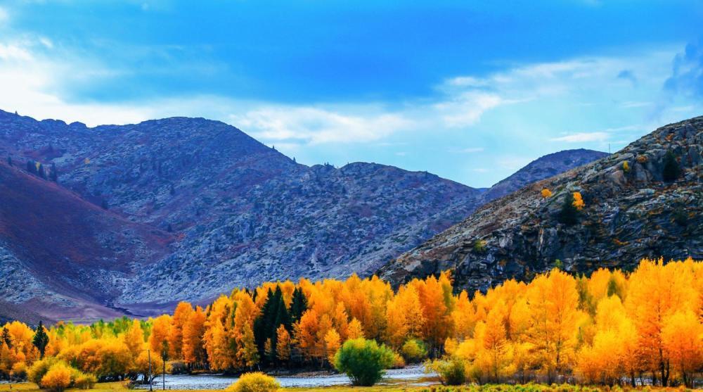
Most of the nomadic history is the footprints of sheep on the grassland, which will be blown away by wind and rain in a few days, except that it is difficult for people to examine their specific survival. The beekeeper of the Cocoto Sea thus married into Ili. Cocoto Sea generally refers to the town of Cocoto Sea. It belongs to Fuyun County, Altay Region, Xinjiang, and is located in the north of Fuyun County, bordering Turhong Township to the east, Tiemaike Township to the south and west, and Mongolia to the north. There is a scenic spot here , the Cocoto Sea Scenic Area, also known as the Cocoto Sea National Geopark. The scenic area is composed of four parts: Irtysh Grand Canyon, Coco Suri, Lake Iremut, and Kalassenger Earthquake Fault Zone.
If there is still a "sea" to be found, it is Lake Iremut. A blue bend, 7 km southwest of the town, formed by the confluence of the Irtysh River and its tributary, the Cayter River, is a reservoir-type lake dammed by the barrage. It is 5-6 km long from north to south, 1-2 km wide from east to west, and the lake surface is 1120 meters above sea level. Iremut, meaning "whirlpool" in Mongolian, is a depression formed on the Karasenger earthquake fault zone, with a maximum depth of 100 meters. The bright eyes of a prairie maiden have a kind of soul-catching blue.
Lake Iremut (river), like Kanas Lake, was also one of the meeting places of the ancient ethnic minorities in the spring, and in the autumn they went to the mountains of the Altai. We have said before that the Altai Mountains are a dividing line between the peoples in the north and the peoples in the northwest of China, and that crossing here to the west, there were Caucasians in ancient China. But in history, the ethnic composition of the northern Xinjiang region in the southern Altai Mountains is very simple, the earliest is the Cypriots recorded in our historical records, and later, this concept was integrated by the Wusun people and gradually disappeared into the long river of history.
What was the concept here when the Wusun people were? Wusun once plundered the population in the war, and in the battle against the Xiongnu in the first three years of the Han Xuan Emperor's reign (71 BC), the Wusun army attacked the Xiongnu Right Valley Li Wang's court, Book of Han. The Biography of the Western Regions records that "he was awarded the rank of father and sister-in-law, juci, the famous king, the plough lieutenant, the thousand chiefs, and the riders below the rank of 40,000... Wusun was captured by himself. "The plundered population naturally became slaves to the ruling class. The national integration in the middle is obvious, and it is also conceivable what it was like to drive out the Cypriots in the past.
Perhaps it is precisely for this reason that the wusun talent clan is not clear, and only then did Yan Shigu of the Tang Dynasty mention in a note on the "Biography of the Western Regions" that "Wusun is in the Western Regions, and its shape is the most different, and the hu people of today's blue-eyed and red-bearded monkey-like people are also of their own species." According to this statement, the Wusun people should be a red-haired, blue-eyed, light-pigmented human race. But today, people living in the local Kazakhs can no longer see this.
The "Book of Han and The Biography of the Western Regions" also says that Wusun "has many horses in the country, and the rich people have up to four or five thousand horses." They are all horses of excellent breeding, only the "West Pole" of the Dawan horse. In addition to horses, sheep, cattle, donkeys, camels, dogs, etc., mostly sheep. At the height of its peak, the Wusun kingdom was estimated to have an estimated number of 4.536 million head of livestock in the country, roughly the same as the Dzungars who were nomadic in the Ili River Valley in the early Qing Dynasty. This horse could be paid tribute to the Central Plains Dynasty during the Han Dynasty, and the princesses of the Han Dynasty could also marry into this grassland, so why did the beekeepers of the Cocoto Sea not marry Ili?
About the road
History can be a song or a road. From the map, the northern xinjiang of Xinjiang is the Junggar Basin, located between the Altai Mountains and the Tianshan Mountains, and its east is the Gurbantunggut Desert, the west is the Ili Grassland, and the north is the Altay region, which is an irregular triangle, the terrain slopes to the west, and the north is slightly higher than the south. In the western gap, air currents from the Arctic Ocean bring precipitation to the basin and surrounding mountains. The basin's airflow channel is also a channel for people-to-people exchanges, and the deserts, grasslands and woodlands in the basin are also the ancient Silk Road.
As mentioned in the previous text, in ancient times, the main ethnic groups in this area were relatively simple, and the Cypriots were defeated by the Wusun people and established the Wusun state. The southward migration of the Cypriots may have made the historical kangju state. According to the Book of later Han, the southwest capital of the Kangju Kingdom is adjacent to the State of Rest, the southeast is adjacent to the Great Moon Kingdom of the Guishuang Dynasty, the Northern Kingdom of Xiangcai and the State of Yan have all been subject to Kangju, and the central part is the territory of the Kangju State, forming a situation in which the three great powers of the Moon Clan, Kangju and Anju in Central Asia are standing. This place "went to Chang'an for 12,000 miles", during the Eastern Han Dynasty, it was one of the thirty-six kingdoms in the western region, and its territory was very large.
After 91 (the ninth year of the Yong Dynasty), the Northern Xiongnu were defeated by the Eastern Han Dynasty, and the Xianbei people rose on the Mongolian plateau, and the Northern Xiongnu moved west to Kangju to join the remnants of Zhi Zhidanyu. Under the impact of the wave of westward migration of the Northern Xiongnu, Kangju was forced to move south to the sogdiana region (in the Zelafshan River valley between the Amu Darya and Syr Darya rivers, around present-day Uzbekistan), so that Kangju's territory was not only inhabited by cypriots, but also by the Huns, whose sphere of influence in Central Asia was not affected, but increased in power. Even, after the younger brother of The Younger Kunmi (King) of the Wusun Kingdom, Ri Yi, killed his brother and usurped the throne, he fled to Kangju for refuge in fear of the Han Dynasty's crusade.
The history books say that Kangju Guo, originally a yueshi person, "used to live in the northern Zhaowu City of Qilian Mountain, so Kangju left and right countries and took Zhaowu as his surname, showing that he did not forget Benye." But the truth is not so simple, they at least have the Huns, Wusun and Cypriots. In The Chinese historical materials, Kangju and Sogdia are often referred to together, and Kangguo is said to be "after Kangju". The real influence on Kangju was after the third century AD, because there is no clear national boundary, the history books have called Kangju "Suyi" since the Three Kingdoms, specifically referring to the types of local residents and place names. During the Southern and Northern Dynasties, the power of Yada rose and Kangju was relatively weak. After the People of Yanda moved west, the Kangju Kingdom ceased to exist. The Jurchens are actually the same ethnic group as the Yueshi people.
Such a national integration can obviously not be accomplished only by the forces within the Dzungar Basin, of course, it also needs the forces from the Mongolian plateau on the other side of the Altai Mountains, the Northern Xiongnu we have mentioned earlier, and the subsequent Xianbei, Rouran and other ethnic groups have also joined. They came to the northern Xinjiang region, except for the gap between the Altai Mountains themselves, that is, from the gap at the northern end of the present-day Mongolian Khan Huhe Mountain, the Tangnu Ula Mountains and the Northern Altai Mountains, to enter present-day Russia, westward into Kazakhstan and Central Asia, and even farther.
The Altai Mountains diagonally span the borders of present-day China, Kazakhstan, Russia, and Mongolia, and the Friendship Peak is the core area of ethnic integration. In later history, the most illustrative of this problem is the Mongols, and the most famous historical event is Genghis Khan's Western Expedition. After Genghis Khan unified the Mongol tribes, he had three major western expeditions, each time crossing the Altai Mountains and resting on the banks of the "Ye'er Stone River". "Yi'er's Stone River" is today's "Irtysh River" ancient name, it flows from the altai mountains under the present-day Burjin County, 30 kilometers upstream, into its important water system is the charming Kanas Lake, Qiu Chuji once wrote a poem here "Who knows the western region is a good scene, Cheng Cheng Chun Shui a pool flat", Cheng Cheng Chun Shui is said to refer to Kanas Lake. The ethnic minorities living in this area are called Tuvans, and they are even regarded as soldiers left behind by Genghis Khan during his western expedition, a tribe of Mongols.
Gaps in the mountains have become roads of national integration here. The road here is a mountain, a meadow, a woodland. In addition to ethnic integration, there are also trade and people-to-people exchanges. In addition to the above, there were crowds from the Hexi Corridor and the Qinghai-Tibet Plateau, the most famous of which was the Tang Dynasty route from Chang'an to the Silk Road, from today's Hami Turpan region to the Junggar Basin, along the Tianshan Mountains, through present-day Kazakhstan to Central Asia and beyond.
There is also the Xiongnu people, or from the present-day Qinghai-Tibet Plateau, who established the Hujie State in the southern foothills of the Altai Mountains. In the fourth year of the Reign of Emperor Wen of the Western Han Dynasty (176 BC), the state of Hujie was conquered by the Xiongnu, and Shan Yu's son was made the king of Hujie. The Chronicle of the Xiongnu: The Xiongnu "Dingloulan, Wusun, Hujie, and the twenty-six kingdoms around them all thought they were Xiongnu." When Yan Shigu annotated the "Book of Han and the Biography of Chen Tang", he quoted the Eastern Han Dynasty people as saying: "Hu Wei, the name of a small country, is in the north of the Xiongnu." ”
The wonderful history is that in 2010, in the Yenisei River Valley in present-day Russia, people found to be inhabited by a group of people with "high noses and beards, deep eyes", and experts have determined that they are Ket, descendants of the Karmic people, and there are 1219 people in existence. The Yenisei River flows into the Arctic Ocean almost parallel to the Ob River, and the Irtysh River is the largest tributary of the Ob River, originating from the southern slope of the Altai Mountains in Fuyun County, Xinjiang Uygur Autonomous Region, China, making the Ob River the boundary between the West Siberian Plain and the Central Siberian Plateau.
The river became a road here, and the ethnic groups located further north of the Altai Mountains, along the Irtysh River, the only river in China that flows into the Arctic Ocean, came all the way south, joining the ethnic assembly scenic area along the line of the Friendship Peak at the northern end of the Altai Mountains.
About people
Today, many people think that there is the name of the Dzungar Basin first, followed by the name of the Dzungar tribe and the Dzungar Khanate, but in fact, it is just the opposite. The name Mongolia appeared late in Chinese history, and the Dzungar Basin, named after the Dzungar tribes, appeared even later in history. Now the so-called Outer Mongolia in history is actually mainly the desert north Khalkha Mongolia, the Mongols who entered the Junggar Basin are called Western Mongolia or Desert West Mongolia. Western Mongolia is erut Mongolia, which was once one of the major tributaries of Mongolia and is a nomadic people in northwest China whose animal husbandry is the mainstay.
Erut is not much different from other nomadic peoples in the steppes of northern China, who conquers them will follow the name of whom, and erut itself may be a mixture of the Serbs, Huns, Wusun, Yueshi, Xianbei, Ruoran and other ethnic groups mentioned above, the Mongols came, they also followed the Mongols. Erut is a title that only existed in the Qing Dynasty, sometimes called Siwei Lat, and in the Ming Dynasty, they were called Wala. In the Yuan Dynasty, they belonged to the Chagatai Khanate.
The Chagatai Khanate (1222-1683) was one of the four great Mongol khanates, which was expanded by The Chagatai, the second son of Genghis Khan, according to his territory. At its peak, the Chagatai Khanate stretched from Turpan, Lop Nur to the west and the Amu Darya River in the east, to the Tarbahatai Mountains in the north, and to the Hindu Kush Mountains in south, including the Altai to The Middle River region (the river region refers to a large area between the Amu Darya and Syr Darya rivers). The northern part of its country is comparable to or close to the historical Kangju state and the Wusun state, and its Erdo (palace tent) is located in the territory of Ali Mari, and the ruins are at the northeast end of the territory of alimari in present-day Ilihuo City, Xinjiang, also known as Alima, Alima, which means "apple" in Turkic language. "Changchun Zhenren Journey to the West" Yun: "The natives call the fruit as Alima." The Gedo fruit tree, in order to be named its city". Alimari means "Apple City", and before the arrival of the Mongols, it was the place of activity of the Turkic nomadic tribes that believed in shamanism and Jingjiao.
"Apple City" was thus used as a place name, emitting the light of history.
The three tribes of Baruch, Zarayil and Kreyat were the main mongols in the Chagatai Khanate, and their rulers were chagatai descendants.
Baru Rath is one of the Mongolian surnames from the Baru Rath clan. According to the "Secret History of The Mongols", the grandson of Genghis Khan VIII's ancestor Tu Dun was very tall and majestic, and the amount of tea and rice was very large, and he was named Baru Ladai. Baru Radai organized the Baru Rath clan, and its descendants formed the Baru Rath surname. After the Mongol conquest of the Khwarazm state, Chagatai left the western region of the town, and Naiman, Kelie, Zasei, Baruch, Arulati, and Duglat were also assigned, with Baruch being the most important. They later became Turkic and Islamic, adopted the Chagatai language, and became Turkic Mongols.
The Zarayi tribe, the YuanShi Taishi Benji is also known as the Oshi Yi'er. The Zarayir were a Mongol tribe divided into ten parts. The most famous is Muhuali, the Za'a Tibu of busy Gosar. The origin of the Zarai'er people is twofold: they moved out of the Daxing'an Mountains with the Mongols, and one is to herd camels for the Uighurs near the Huiyi tent. Zarayir defeated the Mongols during the Liao Dynasty, but after failing to oppose the Liao, he fled to the Mongols and competed with the Mongols for grazing land. Near Lake Baikal, he was defeated by Genghis Khan VII Zuhaidu. Become a servant of the Mongol clan. After Genghis Khan established the Great Mongol State, the Zalais were assigned to their descendants.
The Kelie also belonged to the Kelie tribe, a powerful tribe in the Mongolian plateau during the Liao and Jin dynasties. The settlement is in the upper reaches of the Tula River and the Orkhon River. According to the "Collected Histories", the king of this tribe in ancient times had eight sons, all of whom were dark-skinned, because they were called "Ke Lie", and later the descendants of the sons became tribes and established their own surnames, but the only branch that inherited the king's unity took the name of Ke Lie, and the rest of the tribes belonged to the king of Ke Lie. After genghis Khan established the country, the Kre people were divided into thousands of households. Among the concubines, ministers, and generals of the Mongols and the Yuan Dynasty, there were many famous Clees. As a part of the Mongol nation, the Kre people have always existed, and the later Weyrat Mongols and the Mongols in Ordos, Chahar and other places have the surname of Kre.
Erut is the general term for the Mongols left in this area by the Chagatai Khanate during the Qing Dynasty. There are mainly five major ministries, and the Dzungar Ministry is one of them. The strength of the Dzungars makes the Dzungar Basin the same name as the tribe. But what is even more interesting is that the Russian Empire, which was gradually formed during the Period of the Mongol Golden Horde, named after the "Altai people" in the Altai Territory and the Altai Republic of Russia.
The "Altai" are divided into two branches, the north and the south. The Altai people of the Northern Branch were known as the Black Tatars in the Tsarist era, including the Tubalar, Cherkan, and Kumanjin, and the Altai people of the Southern Branch were once known as the White Kalmyks, the Altai Kalmyks, the Mountain Kalmyks, etc., including the Pure Athais, the Tielenkits, and the Tireyuts. In terms of ethnic origins, the northern branch was formed by a long-term mixture of Turkic, Samodi and Urgol ethnic groups, and the southern branch was mainly formed by a mixture of ancient Turkic tribes distributed in the 6th and 8th centuries with Mongolian tribes that moved into the area in the 13th and 15th and 18th centuries.
The Republic of Altai is located in the altai mountains in the heart of Eurasia, in the south of western Siberia, bordering the Republic of Tuva to the east and Kazakhstan, China and Mongolia to the south. Geographically, it is in the gap we mentioned earlier at the northern end of the present-day Khans of Mongolia, the Tunnuula Mountains, and the Altai Mountains, but here we do not see mongols, not even among the 194 ethnic groups of present-day Russia.
The boundaries of empire changed the title of the nation, the shepherds of the Cocoto Sea in China are still singing, and the problems of the nation are like the rain and tears on the face of the beekeeper, making it difficult to distinguish who is who. Sadness and helplessness are inevitable.
The pictures in this article are from the network, thanks to the original author!
For more exciting content, come and follow the human geography of the west