On the morning of December 14, the western Pacific Ocean in la Niña mode is showing the characteristics of the La Niña year on the morning of December 14, when tropical clouds are still surging in the western Pacific Ocean and the South China Sea, and the updraft and water vapor are quite active, among which, at 2 p.m. on December 13, This year's Typhoon Rey No. 22 has formed in the low-latitude tropical ocean east of the Philippines.
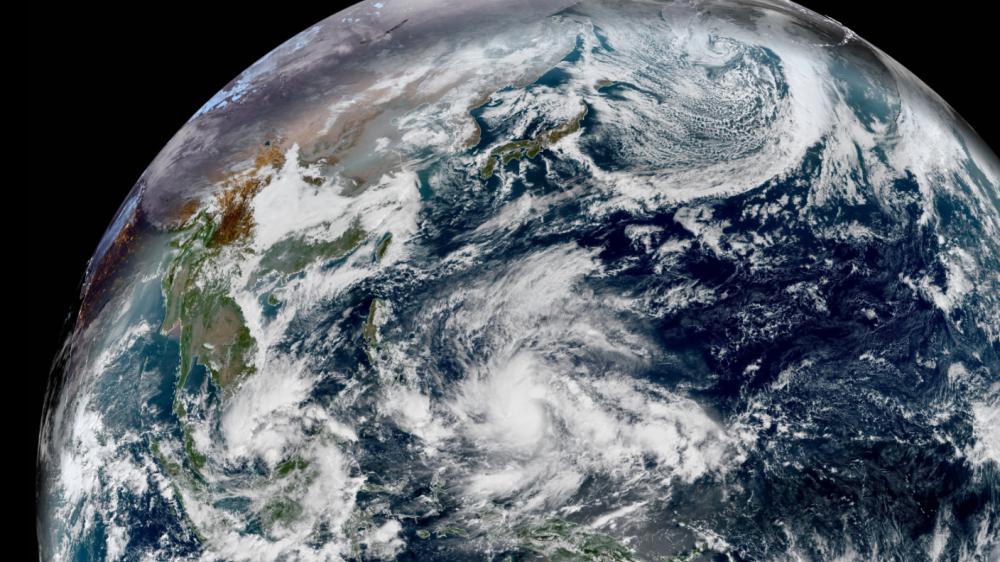
Compared with before, the typhoon embryo 97W in the South China Sea has not changed much, but Typhoon Rey has obviously developed. Today's typhoon Rey not only the cloud system further expanded, the entire typhoon began to become teeth and claws, and the core cloud area has become more compact, the satellite cloud map has appeared a tight and solid core area, which is a large number of convection explosions near its center, the intensity is significantly strengthened, and is absorbing a large amount of water vapor to expand the circulation characteristics.

Therefore, this morning, Before Typhoon Rey was generated for 24 hours, it had already developed into a 10-magnitude severe tropical storm, and the Forecast of the Central Meteorological Observatory believes that today's Enhanced Xeon Tropical Storm is only a small part of the development of Typhoon Rey, and then, as it continues to be in a higher sea temperature region and gradually moves westward, the intensity will be further strengthened, and may strengthen into a super typhoon before approaching the Philippines.
The rapid development of Typhoon Rey also made some netizens wonder: Is Typhoon Rey going to develop into a super typhoon like Super Typhoon Haiyan in 2013? Judging from the current forecasts, although many predictions do point to the fact that Typhoon Rey may be stronger, it may only be the upper limit of the strong typhoon - the lower limit of the super typhoon. That is, the degree of 15-16 magnitude, it is likely that it will not reach the level of a super typhoon of level 17 or above like Haiyan. Even many supercomputers predict that Typhoon Rey may not be east of the Philippines when it is strongest, but will only develop to the strongest after crossing the Philippines into the South China Sea.
Although Typhoon Rey is unlikely to become a repeat typhoon Haiyan, but Rey's current path trend has been relatively clear, considering the weak anti-Taiwan capabilities in the central Philippines, Chinese friends in Tacloban, Cebu and other places should beware of storm attacks on the 16th and 18th, pay attention to safety! After entering the South China Sea, the late path of Typhoon Rey still has signs of northward turning, for the south China coast, the more west the typhoon in the South China Sea north turn position, the greater the impact on China's wind and rain, therefore, the later South China Sea and south China coast should also be vigilant.