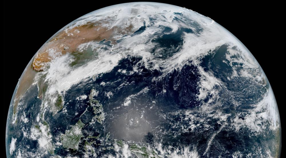
As Typhoon Maleka's transgenic temperate cyclone has moved toward the North Pacific, it began to affect Alaska in the United States today, announcing the end of this wave of convergence in the Western Pacific since April. At noon on April 18, from the high-definition visible satellite cloud map, the low-latitude clouds in the western Pacific region were sparse, especially in the South China Sea and the east of the Philippines, which was a large clear sky area. Typhoon Catfish and Typhoon Maleka staged the unprecedented Fujiwara annexation melee in april a few days ago, and now it is clear that calm has returned to the lower latitudes.
Although the activities of Typhoon Catfish and Typhoon Maleka did consume some of the heat of the western Pacific, from the surface sea temperature of April 18, there is still a large range of high sea temperature zones of about 29 degrees east of the South China Sea and the Philippines today, especially in the southern South China Sea and near the Palau Islands. It's April, and the sun's heat at low latitudes has increased significantly, and after tropical activity in the lower latitudes of the western Pacific ocean becomes calm, the energy of the sea will continue to rise, which may pave the way for the next wave of typhoon activity.

The supercomputer's forecast has pointed out that in the next 15 days (360 hours), there are obvious signs of low pressure system activity in the ocean east of the Philippines and east of Taiwan in the western Pacific Ocean, and the minimum pressure in the collective forecast is low at 925 hPa, and if classified according to tropical cyclones, 925 hPa is equivalent to a super typhoon. Some netizens have to ask: Is it a super typhoon during the May Day holiday?
At present, some forecasts do suggest that in late April, the low-latitude convergence zone east of the Philippines will be active again, and by May 1, a huge circulation low-pressure system will emerge, and the central pressure can be as low as 943 hPa, roughly equivalent to a strong typhoon level. But there are also many forecasts that do not support the high activity of the low-latitude radial zone in late April, which means that there are many variables in whether there will be new typhoons in the next 10 days.
The Pacific Ocean is currently in the midst of a La Niña phenomenon, and in the La Niña model, the Western Pacific is under enhanced Control of the Walker Circulation Upswing Branch, which could indeed lead to more typhoons and more westerly spawning points. However, when the next typhoon is active still needs to be observed.