On December 12, as cold air was moving further south, forming widespread cold clouds in the southern part of china, the weather in the western Pacific ocean was not calm either—clusters of tropical clouds emerged in clusters of highly active low-latitude convergence zones in the southern South China Sea and east of the Philippines.
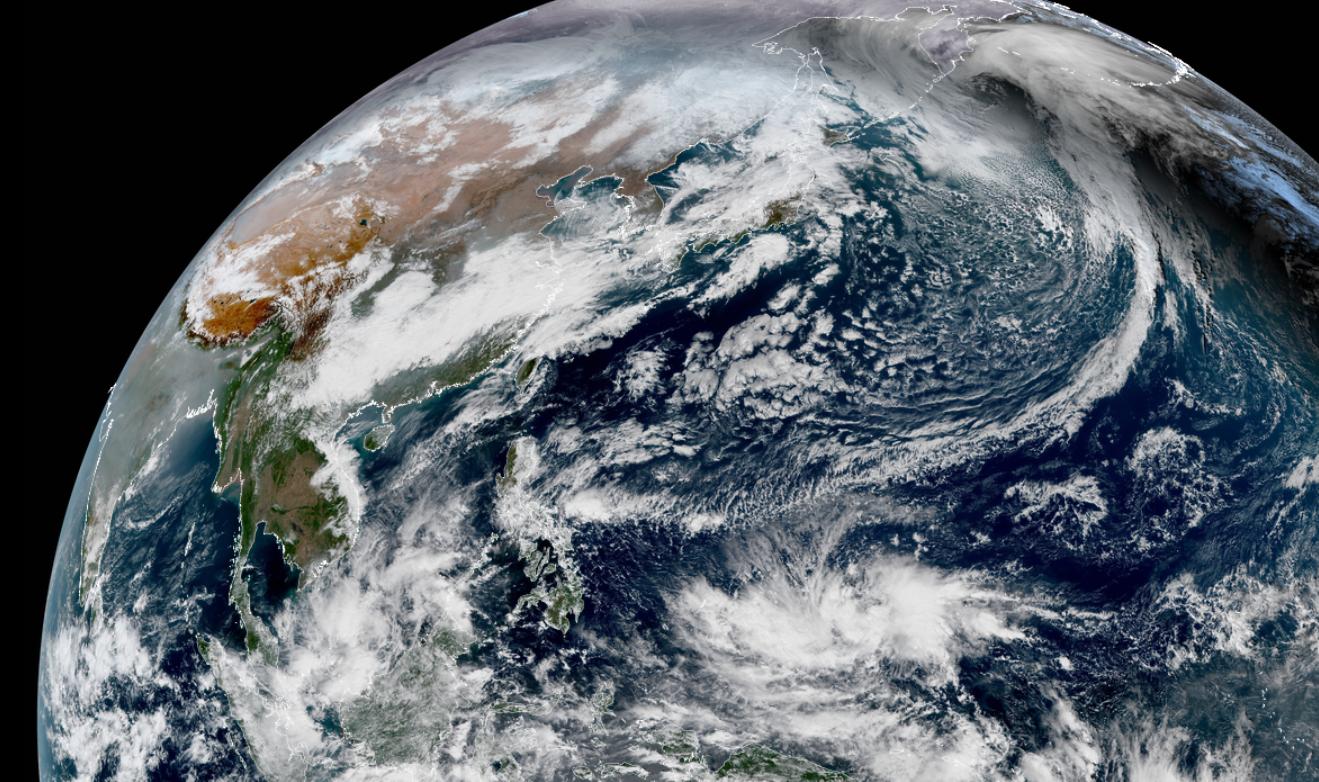
Among them, in the tropical cloud east of the Philippines, typhoon embryos 95W and typhoon embryos 96W have been developed successively. However, after a few days of development, Typhoon Embryo 96W came to the top and now has an advantage in the western Pacific Ocean, developing a large-scale spiral cloud system on the surface of the ocean south of Guam, with a large number of central convection outbreaks. The Japan Meteorological Agency has issued a strong wind warning this morning, believing that its central wind has reached a level 7 and may strengthen into a tropical storm within 24 hours, which means that it may be the 22nd typhoon of the year, Rey.

Although it is now mid-December, the water on the low latitudes of the western Pacific Ocean is still very energetic, so many supercomputers currently predict that this future Typhoon Rey No. 22 has obvious potential for development, and may develop to the level of a Typhoon 12 or above in mid-December.
But compared with its intensity, the most special thing about this future Typhoon Rey No. 22 is that after the formation of Typhoon Rey, the subtropical high pressure may happen to have an intensification process, which will give Typhoon Rey the space to stabilize the westward movement - it will steadily travel westward from the south of Guam, gradually approach the Philippine Islands, and may cross the Philippine Islands into the South China Sea.
However, some supercomputer forecasts believe that after the future Typhoon Rey enters the South China Sea, the subtropical high pressure may weaken just in time, and typhoon Rey will have a northward trend when it is in the central and western part of the South China Sea. This is a rather unusual trend, so that in the future, Typhoon Rey, the No. 22 in the South China Sea, has the possibility of making a positive landing on the coast of South China! Of course, although the possibility of direct landing is still relatively low at present, according to the existing prediction path, it may indeed be very close to the south Coast of China in the future.
Will it bring disaster to our country? The current sea temperature off the coast of South China is relatively low, the offshore is generally less than 25 degrees, if typhoon Rey is really close, it can not maintain a high intensity, so the threat it brings should be relatively small, on the contrary, after the typhoon Rey South China Sea goes north, it may bring a lot of rainfall to the south Coast of South China, which is actually good news for Guangdong and other places that have been dry and strong recently.