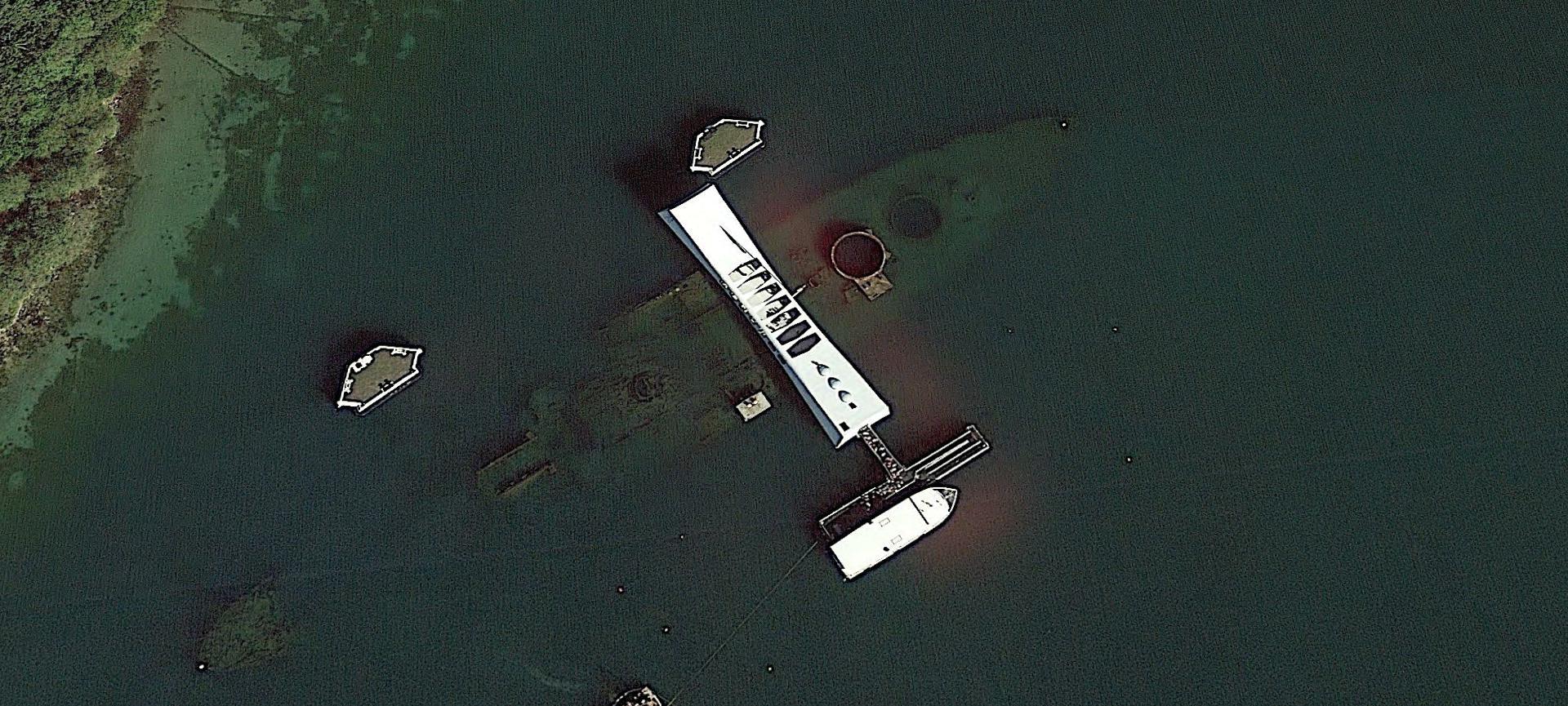
Satellite photographs the underwater wreckage of the USS Arizona, which was sunk by the Japanese attack #Armament #Military ##Battleship # Satellite photographs the underwater wreckage of the USS Arizona, which was sunk in pearl harbor waters by the Japanese on December 7, 1941, and the white building on the surface is the Arizona Memorial. Look up the specific coordinates through Google Earth software: 21°21'52.95"N 157°57'0.87"W, taken on January 17, 2013, due north, 0 clouds in the air, and 214 meters above sea level.
![The high-definition map of the wreckage of the starship was first exposed, and it had fallen to the ground four times in a row, how many stainless steel whistles could be made?[fig]](data:image/gif;base64,R0lGODlhAQABAIAAAP///wAAACwAAAAAAQABAAACAkQBADs=)