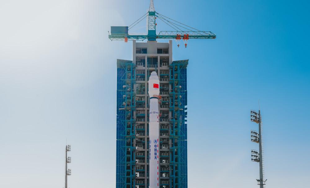
Beijing News Express (reporter Zhang Jianlin) At 7:44 on February 27, the mainland successfully launched the Land Exploration No. 1 01 B satellite (L-band differential interference synthetic aperture radar satellite B satellite B star) using the Long March 4 CYao 30 carrier rocket at the Jiuquan Satellite Launch Center. This launch is the 87th launch of the Long March 4 series of carrier rockets and the 408th launch of the Long March series of carrier rockets.
Land exploration of the 1 01 group B star. Photo courtesy of China National Space Administration (Photo by Zhuang Jiajing)
Today (February 27), the reporter learned from the China National Space Administration that the land exploration No. 1 01 group of satellites is the first scientific research satellite project in the "National Civil Space Infrastructure Medium and Long-term Development Plan (2015-2025)", which is composed of A and B satellites. A satellite has been successfully launched at the Jiuquan Satellite Launch Center on January 26, and is currently conducting on-orbit tests as planned, and the relevant functions of the satellite are performing normally. After the B star enters orbit, it will be tested separately on orbit, followed by a formation test with the A star.

Jiuquan Satellite Launch Center site. Photo courtesy of China National Space Administration (Photo by Zhuang Jiajing)
Land Exploration No. 1 has two modes in orbit: "follow-up flight" and "orbiting"
It is understood that Land Exploration No. 1 is a distributed SAR satellite system, which is composed of two L-band SAR satellites with the same design parameters, and has two formation flight modes of "follow-up flight" and "orbital flight" in orbit.
In the "follow-up" formation mode, the double star takes the surface deformation interferometry as the core task, and can realize differential interference with a single star or a double star to achieve large-scale, millimeter-level high-precision surface deformation monitoring, effectively support the application of ground settlement, landslide, ground collapse, seismic deformation and other industries, which is a sharp weapon for early identification of hidden dangers of major geological disasters in complex areas, and is also an important satellite resource for emergency investigation of earthquake disasters and major geological disasters.
In the "orbiting" mode, the binary stars achieve close-range collaborative Earth observation through the high-precision phase, time and space synchronization between the stars, which can realize the high-precision ground elevation measurement of interferometric SAR, and effectively support the construction of the national natural resources survey system, the construction and updating of global geographic information resources, and the update of high-precision terrain data.
Like the A satellite, the Land Exploration No. 1 Group 01 B satellite weighs about 3.2 tons, and the total area of the SAR antenna is more than 33 square meters, which is currently one of the largest SAR satellites in orbit in China. The satellite operates in a quasi-solar-synchronous orbit at an altitude of 607 km, carrying an advanced L-band multi-polarized multi-channel SAR payload with all-day, all-weather, multi-mode earth observation capabilities.
The two satellites of Land Exploration No. 1 Group 01 A and B adopt three-junction gallium arsenide solar cells with long life, high reliability and average photoelectric conversion efficiency of more than 30%, and for the first time use domestic germanium substrates. At present, the A-star in-orbit data shows that the solar cell not only has no less electrical performance than imported solar cells, but also has better mechanical performance, which can meet the mission requirements of long life in orbit.
Provide space technology support for geological disasters, disaster prevention and mitigation, etc
As an important national basic geographic information data, the digital elevation model has important application value in the fields of major national strategy implementation, large-scale project construction, disaster assessment, geological mapping, urban and rural planning, and land use. It is reported that the land exploration No. 1 Group 01 is the world's first L-band distributed formation multi-polarized interferometric SAR altimeter satellite system, the ground observation resolution reaches the meter level, and the ground elevation measurement accuracy meets the 1:50,000 scale standard. It can provide important technical support for the construction of the mainland natural resources survey system, the construction and updating of global geographic information resources, and the updating of high-precision terrain data.
"For example, we want to build 5G base stations and UHV transmission lines, etc., and these facilities are often located on slopes, hills and mountains. Information such as slope, aspect, ridge line, valley line and so on can provide important data support for the rational layout of these stations. Chen Junli, chief designer of the Land Exploration No. 1 01 satellite, said, "Because our country has many mountainous hills, manual mapping is time-consuming and dangerous, and optical remote sensing is subject to the influence of cloudy and rainy climate characteristics in most parts of the mainland, and it is impossible to obtain it in real time." The characteristics of radar satellites make it possible to penetrate clouds and surface vegetation to achieve all-weather, all-day, high-precision observation, which has a unique advantage in terrain mapping. ”
Chen Junli introduced that the research and development team applied the interference principle of waves, one of the two satellites emitted a radar signal, when the two satellites received the ground echo at the same time, through processing, the distance difference between the ground and the two satellites could be inverted, and then the elevation information of the ground could be obtained.
The principle of interferometric SAR altimetry requires binary stars to observe the earth within a specific angle of view difference, but the binary stars continue to orbit and move, the distance and viewing angle difference between the two stars are constantly changing, and the satellites must leave enough safe distances for collision prevention, which poses unprecedented challenges to the design and control of the formation configuration of satellites.
Renderings of the double star networking of the Land Exploration No. 1 Group 01. Courtesy of China National Space Administration
"According to the requirements of double star interferometry, double stars need to fly hand in hand at all times in space, just like the dancers of the Winter Olympics double figure skaters, not only to ensure the accuracy and stability of their respective technical movements, but also to take into account the coordination and cooperation of double movements." Unlike a few minutes of performances, satellites in orbit need to overcome the influence of various complex interference factors during the mission cycle to achieve stable operation. Wei Chun, deputy chief designer of the satellite, explained.
Taking into account the limited fuel distribution and long-term operation requirements, the research and development team proposed a new method for the design and precise maintenance of the formation around the flight, used the gravitational perturbation relationship of the earth to optimize the configuration of the double star orbit parameters, and designed the formation configuration independent holding technology based on accurate pulse control, and the orbital configuration parameters were accurately controlled at the meter level, reaching the international advanced level.
The satellite launch is an important step in the localization of satellite power supplies
As the largest SAR satellite in orbit in China, the Land Exploration No. 1 Group 01 satellite has a special "large electricity user" - SAR payload on the satellite. To ensure satellite mapping coverage, the power subsystem needs to meet the transient explosive energy requirements of the SAR at boot time, but also to meet its all-weather operation requirements. Liu Yonghui, director of the satellite power supply subsystem model, introduced that the SAR load power is very high, and it will produce a large pulsating current at the moment of start-up, which will have an impact on the safe and stable power supply operation of the satellite platform.
In order to solve the above problems, the developers of the 811 Institute of the Eighth Academy of China Aerospace Science and Technology Group have made efforts of two generations of space power supply people, through careful study of satellite power supply in recent years, comparing domestic and foreign data, and innovatively proposed a dual busbar power supply distribution mechanism, SAR load and platform load are each powered by an independent bus line, which is equivalent to a "power supply package" for each person. It can not only meet the energy requirements of high-power load for a long time, but also suppress the interference of large pulsation currents on other power-using machines on the star when the load is started.
The on-orbit life of the land exploration of the No. 1 Group 01 A star requires long, and the discharge depth of the lithium-ion battery pack will inevitably increase. However, the deeper the discharge depth, the shorter the service life of the battery. To this end, the developers have carried out a large number of ground life tests, solved the problem of long cycle life of lithium-ion batteries under large-rate discharge and other key technologies, and improved the reliability of the power supply system through redundant design and combination of software and hardware power management.
In addition, the satellite uses a long-life, highly reliable average photoelectric conversion efficiency greater than 30% of the three-junction gallium arsenide solar cells. For the germanium substrate, the most important component of solar cells, it has also been replaced by localization. 811 institutes, together with domestic germanium industry leading enterprises, through the precise control of germanium crystal growth solid-liquid interface temperature gradient, growth rate, etc., optimize and cure the process conditions, the use of multi-stage heater, multi-temperature zone variable single temperature zone and other processes, reduce the residual thermal stress of germanium crystals and other measures to enhance the mechanical strength of germanium substrate. "We refer to the international test requirements for the mechanical performance test of the solar cell prepared by the domestic germanium substrate, and the results show that the mechanical performance index of the domestic germanium substrate is better than the original imported germanium substrate." Wang Xunchun, director of the physical power supply division of the 811 Institute, introduced.
Beijing News reporter Zhang Jianlin
Edited by Liu Xixian Proofreader Zhao Lin