Himalayas: A mountain that weighs down on India's map, making it difficult for India to overcome
In 648 AD, many small countries in India surrendered to China, offering rare treasures and maps in the hope of obtaining the statue of Confucius
Let's start with 3 people.
The first Zhang Qian.
It was an extremely arduous march, in order to achieve the strategic intention of the Western Han Dynasty to unite with the Great Moon Clan to attack the Xiongnu, Zhang Qian, who had been detained by the Xiongnu for ten years, took advantage of the fact that the Xiongnu were not prepared to lead an entourage to escape, and then went all the way west, climbing the ice-covered and cold Pamir Plateau, through Dawan and Kangju to the Great Moon Clan. However, the living conditions were improved and the Ōtsuki people lost their hatred for the Huns and did not want to fight and kill anymore. Zhang Qian stayed there for more than a year, and finally did not do their work. During this time, Zhang Qian crossed the Yushui River south and arrived at the city of Lanshi (present-day Khan Wazirabad, Afghanistan) in Bactria, where he saw products from Sichuan. This time was around 126 BC.
The Chronicle of Dawan records these records: "Bactria is more than 2,000 miles southwest of Dawan and south of The Water. Its customary natives, with city houses, are similar to the common customs of the Great. There is no big long, and often the city is placed in a small long. Its soldiers are weak and afraid of war. Shanja City. and the Great Moon Clan migrated west, and attacked and defeated, all of which were subject to the Great Xia. There are many people in Bactria and more than a million. Its capital is known as Lanshi City, and there are city vendors. To its southeast is a poisoned country. Zhang Qian saw that the products of Shudi were Qiong cane, Shu cloth, etc., and he concluded that there was an ancient road in southern China that started from Sichuan and led to present-day India and Afghanistan and even the Mediterranean coast. This led him to return to China and develop the idea of connecting to the southwest to find the ancient road.
In 122 BC, Zhang Qian sent four expeditions from Chengdu and Yibin in Sichuan to southern Qinghai, eastern Tibet, and Yunnan, all headed for poisoning. Although this exploration did not achieve the expected results, it made a great contribution to the development of the southwest, so that the Han Empire basically completed the exploration of the southwest region. In 109 BC, Emperor Wu of the Han Dynasty sent an army to conquer Yunnan, and the King of Dian surrendered to the Han Dynasty, so that the Han Empire controlled the southern region of the State of Dian, which was about 150 kilometers wide from east to west and about 400 kilometers long from north to south, centered on the Dianchi area.
Although there was no arduous exploration like Zhang Qian and the Han Empire on this road in ancient India, today's India has written all this into the history books and is convinced of the existence of the ancient road that Zhang Qian "felt". It should be noted that at that time, India was not called India, and there was no time and ability to complete this exploration. Although the Peacock Dynasty was experienced, from the beginning of the 2nd century BC, the Greeks, Cypriots and Sabbaths invaded India successively, especially the Cypriot invasion was particularly extensive. The Dayue people, who did not want to fight with the Han Dynasty against the Xiongnu, became the most successful invader in India nearly two centuries after Zhang Qian's departure, establishing a powerful Kushan Empire in northern India. At this time, with the development of history, the commercial exchanges along the Southwest Silk Road became more and more frequent, the types of commodities were constantly enriched, and the economic ties between China and south and Southeast Asian countries were closer. In the experience of small countries and domination, the Indians of the North and South enjoyed the fruits of civilized trade from China comfortably.

The second Xuanzang.
In the words of "Journey to the West", Xuanzang traveled 108,000 miles to learn the scriptures, but the truth is longer than this. A circle around the earth is 40,000 kilometers, or the equatorial circumference. Xuanzang traveled all the way from Xi'an via Gansu and Xinjiang to the present-day Kingdom of Daga Shimila in present-day Kashmir, traveling more than 13,800 miles, nearly a circle and a half around geography. In the kingdom of Yingshi Mira, Xuanzang studied Sanskrit classics, and then arrived in present-day Pakistan, where he personally visited four countries in one year, studying Buddhism while seriously traveling and investigating. In 633, Xuanzang entered Central India, and according to his travels to the Western Regions, there were thirty kingdoms such as Yue Bo Li Ye Yu Luo and Yue Mo Luo, and he later went to Nalanda Temple, which was exactly 4 years since he set out from Chang'an in 629. That is to say, most of xuanzang's first days of "learning the scriptures" were in present-day Pakistan, not in present-day India.
Nalanda Monastery was the great monastery north of Wangshe City, the capital of the ancient Central Indian state of Magadha, and its site was Baragaon, about eleven kilometers north of present-day Rajgir. It belongs to the present-day Indian state of Bihar, located in the north of India, bordering Nepal to the north, Bengal to the east, Uttar Pradesh and Madhya Pradesh to the west, and Odisha to the south, which is one of the major indian states. In ancient Times, Bihar had four kingdoms, namely the Kingdom of Vidah, the Kingdom of Lycivi, the Kingdom of Enge and the Kingdom of Capricorn. The kingdom of Magadha is located in central Bihar.
Xuanzang spent 5 years at Nalanda Temple. He then traveled throughout India, returning to Nalanda Monastery in 641 AD and returning home in 643 AD, where he spent about 10 years in present-day India. During this period, India was the Jieri Dynasty, and the ruler was the Jieri King who founded the Jieri Dynasty, a famous king who unified India after the Gupta Dynasty, who was very kind to Xuanzang and sent envoys to communicate with the Tang Dynasty of China many times. Known as one of the most influential emperors in The history of India, during the more than 40 years of his reign, North India was relatively stable and prosperous, making India enter a more glorious era.
In 641, Xuanzang met with the King of Jieri and received generous courtesy. King Jieri decided to hold a Buddhist debate conference in Qunu City with Xuanzang as the main commentator, and 18 kings, 3,000 Mahayana Buddhist scholars, and 2,000 foreign scholars from the Five Seals (the five divisions of ancient India were divided into east, west, south, north, and central) participated. At that time, Xuanzang was talking and asking people questions, but none of them could criticize them. For a time, it was revered in India and revered by the Mahayana as the "Mahayana Heaven" and by the Hinayana as the "Heaven of Liberation". The King of Jiezhi also insisted that Xuanzang participate in the 5-year, 75-day Unshaven Conference. Return home after the meeting. [i]
Xuanzang is not only a household name in today's China, he brought 657 Buddhist scriptures back to China, and was praised by the people of the world as an outstanding messenger of Cultural Exchanges between China and foreign countries, and his patriotism and the spirit and great contribution of supporting Buddhism were praised by Lu Xun as "the backbone of the Chinese nation" and a messenger of world peace. Indians also worship Xuanzang very much, because his book "Records of the Western Regions of the Great Tang" accurately records the humanistic history of India at that time, and Indians like to tell historical stories with myths, which makes it difficult for history to return to its original appearance for a while. Therefore, whether it is a Chinese scholar or an Indian scholar, everyone admits that it is impossible to reconstruct the history of India without Xuanzang.
There is a saying that the kingdom that destroys man must first go to its history. The history of a nation and a country cannot be supported by legends alone, not to mention that history is sometimes like this: how far history is, how far can we see the future. This is clearly the greatest contribution of Xuanzang, a Chinese Tang Dynasty student abroad student to today's India. In addition, the reason why India has the name India also began from him, although he said that India is a guide to the Subcontinent, including many countries, not only today's India, but today's India still retains this name.
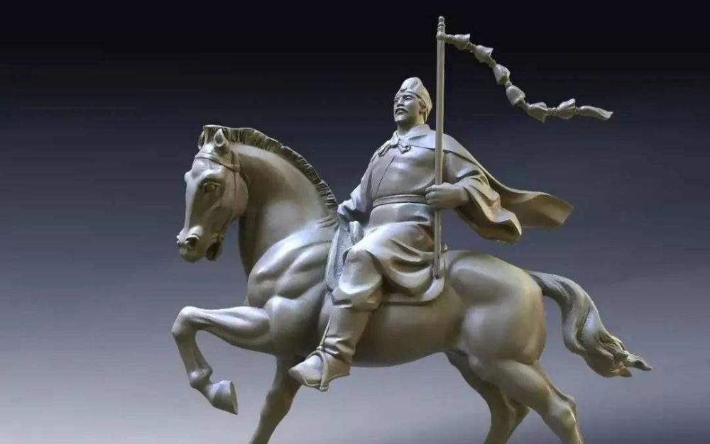
The third Wang Xuance.
Wang Xuance was a cattle man, and because of the legend of "one man destroying one country", he was known as "a shrewd and capable envoy" and "an outstanding diplomat of China's Tang Dynasty".
Today, there is controversy about how many times Wang Xuance went to India, but there is no controversy about the first 3 times. They were 643 AD, 647 AD and 657 AD. It can be said that Wang Xuance and Xuanzang basically walk on one front foot and come on one back foot. In 641, the year xuanzang met with the king of Jieri, the Indian Zhongtianzhu sent an envoy to Tang. Tang Taizong saw that the Indians were coming from afar, and in 643 AD, he appointed Wang Xuance as a deputy envoy and followed Li Yibiao on the mission to Tianzhu (India). This was the first time That Wang Xuance had come to India, and they had also arrived in the kingdom of Magadha, the seat of the Nalanda Monastery where Xuanzang had studied, in present-day Bihar, India.
This trip enabled Wang Xuance to accumulate a lot of experience in visiting abroad, and by 647 AD, he was converted, and the Tang Dynasty sent him as a regular envoy and Jiang Shiren as a deputy envoy and 30 people to India. The Indian states offered tribute to the Tang Dynasty and prepared to pay tribute to the Tang Dynasty with Wang Xuance, who returned happily with his men and horses. However, it was not coincidental that the King of Jieri died at this time, and his ministers wanted to usurp the throne, set up an ambush in the middle of the road, captured more than 30 of Wang Xuance's men, and stole the property contributed by various countries to the Tang Dynasty. Wang Xuance was very angry after escaping, borrowing 1200 Tubo soldiers and 7000 mud Brahma (present-day Nepalese) cavalry, and without much effort, he captured most of India, which shocked and frightened the Indians, and some small countries surrendered, and some even offered rare treasures and maps, hoping to get the protection of Confucius statues and the Tang Dynasty.
In 648, Wang Xuance returned to Chang'an with more than 10,000 Indian captives and more than 20,000 cattle and horses sent by Indians to offer captivity, and Tang Taizong gave him the title of a doctor from Wupinxia. Today, there are many people who are very entangled in this matter, believing that Tang Taizong should take the opportunity to control India and attach importance to the victory of Wang Xuance. The fact is that Tang Taizong did not regard India as an opponent at that time, and because of geographical reasons, he felt that there was no need to control there. The captives offered by Wang Xuance were released by the Tang Dynasty in batches, leaving only a Magadha state and an alchemist named Na Luo Tou to make medicine for Tang Taizong. In 649, after the death of Emperor Taizong of Tang, the Tang Dynasty wanted to let Na Luo Bao return to India, but Wang Xuance did not mean it, and Na Lu Bao Bao eventually died in Chang'an.
Wang Xuance's deeds of "one man destroying one country" are very important for future generations: First, the Tubo Dynasty on the Qinghai-Tibet Plateau at that time and the north bank of the Henghe River south of the Himalayas in India, Tubo sent people to stay on the north bank of the Ganges River, and erected monuments and iron pillars along the river, indicating that the north bank of the Henghe River belonged to Tubo territory. [iii] Thereafter, the two sides ceased to be entangled in territorial matters. Second, Wang Xuance's action opened up the route from Tibet to India and became the main pioneer of the Tibet-India road. [iv] To the Republic of China, there are still Muslims in the northwest who take this route to Qinghai, Tibet, and India to make the Pilgrimage.
In 657 AD, Wang Xuance sent a third mission to India, although it promoted cultural exchanges between the two peoples, but India began to split, and there was already a situation of many dynasties. Until the end of the 10th century, North India had been in a situation where Pratihara, Parra and Lahitrakuta had been in a situation of three countries competing for supremacy, and had never been able to complete the unification. At the time, South India was the State of Jura, but its sphere of influence in the north extended only to the banks of the Godavari River in south-central India. Subsequently, India entered the Delhi Sultanate, the Mughal Empire, and the British colonial rule.
The Mughal Empire was a feudal absolutist dynasty established in India by Babur, a descendant of the Mongol Timur, and in its heyday, its territory encompassed almost the entire South Asian subcontinent and Afghanistan. In 1858, Queen Victoria of the United Kingdom was awarded the title of Queen of India, establishing British India and the fall of the Mughal Dynasty. British India refers to the colonial rule established in the South Asian subcontinent between 1858 and 1947, including the present-day Republic of India, Bangladesh, Pakistan and Burma. It should be noted that during the period of British India, many territories were not directly controlled by britain, but were nominally independent states.
Beginning in 1876, the "Empire of India" was used as an official name and passports were issued under this name. However, it should be noted that many territories at that time were not directly controlled by the British, but nominally independent states, that is, the so-called "Indian Empire" was actually still fragmented, and this also made it constantly "separated", such as: Burma, which was classified as a province of British India in 1886, finally achieved independence. Although the partition of India and Pakistan in 1947 announced the disintegration of British India under the british empire, it was not unrelated to this, and the rule of British India left a series of sequelae for both sides.
Let's tell another story.
The protagonist's name is Lu Zhenxuan. He is a weak scholar and his final position is a professor at Guangdong University of Foreign Studies. [v] male, born in June 1902, Han ethnicity, from Wujin County, Jiangsu Province. He retired in 1987 and died in November 1999 at the age of 97. After Burma was captured by the Japanese in 1942, Land communication between China and foreign countries was completely interrupted. Lu Zhenxuan, in his capacity as deputy director of the Ministry of Communications' India-Iran Transport Department in India, was sent to implement the joint consultation between the United States, Britain, and France to borrow the Soviet Railway and build a new material transportation line connecting the Chinese theater. This story was made by Xinjiang Television 10 years ago into a documentary "Diary of a Driver in 1943".
The port of Karachi, now part of Pakistan and then British India, was stranded there for a shipment of international aid to China. Lu Zhenxuan originally wanted to send chinese aid back to China through Iran and the Soviet Union, but when he arrived in Karachi, he realized that the road was not feasible, and some ports were closed. Lu Zhenxuan was so anxious that he could only find a new way, and went to the local library to check the materials and learned that from Karachi to Leh, he had crossed the Karakoram Mountains to Hotan or Yecheng. This road was a trade route between ancient China and ancient India, but it has been abandoned in the section from Leh to Yecheng, which is very difficult to walk, known as the road of death, and is guided by white bones.
Changing the transport route, Lu Zhenxuan's plan was approved domestically, and the relevant matters were coordinated with British India. Although the British Indian side finally agreed to Lu Zhenxuan's plan, the responsible officials did not know that there was such a road that could lead to Xinjiang, China, which was very intriguing, at least it could show that some people in British India at that time were not familiar with this area, and the ancient road from Leh to Yecheng was very unfamiliar. Although some British people at that time had been searching for the ancient secret passages between ancient China and ancient India, this strangeness never erased their embarrassment as outsiders.
In the end, Lu Zhenxuan, with the help of 180 Uyghur, Kyrgyz and Tajik pack workers, collected 1,000 camels and horses from Xinjiang lasted more than 40 days to transport international aid to China from Lecheng to Yecheng through the "Road of Death". The earliest walk on this road is also Chinese, the Ladakh where Leh is located is called "Little Tibet", in the Tang Dynasty was the territory of the Tubo Dynasty, during which the Tang Dynasty also ruled this area, and people at that time also reached ancient India through here. Later, although it was occupied by the Mughal Empire, time and space changed, and by the Qing Dynasty, Tibet became part of the Qing Dynasty, and Ladakh also became the territory of the Qing Dynasty.
With the Karakoram Mountains to the north and the Himalayas to the south, the Mughal Empire made India "bigger", but its ruler was also an invader for the real Indians. Historically, the Himalayas are a mountain that presses on the territory of India, making it difficult for Indians to cross, and it is also a natural boundary mountain between the East Asian continent and the South Asian subcontinent, and it is also the natural border between China and India, Nepal, Bhutan, Pakistan and other countries today. Because it is the highest mountain range in the world, it is called "the home of snow" in Tibetan.
Conclusion: These people and this story tell us the fact that the Chinese nation has been a pioneering nation since ancient times, and this pioneering spirit has not only opened up the cultural channel for China to communicate with the world through the world's third pole, but also made the world's roof civilization subsumed into Chinese civilization.
[i] Park Jun-gi, Xuanzang and Korean Peninsula Buddhism, East China Normal University, 1999.
[ii] Edward Hetzel Schafer, The Golden Peach of Samarkand: A Study of Imported Products from the Tang Dynasty, China Social Science Press, 1995; Lu Qingfu, A Few Discussions on the Study of wang Xuance's Historical Sites, Dunhuang Studies, 1995.
[iii] The New Book of Tang and the Biography of the Western Regions records: "More than 580 towns and towns were surrendered, and before long the Qiantuo Acropolis was destroyed, Zhongtianzhu perished. For this reason, Tubo once erected an iron monument in Tianzhu to determine the southern boundary of Tubo here. ”
[iv] Lu Qingfu, "On Wang Xuance's Contribution to Sino-Indian Transportation", Dunhuang Studies Series, 1984.
[v] Xia Zongwan, "Lu Zhenxuan: A Thousand Miles of Camels Crossing kunlun mountains", Guangdong University of Foreign Studies, 2019-11-11.