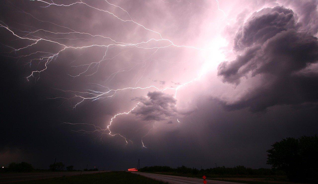
At present, a northeast storm is expected to bring several inches of rain to the tri-state region, while the National Hurricane Center is looking at the possibility of another storm developing in the northeast.
▲ (Image from pixabay)
According to NBCNY, the National Hurricane Center said a strong wind storm will move northeast in the coming days. By late Tuesday, it could "have subtropical storm characteristics" and merge with another shareholder, North Wind, into a tropical storm, named Wanda.
The National Hurricane Center committee said late Monday that there was a 20 percent chance of the tropical storm system forming in the next 48 hours. Over the next five days, this odds increase to 50%.
What does this mean for the tri-state region? Weather forecasters said that as the low-pressure system bent in the middle of the Atlantic on Wednesday, New York, New Jersey, Connecticut and other parts of the northeast could be affected by heavy rains and high winds.
It is reported that on Friday, there may be more rain in the tri-state area, and the showers are expected to continue until Saturday. The weather looks like it will improve on Halloween, with some of the sky clear and the maximum temperature in the 60s.
Parts of New York's NSW streets were flooded and impassable
Parts of New York City and streets in upstate New Jersey were flooded Tuesday morning as the Northeast storm brought torrential rains and strong winds hitting New York and New York State. The New York City Police Department issued a notice on Twitter that some sections of the road were still impassable because they were flooded.
According to Pix11, flooding flooded the intersection of First Street and Harrison Streets in Hoboken, NSW. The video shows cars slowly passing through flooded intersections as heavy rain pours down.
The NYPD Police Department tweeted that some streets in several districts were closed due to flooding.
The Brooklyn-Queens Highway (BQE) was affected by flooding at multiple locations in Brooklyn and Queens.
Brooklyn:
I-278/BQE headed east, near the Brooklyn Bridge, and all lanes were flooded but passable.
I-278/BQE is headed east, near Cadman Plaza, and all lanes are flooded and impassable, requiring vehicles to pass over the left shoulder.
Queens:
BQE to the east, all lanes of North Avenue are flooded, and the right lane and deceleration lane are impassable.
BQE heads east to the Grand Central Parkway, where all lanes are still flooded and the right lane is not accessible.
BQE to the north, the van Wyck Expwy right lane is still flooded, but can pass.
In Upper Manhattan, the streets between Bennett Avenue and Broadway were flooded.
Flood warnings were issued for most of New York City, Long Island, Westchester County and parts of northern New Jersey. Coastal flood warnings have been issued along the long island and Connecticut coastlines. In addition, wind warnings for the eastern part of Long Island have been issued.
Flash flood alerts were also issued in Burlington, New Jersey, Mercer, Middlesex, Monmouth, and Ocean County. Bergen, Essex, Hudson, Passaic and Union also issued flash flood alerts Tuesday morning.
New York Governor Hochu and New Jersey Murphy both declared a state of emergency ahead of hurricanes.
Storms and rain continue! More than 4,000 people in New York and New Jersey lost power
More than 4,500 people in New York and New Jersey lost power Tuesday morning as strong storms in the Northeast continued to bring torrential rain to the region, with rainfall as high as 2 inches in some areas.
According to the New York Post, there was about 1.6 inches of rain in Central Park by Tuesday morning, and about 1.5 inches at LaGuardia and Kennedy airports. According to Paul Walker, a senior meteorologist at AccuWeather, the total rainfall at Newark and Teterboro airports is slightly higher, about 2 inches. By the end of the storm wednesday morning, there could be another 2 to 4 inches of rain in the area, and the total rainfall for the entire storm will reach 4 to 8 inches.
"Later today, the wind will get stronger, so the night commute won't be so good," Walker said. By late Tuesday, gusts could reach 45 miles per hour, according to Walker.
Meanwhile, according to the National Weather Service, flood warnings will also be activated throughout the tri-state region on Tuesday morning.
Walker said: "I think that due to heavy rain, the leaves will fall off the trees and the sewers will be blocked by the leaves. Not to mention that the ground is soaked with rain, so I expect torrential rains to cause damage to the trees, with large numbers of trees in danger of being blown down. ”
Walker urged the public not to drive through flooded roads. "One of the main causes of death is that people are trapped in these cars and can't get out," he warned.
Con Edison reported that as of around 10 a.m., 1,205 users had lost power. In New York, where most of the blackouts occurred in Queens, 117 people were affected, according to the utility. There were 91 people without power in Brooklyn, 2 in the Bronx, 1 in Staten Island, and no power outage in Manhattan. On Tuesday morning, there were 994 people in Westchester County without power.
According to long island power services group, there are 348 customers without power, including 315 in Suffolk County, 32 in Nassau and less than 5 in Rockaway Peninsula.
In New Jersey, the Public Service Group reported that 996 people lost power, the vast majority of them in Essex County, and as many as 854.
Meanwhile, The Jersey Central Power and Light Company reported a power outage for 1,966 people, including as many as 1,404 in Monmouth County.
The Metropolitan Transport Department and the NSW RAPID Deployed Large Numbers of Personnel to Respond to the Storm
The first Northeast storm of the quarter hit the Tri-State region, bringing heavy rainfall and high winds to the Tri-State region, and public transport agencies are now calmly coping.
According to abc7NY, metropolitan transportation agency (MTA) officials said the New York City Transit, Metro-North, Long Island Railroad (LIRR), Bridges and Tunnels divisions have deployed large numbers of staff to respond to flash floods.
Craig Cipriano, president of the New York City Public Transportation Bureau, said they had installed the pumps ahead of schedule and hundreds of employees were resettling generators and emergency equipment.
Cypriano said: "Every time there is a storm, I tell people to give themselves more time. As of 6:45 this morning, everything is going well. If you're coming to New York City, we're here for you. ”
subway
The metro department is already prepared for the storm in 50 specific locations, and the number of specific locations has been selected to increase from lessons learned from Hurricane Ida. As a systematic deployment, the pump has been placed in 5 locations in advance.
Maintenance crews are inspecting rail and subway station drainage pipes in flood-prone areas and are preparing and installing rail pumps and storm boxes in sections.
Passengers are asked to allow extra time when planning to travel by metro. Be extra careful when walking on platforms and stairs to prevent slipping, paying attention to leaves and wires overhead.
Bus
On bus lines where flooding is likely, trailers are already in place.
At the bus parking lot, the staff will park the bus at a high place, and the lifting equipment, flood barrier and water pump are ready.
The Long Island Railroad and the Northern Railroad
The operations center will increase manpower to monitor the weather and rail system, especially in flood-prone areas.
Additional personnel include vegetation management specialists, plumbers, electricians and Northern Railroad catenary employees, who will be deployed to strategic areas to protect rails, signals and equipment.
The Northern Railroad will deploy staff in the Dobbs Ferry and Greystone areas to monitor ongoing slope and culvert work.
Metropolitan Transportation Department Bridges and Tunnels
On Tuesday (October 26), between 6 a.m. and 10 p.m., two-wheeled two-seater bicycles and empty trailers are prohibited from driving on seven bridges managed by the Metropolitan Transportation Department.
Wind conditions will be monitored by staff and additional traffic and speed limits will be imposed depending on the wind conditions.
At present, staff have inspected all flood-prone areas, cleaned up debris and other obstacles affecting drainage, and will continue to monitor throughout the storm.
Staten Island Railway
Staff are ready, equipment, including emergency generators, is in place, and staff are in place to clean up fallen trees and debris.
During periods of heavy rainfall and high tides, staff will monitor flood-prone areas to prevent any situations that could affect rail service.
Affected by the aftermath of Hurricane Ada, staff also increased the number of emergency equipment at the subway station.
Meanwhile, New Jersey Governor Phil Murphy announced that a state of emergency began at 8 p.m. on Monday (October 25).
NJ Transit
While ensuring safety, the New Jersey Rapid Transit's bus, light rail and Access Link services will operate on weekday schedules.
For now, the New Jersey Rapid Transit will continue to monitor weather conditions through Wednesday (October 27).
On tuesday (October 26) morning, there were some problems in the North East Corridor. (Original title: Heavy wind and rain continue!) More than 4,000 people were flooded in multiple districts without power or evolved into a tropical storm)
![A bit whimsical! Western media: Wanda contacted Real Madrid to discuss the possibility of Icardi joining[fig]](data:image/gif;base64,R0lGODlhAQABAIAAAP///wAAACwAAAAAAQABAAACAkQBADs=)