The U.S. Westbound tour began on June 8, 2016, and started in self-driving mode from the first day of travel. Via San Francisco, Route 1 to Kings Canyon National Park, Sequoia Tree National Park, Grand Canyon and Horseshoe Bay. This one chronicles our journey from Antelope Valley to Salt Lake City.
"American West Trip" plans a total of five articles, the previous two click on the following titles to watch:
,
,
This is the third article, starting from the 7th day of the trip on June 14, 2016.
Day 7, June 14, 2016; Arizona. Utah
Gran Canyon Dam
Antelope Valley
Monument Valley
1, Gran Canyon Dam,
The Western United States is sparsely populated and the cost of living is low. Last night stayed in the town of Pecs homestay, two bedrooms, living room with kitchen, simple and bright interior decoration, clean and tidy, for the first time since the United States to meet such a spacious accommodation unit.
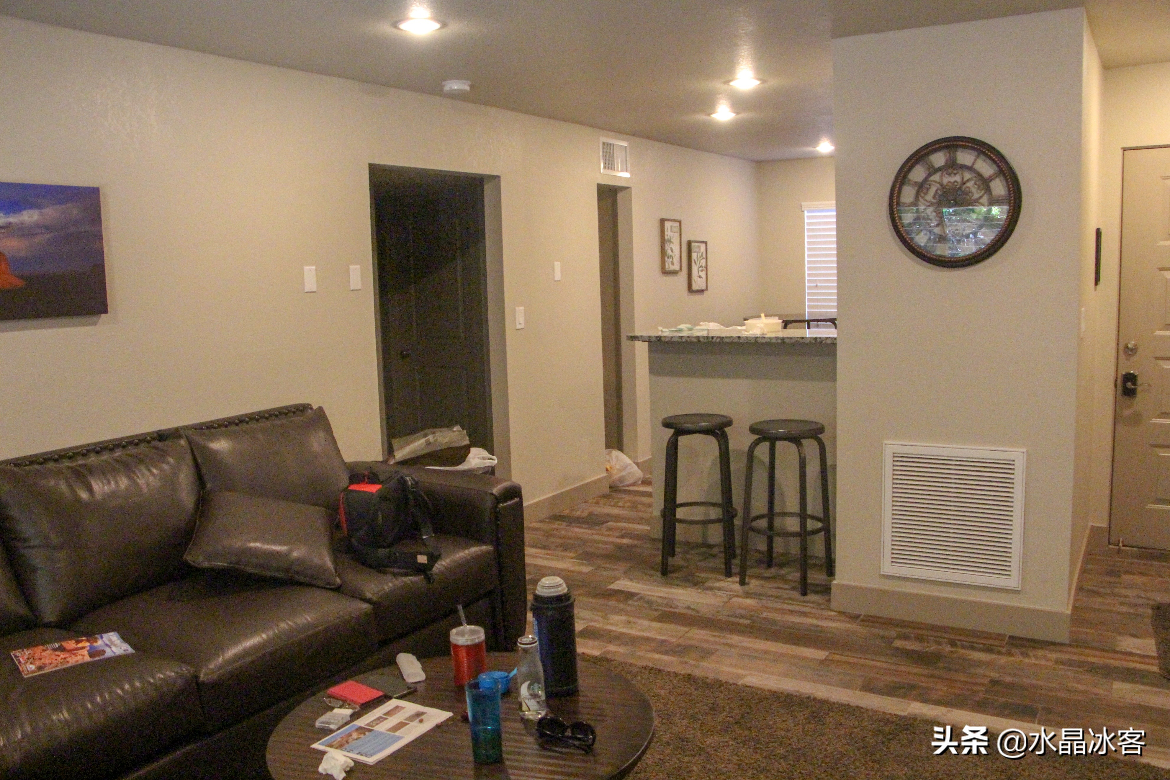
The living room of a homestay in Pecs town
After breakfast, it was only 9 o'clock, and it was still early to visit Antelope Valley at 12:30, and after reading the map, I came to a spot that was not planned in advance: the Gran Canyon Dam.

Gran Canyon Dam Viewpoint
The Gran Canyon Dam, which controls the flow of the Colorado River, is the second largest dam in the United States, after the Hoover Dam, and its mission is to store water for this particularly arid part of the United States. It is 216 meters tall and has an arched top up to 470 meters long.
Gran Canyon Dam
A few hundred meters downstream of the Gran Gorge Dam, is an iron bridge across the Gran Gorge, above which is Route 89.
Iron Bridge, Route 89
2, Antelope Valley
Antelope Canyon is 10 km southeast of the town of Pecs and is one of the most famous slit canyons in the world. Antelope Valley has two sections: Upper Antelope Valley and Lower Antelope Valley. Upper and lower Antelope Valley has its own characteristics, and we went to the Upper Antelope Valley that most people choose to go. The Indians' travel agency built a simple wooden house (shed) on the hot red soil. Tickets to the Antelope Valley were booked online a month ago, there are about 6-7 periods a day, each period is 1 hour, the fee is different, and it only pays $40 / person.
Antelope Valley Travel Agency
Tickets at 12:30, we arrived early at 10:30. To go to Antelope Valley, you must take a mountain bike from a local travel agency, because: 1 is poor road conditions, 2 is to better protect antelope valley is a valuable resource of this world. At nearly 12:00, the car of our group came, a total of 14 people.
mountain bike
After more than 10 minutes of driving in a red wilderness, the mountain bike reached the mouth of the Upper Antelope Valley Cave, led by an Indian driver and guide. At this time, there is also a team of local travel agencies entering in turn, and the team of the previous period is coming out.
Antelope Valley Cave Entrance
Just a few steps into the mouth of the Antelope Valley Cave, the brown cave wall slowly began to become lighter and redder, and under the action of light from the slit above the hole, the rough and stiff stones that had just been seen outside the cave instantly became smooth, lovely translucent here.
Just entered antelope valley
Look up through the narrow gap in the cave: a red mural with a clear texture and crystal clearness looks like a strange posture, making people feel that they have seen it somewhere. In addition to here, there is also a way to find it in the Windows operating system computer wallpaper library.
Computer wallpaper
In the Antelope Valley, the dull rough and hard stones, under the action of light, will also look bright and tender like water, like silk smooth.
Like silk
The curtain opens, and the midday sun shines like a "spotlight" from the top of Antelope Valley, casting a "map" of unknown places on the ground. Here I would like to say that only the ticket at 12:30 can have such a good "stage lighting" effect.
spotlight
There are many "spotlights" in Upper Antelope Valley, which are dizzying and dazzling. People also call it a pillar of light or "holy light." It is said that there are fewer scenes like the Lower Antelope Valley, the Lower Antelope Valley is very deep, to the next long iron ladder, the opportunity for direct sunlight patronage is much less, and the Lower Antelope Valley is known for its "danger".
Beam
Holding the "Holy Light" in your hand and receiving God's gifts is a must-do lesson when coming to Antelope Valley, says our Indian guide. It should be noted here that only tickets in the 12:30 period have the opportunity to feel such a strong "holy light".
Holding the Holy Light in your hand
At 12:30, in addition to our group, there is a smaller professional photography group in The Upper Antelope Valley, who enters half an hour earlier, and the price is not easy to register.
Light
After the brigade left, the gentleman who studied optics went back to photograph this quiet, almost vertical, very "collimated" column of light.
A "collimated" pillar of light
Upper Antelope Canyon means "rock through which water passes" in Indianawa. Some people also say: There are many antelopes that accidentally fall into the canyon and get the name, I believe. Wearing glasses and a black cowboy hat is our Indian driver-guide.
guide
Just then, our Indian guide pointed to the top and said, "Heart!" and sure enough, a beam of light shot in through the middle of a heart-shaped stone, like the heart that had been hit by Cupid's arrow. Wow, another computer wallpaper or screensaver was born.
An arrow through the heart
The rocks of Antelope Gorge are varied under the strong midday sun, sometimes warm, sometimes wild, and some are like molten iron in a steel furnace or lava flowing on a volcano.
molten iron
This torrent (light) is unstoppable, flowing down the crevices of the rocks, and everywhere it goes, it is radiant and brilliant.
torrent
The "stream of light" that rolled in went straight to the bottom of the valley, and everyone was stunned to see it, looking at the sour neck, and refusing to move for a long time.
Straight to the bottom of the valley
The dazzling opening of the cave above the front resembles the mouth of the Taishang Laojun's "Bagua Furnace", and the "red flame" in the furnace is one of the four heavenly fires, the Liuding Divine Fire, which is also called the Samadhi True Fire. So the crowd raised their cameras.
Bagua furnace mouth
It is said that in that year, when Sun Wukong made a big fuss in the Heavenly Palace, he overturned the "Bagua Furnace" of Taishang Laojun, and the embers fell to the "Flame Mountain" in Xinjiang, and in fact, a little bit of Mars floated to the Antelope Valley in the United States. The rocks of Antelope Valley are calcined by the Samadhi True Fire, making them colorful and textured, like rubies in a boudoir. The above statement is purely fabricated, haha.
"Ruby"
The narrowest part of the Upper Antelope Valley can only be passed by one person, and the noonday sun shines down from above a slit, like a waterfall or a light curtain, in a dream, or in a science fiction movie, if there is no crowd in the picture, you will suspect that this is the scene in the game.
Light curtain
If you want to clock in in antelope canyon, don't expect the clarity of the characters, because the light is dark, the environment is orange-red, and there is a figure that is satisfied, unless the flash is used. By the way, I didn't see anyone using a flash in Antelope Canyon, and the effect was not good.
Punch in antelope gorge
Follow your guide to an exit in Antelope Valley and take a short break. The sun was scorching outside, the color of the stones had changed from red to brown, and looking at the time, it had been almost an hour since the cave had been walked.
Exit of Upper Antelope Gorge
Back in the cave, the same way back, on the way encountered is the 13:30 time of the group, obviously at this time the light is not as good as before. Not far from the cave door, the root of an unknown tree protruded into the hole.
Roots
Returning by car at 13:20, the blonde beauty in the front row who came alone to travel was invited to the passenger seat by the driver and tour guide. When he was about to arrive at the travel agency venue, the gentleman's hat was blown off, and after the car reached the end, the gentleman ran 500 meters to pick it up.
Mountain bikes
2. Monument Valley
From Antelope Valley, run for hundreds of kilometers, take Route 98, 160 and then turn to Route 163 to the south of Monument Valley. Along the way is the empty western Gobi Plain, with the occasional sight of plants. The pastures enclosed in barbed wire are as hard (old) as the camel grass in Xinjiang.
Camel grass
In the western United States, in addition to coastal cities, such as California, etc., other inland states are wide and sparse, the highway is flat and wide, the vehicles are scarce, you can increase the throttle to run wildly, if you see a car on the side of the road, the speed is best to slow down, maybe the police are waiting for the rabbit.
Suspected police car
In these sections, you can stop and go, and there are good scenery to stop at any time, because the road is too wide and there is a wide buffer zone. The road is a detour through the mountain stones in the valley of monuments in front of it.
Monument Valley south
Monument Valley, that is, on a large piece of Gobi Desert, is scattered with some mountain stones, some of which are like ruined walls, some of which are lonely stones emerging from the plain, and some of which are like the palms of broken fingers. An abandoned roadside shop belonging to a farm was blocked by barbed wire, one of the better observation points on the south side of Monument Valley.
A farm
Coming to the north of Monument Valley, the straight road pointed in the direction we came from. It was here, at the end of the movie Forrest Gump, that Forrest Gump and a group of others were walking up Route 163.
North of Monument Valley
At some point, Forrest Gump fans erected a wooden plaque on the side of the road as a memorial, which read: Forres Gamp, 1960 running through the United States ended here.
Forrest Gump Medal
Forrest Gump's run is purely a folk attraction and is not on the map. It's easy to find by car, the signs of the mountain are unique, there are many cars parked on the side of the road, and some people are clocking in, such as me.
Punch in forrest Gump run to the end
Leaving Monument Valley and turning onto Route 191, the roadside is less desolate, there are tall green trees, the stones on the hill are rounded, and there are restaurants and hotels.
Route 191
When I saw this cave, I thought I had entered the Arches National Park that I was going to go to tomorrow. I looked at the sign next to it and realized that it was called: Wilson Arch Willson Arch. Joe. Wilson was a local pianist who had a wooden house here.
Wilson Arch
It's 20:30 in Moab, Utah, but it's not dark yet. The keys to the B&B are left under the carpet at the entrance (agreed) and there is a back garden with a large lawn. Just a few kilometres from Arches National Park, moab was built on brown land with brown stoneweights that the landlord had placed on the back garden table.
Moab homestays
Day 8, June 15, 2016; Arches National Park. Utah
Park Avenue
Balance stone
Double zero arches
Devil's Garden
Exquisite arches
1, Park Avenue
Last night's homestay was square in shape, and the color of the walls was the same as the surface of Moab Town. To be honest, last night's homestay was the best of all foreign accommodations, the living room kitchen is on the ground floor, the room is big, tidy and well equipped.
In front of Moab homestay
The two bedrooms of the homestay are on the second floor, and there is a living room on the second floor, which also has a bed, which means that two more people can live. There was also a small room for clutter, full of toys, and it seemed that the landlord's children had grown up.
Moab homestay bedroom
Before leaving the property, $25 cash was put in the living room (cleaning fee) as requested by the host. After leaving 2 km the gentleman returned to the property and put the key back under the carpet in front of the door (obviously forgotten). Today there are many cars, tickets are on the car, after 3 kilometers into the Arches National Park, get off in a large parking lot, walk 100 meters north is a viewpoint. Just arrived, Xiao Li and his wife were invited by foreigners to help take pictures.
Punch in the Park Avenue viewpoint
A mountain stone on the Gobi, looking like an ancient broken city wall, this attraction is not in the plan, but the gentleman does not know where it is. Mr. Che recognized it as the filming location that appeared at the beginning of the movie "Raiders of the Lost Ark 3 - Jihad".
Park Avenue viewpoint
This attraction is called: Park Ave Viewpoint. Next to it is a 1 km walking path called Park Avenue Part Ave, which is very scenic from the front, and this path meets the road in front of it. In order to save time and physical strength, this trail was not taken.
Park Avenue
The "Park Avenue" walk ends at the "Court Tower" attraction. You have to park here because there are many natural sculptures on the side of the road for you to imagine. Next to it there is a small red card introducing "Park Avenue".
"Court Tower" viewpoint
Regardless of three seven twenty-one, get off the car to punch the clock, the neatest look of the mountain stone called "court tower", almost forgot to come to Arch Park to see the arch.
Court Tower
Also behind me (above), there is a small hill stone on the opposite side of the "Court Tower" road, I began to think it was a hat or a crown or something, and when I came back to check the information, I knew that it was called "Sheep Stone", and I enlarged it to see that it really looked like a sheep with big legs.
Sheep stone
"Sheep Stone" is not labeled on Google Maps because next to it there is a group of taller, crowd-like natural sculptures of mountain stones called "Three GossipIng Women" on the map. From this point of view, it seems that there are four people.
Three chattering women
Come to Arches National Park, most of them are self-driving, the park did not see the kind of shuttle bus, it is said that there are also hikes, turning a circle is also tens of kilometers, that is the need for extraordinary physical strength. In the "Court Tower" parking lot, see a Harley motorcycle team.
Harley Motorcycle Team
2. Balance stone
The mountain stone in front of it is called "fossil dune" Petrified Dune, and there is a small parking lot next to it, and when you pass by, you don't see any name, so you don't park. When writing travelogues, observe on the map that this "fossil dune" is indeed like a large animal archaeological site exposed to the surface, if you do not use drones to see, there is no "fossil dune" feeling.
Fossil dunes
It is said that arches national park is one of the world's largest natural sandstone arch concentration, just the catalog of arches is more than two thousand, can enter the arches national park 16 kilometers, see a lot of strange rocks, did not see the arch, this one attraction is not yet an arch, is the "balance stone", looking at it from a distance, really afraid of being blown down by the wind.
Look at the balance stone from a distance
The Balance Stone has a trail that circles it. From this point of view, the stone above the "balance stone" is no longer so hanging, but it is a little worried about its base, the whole base has weathered into a small piece of sand, almost unable to bear it, this is not unfounded.
The other side of the balance stone
It's really amazing, from different angles, the appearance of the "balance stone" will be very different. If you want to punch in the "balance stone", it is at this angle, because it seems to be slightly more stable.
Punch card balance stone
Drive to the next attraction. In the distance, a dotted mountain of rocks, like ancient, abandoned, once orderly and lively ruins of the city.
eden
Officially, it is known as the "Garden of Eden" Garden of Eden. A wide stone road leads to the first settlement on the hillside that God Himself built for mankind.
Walk towards the Garden of Eden
Xiao Li and his wife stood in front of the gate of the "Garden of Eden" and marveled at the tall stone pillar on the right side of the door. In my opinion, this stone pillar can also be called "balance stone", although it is not as dangerous as the official name of the "balance stone", but it is much higher.
Gate of Eden
3. Double zero arches
It's been more than 2 hours to Arches National Park, and now I finally see the arches, and it's a chain of arches, called "Double Zero Arches". From the parking lot to the north, to the "Double Zero Arch" is a 700-meter path.
Punch card double zero arch
The "Double Zero Arch" is famous for having two naturally formed stone arches of almost the same size. Geology says this: The terrain is due to the erosion of the water above, which is different from most of the other side erosions in the park. Also, in this arid climate, how can the water that erodes the stones be preserved for a long time.
Double zero arches
The "double zero arch" is like a huge foyer, and it still needs to be worked hard to get to the top of the arch, because there is no road, all crawling on the stone. I have drunk a bottle of water so far, and at the end of the day, it seems that no 3-4 bottles of water are not enough.
Climb towards the double zero arch
Few tourists climb up in one breath, and there is no need for this, while climbing and playing while patting and drinking water, slowing down when encountering steep ground, maybe they will find the "Golden Cross of Colorado" in the "Double Zero Arch" as in "Raiders of the Lost Ark 3".
Double zero under arches
From the map, an attraction adjacent to the "Double Zero Arch" is called the "Elephant Parade" Parade of Elephants. At that time, I watched it for half a day, and I didn't see it (found). Now (when writing a travelogue), it appears in a photograph, and after cropping I think it's "Elephant Parade". Lo and behold, a baby elephant is in front, several elephants are behind, lined up.
Elephant parade
Back to the parking lot just now, walk about 800 meters to the south to go to the "North Window Arch" and "South Window Arch", in order to save energy and time, only go to the "South Window Arch" where most tourists go.
South window arches
It may be that the "double zero arch" is the first, so it feels that the "south window arch" lacks the majestic momentum and luxurious appearance of the "double zero arch", but tourists still flock to it.
South window under the arch
Is it really because the "double zero arch" is so perfect, and the nearby "turret arch" Turret Arch, which is less than 300 meters away, is too lazy to go, but just clocked in from a distance. No, the main reason is to save stamina, haha.
Fort arches
4. Devil's Garden
Return to the main road of Arches National Park, 10 kilometers north. If it weren't for the large fence on the side of the road and the multiple cars parked there in the parking lot, it might not have come in.
Furnace parking
It's a sight called Fiery Furnace, and the hillside is covered with stone pillars of all sizes, like flames, a little reluctant, but acceptable.
Stone Pillar "Flame"
A path leads to the stone pillars that resemble flames. Isn't it a fire pouring oil on the hot weather plus the "melting pot", but it is much cooler to see the snowy mountains in the distance.
Snow-capped mountains in the distance
Stopped for a few minutes at skyline Arch, the skyline arch, and looked out into the distance. Looking at the sign next to it, before 1940, when the stone on the left side of this arch (hole) was not dropped, the area of the cave was only 2/5 of the current one.
Skyline arches
The parking lot of the "Devil's Garden" is on a flat dam with a circumference of about 2 kilometers. Here I first saw the tap for open drinking water (2016), and I drank the water in the bottle and filled it.
Devil's Garden parking lot
The car park is the starting point of the "Devil's Garden". Maybe you can also see it, starting from the parking lot, the surrounding rocks are strange, the mountain is not high, steep and not steep, the mountain tip is rounded as if it has been polished by someone, thinking of what it is like, there is really a feeling of not seeing the ghost, fortunately, the popularity (yang) is strong along the way.
Devil's Garden Trail
Devils Garden is a more difficult hiking trail with a total of more than 11 kilometers of loops and various branch lines, all of which take about 3 to 5 hours to walk. Wow, physical strength and time do not allow, it is good to go to the famous "Landscape Arch" only 1.5 km.
Devil's Garden
Half an hour later, we finally arrived at the "Landscape Arch" at 15:13. In order not to let tourists climb and damage this famous attraction, the park fenced it with a wooden fence. The small hole in the upper right should be an arch of some kind, but there is no need to go because it is too exhausting.
The landscape arch has arrived
Whoever looks at the Landscape Arch is worried about how long its thin "door" frame will last, and it is said that it is still about 20-30 years away. But don't worry, maybe there will be new beautiful arches, this is what the book says.
Landscape arches
Seeing the "Landscape Arch" is the purpose of coming to the Devil's Garden. Went back, but didn't go the same way. This cypress tree was designed with this cypress in mind when the park designed the wooden fence. The question is whether its twisted body wants to come in or out.
Twisted cypress
It is said that it is not the same way to return, and it is halfway through or back to the same way. There were no flowers in the Devil's Garden, but a large area of small, unknown plants, which was different from the other barren mountains around it. Under the sunlight, the devil's castle in the distance seems to be quiet, and I don't know if it will be lively at night.
Devil's Castle
5. Exquisite arches
It took only ten minutes to get from the Devil's Garden parking lot to the exquisite arch parking lot, next to an uninhabited log cabin known as "Wolf Ranch", the exquisite arch trail passes in front of the door, and 50 meters later crosses a small iron bridge to begin the last and most arduous hike of the day, a unilateral 2.4 km mountain road. The sun was shining brightly and the weather was hot, and it was now about 16:00, and each person brought a bottle of water.
Wolf Ranch Cottage and Iron Bridge
With 1/5 of the mile left from the exquisite arch, he left the large army and headed for the small hill behind him, which was located on the south side of the exquisite arch, and they were separated by a ravine nearly 100 meters wide and 70 meters deep. You can now see the side of the delicate arch (in the upper left of the photo).
The deep ditch on the south side of the exquisite arch
Climb to the top of the hill and look south, for which the exquisite arch of more than 1 hour is right in front of you. This road is rarely visited, and on this path (actually there is no road), only a young foreigner couple is encountered who are returning.
Punch in the exquisite arches
Looking north with an elongated focal length, the delicate arch stands on the edge of a large, sloped clearing. Not far away are hills like buildings, small as tourists like ants, and the exquisite arches resemble a huge triumphal arch that stands on the square.
Exquisite Arch Square
Probably because he had put in considerable physical effort to this project, or had received a good return, the gentleman was very excited, did not like to be photographed, and pretended to sit on a rock.
Sir and exquisite arches
Descend the hill and return to the exquisite arch trail. A detour must be taken from the back of these mountains to reach the exquisite arches.
Rocks to the west
Probably because the incircular cave above seemed to have been squeezed, it was named the Twisted Doughnut Arch. Tired and can't go up, just punch in here, the feeling at that time is that I don't want to take more than half a step.
Twisted donut arches
It is only 100 meters away from the exquisite arch, but there is still a seemingly dangerous road to be artificially carved on the mountainside, but it is actually wide enough for two people to walk side by side.
Mountainside paths
Most visitors sit in the sheltered shade of the backers or look at the exquisite arches in a daze. If you want to punch, you must be exposed to the wind and the hot sun. Special emphasis, the wind is so strong, more than one foreigner's skirt was overturned, haha.
tuyere
In a fierce wind, Mr. Mister's baseball cap was blown under the cliff, which was visually about 20 meters deep, and below it was a pine forest. Sir went down a few minutes later and came up with 4 hats. The other 3 were pressed between conspicuous stone crevices for those who needed them.
Missing hats
If you're going to punch in underneath the delicate arches, don't expect others to recognize who's with them. Here I met a young couple from Nanjing who met in Williams Town. They're back, and tonight they're going to Salt Lake City, and wow, there's still more than 4 hours to drive.
Exquisite arches
A regiment from Chinese mainland, known as Captain America Outdoor Club, is punching in a delicate archway. It's 19:00 and there are many people who are still here waiting for sunset. We couldn't wait because tonight's stay was a 2-hour drive away.
Captain America Outdoor Club
When I came, I didn't see (find) the "Bible Tower", so during the return trip, the gentleman paid extra attention. The "Bible Tower" is particularly striking under the setting sun. Parking, just at 20:00. It's 1 hour before we get to tonight's accommodation: The Buckett Budget Inn in Green River Township.
Bible Tower
Day 9, June 16, 2016; Salt Lake City. Utah
Temple Square
Utah State Capitol
1. Temple Square
It took nearly 3 hours to drive from green river town, where we stayed last night, to Salt Lake City. Go to Temple Square at 11 o'clock. From a distance, you can see the 3 towers on the Temple of Namor, which are actually 6, 3 at the East Gate, and 3 at the West Gate.
Temple Square
Temple Square is actually a garden, a leisure place surrounded by trees, birds and flowers, and turquoise water. Today is Thursday, encountered several waves of wedding photos, is it an auspicious day.
fountain
Mormonism, also known as The Church of Jesus Christ of Latter-Day Saints, has more than four million adherents and is headquartered here. Mormon Temple Square (and adjacent neighborhoods) is the equivalent of the Catholic Vatican.
Mormon temple
The Synagogue is one of the most ornate and colorful buildings in Temple Square, built in 1877. It is said that the meeting hall often hosts free concerts of well-known artists at home and abroad on weekends, but unfortunately today is Thursday.
Meeting hall
Mormons claim to be Christians, but are considered a cult by Christians. Mormons have tens of thousands of full-time, self-funded missionaries spreading the gospel around the world. In Temple Square you can see women missionaries from all over the world, all beautiful, dressed in blue priestly clothes, and enthusiastically serving visitors who speak all kinds of languages.
Female missionary
The temple gates are not open, the surrounding area is bustling, and people dress up in costume on a hot day, as if they are celebrating some festival or party.
party
This is an upcoming wedding scene. In the garden, the bride and groom, the groomsmen and bridesmaids, or whispering, or rubbing their fists, warmed up for the upcoming grand ceremony.
Groomsmen and bridesmaids
On the side of the temple, the bride is already surrounded by relatives, friends or girlfriends. Maybe it's the different habits, the bride and groom are not together at this time. Since the dress was not special, it was not clear who the groom was.
bride
Mormon doctrine promoted polygamy in 1833, which was later abolished in 1890. There are several sculptures in temple square, held down by three people, not a group beating, but a sculpture called Restoration of Melchizedek Priesthood called "Restoring melchizedek Priesthood".
Restoring Melchizedek's Priesthood
2, Utah State Capitol
At 1:30 p.m., I entered a Chinese restaurant, which was mostly Chinese. When ordering, the waiter actually only speaks English and can't Chinese, it turns out that this is a Chinese restaurant opened by Vietnamese people, dizzy.
Salt Lake City Restaurant
In the United States, there are many copycat versions of the "Capitol", such as the California State Capitol, but the Utah State Capitol is said to be the most similar to the U.S. Capitol of these copycat versions. Whatever it is, punching the clock is, haha.
Utah State Capitol
The Utah State Capitol, if there are no meetings or other events, is accessible to visitors. The interior hall and staircase are built of white marble, and the front walls are painted with colorful frescoes, which in short, they all look more magnificent.
State Capitol Lobby
The State Capitol, one of Utah's landmarks for nearly a century, opened in 1916. The meeting places of the parliamentarians can be visited but not entered, and only here are staffed.
Parliament Hall
The Utah State Capitol building is topped by a Byzantine dome that shines brightly and brilliantly in the sunlight. The interior of the dome is magnificent and intricately carved, the ceiling is painted with exquisite frescoes, and countless intricately carved figures stand in it.
Dome of the Parliament Building
"American West Trip (III) - Antelope Canyon and Arches National Park" is over, if you are interested, please watch "American West Trip (IV) - Yellowstone National Park", thank you.