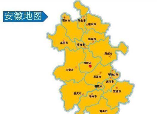
Today, as far as Anhui and Jiangxi provinces are concerned, they are geographically very close. Anhui, abbreviated as "Anhui", is the provincial capital of Hefei. Anhui is bounded by 114° 54 ′ -119 ° 37 ′ east longitude, 29 ° 41 ′ -34 ° 38 ′ north latitude, east of Jiangsu, Zhejiang, west of Henan, Hubei, south of Jiangxi, north of Shandong, Anhui Province with a total area of 140,100 square kilometers. Jiangxi Province is located on the south bank of the middle and lower reaches of the Yangtze River, located in East China, bounded by longitude 113 ° 34 ′ 36 "-118 ° 28 ′ 58 "E, latitude 24 ° 29 ′ 14 " -30 ° 04 ′ 41 ", east of Zhejiang, Fujian, south of Guangdong, west of Hunan, north of Hubei, Anhui and connected to the Yangtze River. The total area is 167,000 square kilometers. Among them, in The taihe county under the jurisdiction of Anhui Province and the Taihe county under the jurisdiction of Jiangxi Province, the pronunciation of the name is exactly the same. And this, without a doubt, is a very interesting place.
One
On the one hand, as far as Taihe County is concerned, it belongs to Fuyang City, Anhui Province, and is known in ancient times as Lushang, Xingqiu, and Liaoqiu. It is located in the northwest of Anhui Province, at the southern end of the Huanghuai Plain, between the cities of Fuyang and Bozhou. As far as the history of Taihe County is concerned, the Spring and Autumn Period belonged to the Song Dynasty, named Lushang, also known as Xingqiu and Liaoqiu. During the Warring States period, it belonged to the State of Wei and later returned to the State of Chu. Qin Shi Huang established the Qin Dynasty and established Xinyang County, which belonged to Yingchuan County, which belonged to the area of present-day Taihe County, Anhui Province. At this historical stage of the Three Kingdoms, the Three Kingdoms of Wei shu and Wu were established, and the area around present-day Taihe County in Fuyang City became the territory of Cao Wei. In the second year of the Jing Dynasty (238), it was subordinate to Yu Commandery (谯郡). In the second year of emperor Tai of the Jin Dynasty (266), Song County was transferred to Ruyin County, and the area belonged to it. During the Southern Dynasty Liang Dynasty, Chenliu County was established, and the area around present-day Taihe County belonged to it.

Two
During the Sui Dynasty, Chenliu County was changed to Yingyang County. In the first year of Tang Zhenguan (627), Yingyang was abolished and merged into Ruyin (present-day Fuyang), and the town of Baizhi (present-day original wall) was established in the territory. In the sixth year of Song Kaibao (973), Wanshou County was established in Baizhi Town, Ruyin County, which belonged to Yingzhou. In the first year of Xuanhe (1119), it was renamed Taihe County, and moved the county to the north bank of the Shahe River (present-day Jiuxian Town). In 1304, the Yuan Dynasty changed "Tai" to "Tai", and the county rule was moved to present-day Yingzhou. Therefore, as far as Taihe County in Anhui Province is concerned, it was historically named "Taihe County". In the second year of Qing Yongzheng (1724), Taihe County was changed to Bozhou. In the thirteenth year of Yongzheng (1735), Yingzhou was elevated to the capital and restored to Yingzhou prefecture. As of the end of 2018, the total area of Taihe County reached 1867.19 square kilometers, and the total population was about 1.43 million people.
Three
On the other hand, as far as Taihe County is concerned, the pronunciation of the name is exactly the same as that of Taihe County. In other words, just from the pronunciation point of view, it is impossible to accurately distinguish between Taihe County and Taihe County. Taihe County is located in the jitai plain in the south-central part of Jiangxi Province, in the center of the Jitai Basin, adjacent to Xingguo County in the southeast and Jinggangshan City and Yongxin County in the west. Taihe County is 105 km long from east to west and 57 km wide from north to south. As far as the history of Taihe County is concerned, the Spring and Autumn Period and the Warring States successively belonged to Wu, Yue, and Chu, and Qin belonged to Jiujiang County; during the Western Han Dynasty, the area around present-day Taihe County in Jiangxi Province was the territory of Luling County, and Xichang County was established in the fourth year of the Eastern Han Dynasty (199 AD), which was ruled by Luling County, and the ancient city was 1.5 kilometers west of the present-day county seat.
Four
Finally, at this historical stage of the Three Kingdoms, the Three Kingdoms of Wei, Shu and Wu were established, and the area around present-day Taihe County became the territory of Eastern Wu. In the eleventh year of the Sui Dynasty (591 AD), Taihe County was officially established, which belonged to Ji Prefecture (later known as Luling County). During the Tang Dynasty, Taihe County was renamed Taihe County and still belonged to Jizhou. During the Yuan Dynasty, Taihe County belonged to Ji'an Road in Zhongshu Province, Jiangxi. After Zhu Yuanzhang established the Ming Dynasty, he changed Taihe County to Taihe County again. Therefore, it is more interesting that historically, Taihe County in Anhui Province and Taihe County in Jiangxi Province have used each other's names. As of the end of 2018, Taihe County had 2,667 square kilometers and a total population of about 600,000 people. What do you think about that? Feel free to leave your views and let's discuss them together.
Text/Sentimental History