Beijing News Express According to the micro-news of the Chinese lunar exploration engineering officer, as of July 8, the "Zhurong" rover has worked on the surface of Mars for 54 Martian days, driving more than 300 meters. Since the rover drove on the surface of Mars, it has carried out patrol and exploration to the south, the navigation terrain camera has imaged the landforms along the way every day, traveled to the secondary surface radar, meteorological measuring instrument, Mars magnetometer to start the detection, and when encountering rocks, sand dunes and other special landforms on the way, the surface composition detector, multispectral camera and so on are used to carry out fixed-point detection. Figure 1 and Figure 2 are images of Martian rocks on the way, synthesized by multiple spectral segment data obtained by multispectral cameras, the texture characteristics of Martian rocks and Mars rover ruts can be seen in Figure 1, and Figure 2 shows the coverage of Martian dust on the rock surface.
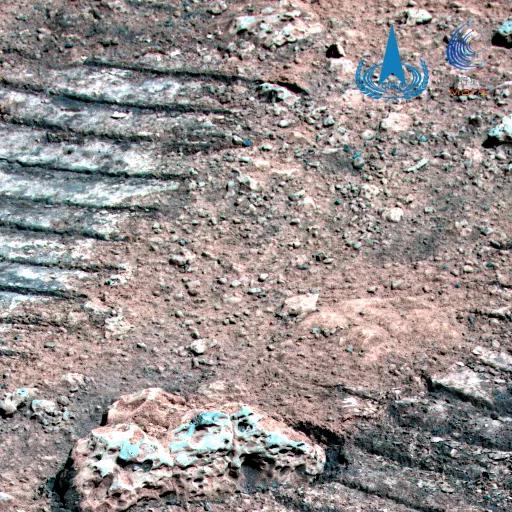
Figure 1 Martian rocks

Figure 2 Martian rocks and dust
On June 26 (42nd Martian Day), the rover reached a dune area and used a navigation terrain camera to take a high-resolution image of a red dune (Figure 3), about 6 meters from the dune, surrounded by stones of different sizes, of which the stones facing the rover were about 0.34 meters wide.
Figure 3 Martian dunes
On July 4 (the 50th Martian Day), the rover traveled to the south side of the dune and imaged the surrounding terrain and landform perception, And Figure 4 shows the full view of the dune, which is about 40 meters long, about 8 meters wide, and about 0.6 meters high. On the left side of Figure 5 is a cluster of stones of different shapes, the back cover and parachute are visible in the upper right corner, and the rover is about 210 meters away from the landing site in a straight line during imaging, and about 130 meters away from the back cover and parachute.
Figure 4 Martian dunes
Figure 5 Martian stones
Edited by Jiani Liu