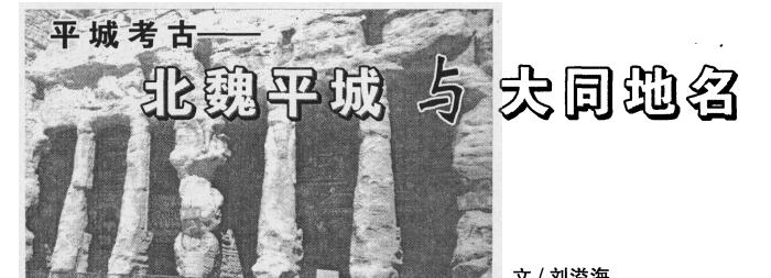
Pingcheng Archaeology - Northern Wei Pingcheng and Datong place names
China Geographical Names, No. 04, 2003, Liu Yihai
Place names, as symbols of ground entities, have various reasons for their name, and as a famous historical and cultural city, especially as the Datong of the Northern Wei Dynasty for nearly a hundred years, many of its place names are inextricably linked to the Pingcheng City of that year. When m, the place names mentioned in this article are not all limited to the Northern Wei, but are mainly northern Wei. In addition, the interpretation of a certain place name in the literature is mostly speculative, and there is not much evidence, which needs to be explained to historical readers first.
1. Ancient shop and Reed Bay
Gudian (now the seat of the Gudian Township Government) is 13 miles south of Datong Railway Station. In recent years, experts and scholars in our city's historical circles, such as Zijin and Yin Xian, have all identified the ancient shop as the "Northern Palace" of Northern Wei Pingcheng. Notes on the Water Classics, vol. XIII: "... For example, if the muddy water passes south through the North Palace, the old palace is thin. "If the muddy water is now the royal river." The "North Palace" mentioned here in the "Notes on the Water Classics" is exactly in the midpoint of Fangshan (now known as Xisi Liangshan) in the south to Pingcheng (in the area of present-day Datong Railway Station), and today's ancient shops are commonly known locally as "Bocheng", which is quite consistent with the descriptions in the "Notes on the Water Classics". "Thin" means curtain; "thin" means making curtain. The 21st meaning of the "thin" article of the Hanyu Da Zidian is: "Curtain, followed by 'foil'." Erya Shi Gong. ":'The house is thin and redundant'. Hao Yixing yishu: "Thin is the curtain, with reeds, or with bamboo." Since the ancient shop was used as a "workshop city" for the imperial and aristocratic people to produce curtains, it was bound to become a rather lively market town on the northern outskirts of Pingcheng. In addition to the original meaning of the word "shop," there is another meaning of "inn and guest house," that is, "commercial market town." This is not only the "curtain city," but also the key place at the pass (Zhenchuankou and Deshengkou) in the north out of Hudi, and its liveliness can be imagined.
Both to make curtains, when there are raw materials. Nowadays, from Gudian east across the Yuhe River, to the east for more than a dozen miles to the northeast, there is a village called "Reed Bay". When we link Reed Bay with Bocheng, it is not difficult to see that the raw materials for making curtains in Bocheng come from the area around Reed Bay, which can be described as local materials and local processing. It is not difficult to see from this that the ancient shop of that year was a workshop and trading town mainly engaged in curtain making and mats. Today, we regard the ancient shop as the northern palace of Wei Pingcheng, Bocheng, and Reed Bay is the most accurate evidence.

Second, the red wall village and the side wall beams
From Shanghuangzhuang, 8 miles northwest of Datong City, to the east, through the south of Anjia Village, and north of Baima City Village, there is an east-west intermittent Tufang Liang. After crossing the Royal River to the east of Hakuba Castle, this beam climbs up the east slope through Majia Village until it disappears north of Quansitou Village. Locals call this Tupeiliang "Border Wall Beam" In recent years, scholars in Pingcheng studies have identified this border wall beam as the "deer garden" south wall built on the northern outskirts of Northern Wei Pingcheng in that year. The Book of Wei, Taizu Ji, in the second year of Tianxing (399), "February... Gengji... With the high car obtained, the deer garden, the south because of Taiyin, the north from the Great Wall, the east bao Baideng, the west mountain of the genus, the guanglun tens of miles ...". This "southern wall of the deer garden" was built in the Northern Wei Dynasty, but rather that the Northern Wei Dynasty used an abandoned Great Wall to raise it and became the deer garden wall. The reason is as follows: From the 1:200,000 Datong map, there is a village called "Red Wall" in the northwest of Present-day Yungang, and interestingly, there is also a "Red Wall" village in the northeast of Huayuantun Village in the east of Yuhe. From the Eastern Red Wall Village to the northeast, there is still a "Border Wall Village" at the southern foot of the Liangliang Mountains, and further east there is a "Dusikou." If we start from the West Red Wall Village and go east through Shanghuangzhuang, Baima City, Majia Village, Quansitou, East Red Wall Village, Border Wall Village, and Dusikou, we just form a "bow," and the south wall of the Deer Garden mentioned above is just the part of its bow back. The name of the village here as "wall" and "mouth" is completely opposite to the ground entity (side wall beam). I speculate that if it is possible to conduct field investigations, the remnants of the abandoned Great Wall may also be found on the extension line at both ends of the "bow" (that is, around the East-West Red Wall Village). It is not difficult to see from this that there was an ancient border wall remnant here as early as before the Northern Wei Dynasty. Local villagers say that this side wall beam is said to have been built by Qin Shi Huang. Although this legend cannot stand up to scrutiny, it should be said to be a fact to a large extent as an ancient Great Wall site. Therefore, I think that the southern wall of the Deer Garden in Northern Wei Pingcheng cleverly makes use of the remains of this ancient Great Wall and achieves the purpose of saving work and time. Later, the southern wall of this deer garden even became the northern wall of Wei Pingcheng at the same time.
Third, the earliest and largest forest park
"Forest park" or "nature reserve" is a term that has only been known in China in the past decade or so. The "Dinghu Nature Reserve" in Zhaoqing City, Guangdong Province, is considered to be the earliest forest park established in China (this area was established in 1956).
However, if we trace it back from history, Dinghu Nature Reserve cannot be called "the earliest" at all. In that year, after the Northern Wei Emperor moved the capital to Pingcheng, in addition to building the capital, another huge project was to establish a "deer garden" and a "tiger circle," as well as a farther and larger imperial hunting area. This hunting area generally stretched from Huanghualing (present-day Huanghualiang in the area of present-day Huairen and Shanyin) in the south, to Mount Wuzhou and Mount Leigong (collectively referred to as Xishan) in the west to Baideng Mountain (present-day Mapu Mountain) in the east, and to the panyang Mountain (now Panyang Mountain) and Jackal Mountain (now known as Wolf's Head Mountain) in the northeast, and the latter two mountains were all in Fengzhen City, Inner Mongolia, outside the Ming Great Wall. The Northern Wei Royal Hunting Area, which formed a radius of hundreds of miles, was the largest forest park in northern China at that time. In the qin and Han dynasties before that, although the national strength was strong, because the emperors were all Han chinese and had little interest in hunting, the Northern Wei imperial family was originally a Xianbei ethnic group, and its ancestors had always been "a nation on horseback," and hunting was the basis for their people's survival. Therefore, although the Northern Wei emperors developed toward a settled farming culture after the capital Pingcheng, their natural hunting nature was difficult to change, so the establishment of a large-scale royal hunting ground became an inseparable part of the construction of Pingcheng.
It should be pointed out that we cannot measure the ancient Datong by the vegetation conditions of today's Datong. As early as 1500 years ago, Datong was completely a forest world with a vast forest sea. Li Daoyuan described this area in his Notes on the Water Classics as follows: "The trees of the mountains, even the number of spans, the collection of thousands of miles of forests, and the lush shade of the trees." Later, even 800 years ago, in the Liaojin Period, Datong was still forested and covered in the world c LiaoXingzong used to hunt in Huanghualiang, and he could "shoot thirty-six bears"
The vast forest world provided unique conditions for the Northern Wei emperors to build royal hunting. Located on the outskirts of Pingcheng in Northern Wei, the "Deer Garden" and "Tiger Circle" are the "Forest Zoo" built by the royal family. A small number of wild animals in this garden, such as tigers and deer, come as tributes, but most of them are "indigenous peoples" in the local forest. In the Book of Wei, the account of the emperors hunting has become an important activity in their daily lives.
It is precisely because of the existence of this imperial forest hunting ground here that many place names related to animals and plants have been left within a radius of hundreds of miles in Datong today.
Crouching Tiger Bay, located in the eastern foothills of lei gong mountain in the northwest of Datong, was once the location of the "tiger circle" of Northern Wei Pingcheng, and the name Crouching Tiger Bay should have originated from this.
Luyeyuan Grottoes are located in a ravine in the western part of Anjia Village, more than ten miles northwest of Datong. This place is located in the pingcheng deer garden range, and the name of the grotto should be derived from this.
Da Monkey Mountain, located in Lei Gong Mountain, Datong West, in the area of Beiduousugou Village; Lion Village, located in the northwest foothills of Lei Gong Mountain, 20 miles north of Yungang; Wolf'ergou Village, in the eastern foothills of Mawu Mountain, 6 miles northeast of PingwangXi; Qingyangling Village, on the slope of the east bank of the Royal River 8 miles northeast of Gushan Mountain; Jackal Mountain, in the territory of Fengzhen City, 70 miles northeast of Zhaoliang Mountain; Panyang Mountain, also in fengzhen outside the Great Wall northeast of Cailiang Mountain; Wolf's Nest Mountain, 18 miles northeast of Xiping; Lujiaogou, at the foot of the Great Wall 15 miles northwest of Yanggao; Eagle Gully, in the northern foothills of Cailiang Mountain; Eagle Tsui Pier and Crow Cliff in the southern foothills of Cailiang Mountain; Swallow Seat, 2 miles north of Datong East Station in the east of the Royal River; Zhulin Temple, 10 miles northeast of Yungang in the west of Lei Gong Mountain; Yulin Village, in the south of Kouquan; Yujian Village, north of Yungang; North Yujian Village, on the west bank of the Royal River in the northeast of Gushan Mountain; up and down Yujian (two villages), on the south side of the Jingbao Railway Road northwest of Xiping.
Most of these place names are related to the royal hunting grounds and the vast forest world of that year.
4. Geographical names associated with the Royal Family
The tomb village of Emperor Qi is located on the west bank of the Drinking Horse River (the upper reaches of the Royal River) 40 miles north of Datong. The tomb of Emperor Qi is the common name of the Yonggu Tomb of Empress Feng of Fangshan. "Qi" means "big", and "Qi Xi Tomb" also means "Emperor Tai's Mausoleum". Because of the existence of this mausoleum, 'Yonggu County' was set up here in that year. There is no longer any more yonggu county, but the village named after the "Tomb of Emperor Qi" has been practiced to this day. The village may have been the site of the tomb guards and later developed into a village.
Shengshuigou Village is located in the eastern foothills of Lei Gong Mountain, southwest of Gudian Village. Called "holy water", there must have been a pure dry mountain spring water (mineral water) here. There may be a Buddhist temple on the water side, and the spring is named "holy water" because of the location of the Buddhist temple; Another reason may have to do with the royal access to the water. It is only a dozen miles from Heijo, and such a good mountain spring water is likely to be used as a special drinking place for the emperors in Kyoto. Providing water for the emperors is, of course, called "holy water". Later, Xu was a person who carried water for the palace for a long time, and it became a village.
Shangxia Huangzhuang, located a few miles northwest of Datong City, is a two villages in the south and one in the north. It is a stone's throw from the capital, and it is also located on the main traffic route leading to Unoka and even the old capital, Shengle, outside the west gate of Kyoto, and even some major events such as the emperor's sacrifices in the western suburbs are also held here. At that time, this area was a forbidden area for royal activities, and it was difficult for ordinary people to set foot in it, and only courtiers and servants serving the palace could move or live here. Later, these servants and other people who served the imperial city settled here for a long time and developed into villages, and their name was "Imperial Palace"
Huayuantun, at the western foot of Mapu Mountain (Baishan Mountain), seventeen miles northeast of Datong City. At that time, this area was the northern suburb of Pingcheng Deer Garden (east), where the emperors came to watch or shoot deer, accompanied by palace garden buildings for the emperors to play and rest. After that, Xu was abandoned as a garden, and its land was occupied by the Tuntian troops, so it was named "Garden Tun".
Hubu Village is located on the south bank of the Silt River, more than 30 miles northwest of Datong. Hubu is the name of the central administrative organ, which was set up from the Sui Dynasty onwards. His official head was called "Tobe Shoshu." Here there may have been a sui or post-Sui dynasty that produced a great official who served as a shangshu in the capital, and the village is named after him.
Gelao Mountain, more than ten miles northeast of Xiping Town, Datong County, is the remains of an ancient volcano. There is also a "Gelao Mountain Village" with the same name as the mountain. "Cabinet Elder" is the name of an official position in a central organ. The elderly zhongshu of the Tang Dynasty were called the "Elders of the Cabinet" of the State. In addition, the subordinate officials of Zhongshu Province and Menxia Province also called each other cabinet elders.
In the thirteenth year of the Ming Dynasty, Hongwu set up a cabinet of daimyōs to exercise the post of prime minister (equivalent to the current premier of the State Council). In addition, Han Lin was also known as the Elder of the Cabinet in the Wenyuan Pavilion. This mountain is named after "Ge Lao", and it is very likely that there was a Ge Lao here who was buried on this mountain after his death, so the mountain is named after people, and the nearby villages are also named after the mountain.
Yuchao Mountain, the name of the village, is in the northeast of Zhoushizhuang Village in the southern foothills of the Shan Mountains. This place may have been a place where a certain emperor passed by while on a parade. There may be an anecdotes about the emperor's luck.
V. "Fang" and "Soap"
According to the Book of Wei, in the southern part of Heijo in Kyoto, the Rifang District is dotted with various workshops serving the imperial city. In addition, there are many workshops related to agriculture and animal husbandry in the suburbs of Pingcheng. Later, these workshops evolved into villages and were named after their workshops.
There is a "Yangfang" village in each of the more than ten miles south of Kouquan and a few miles north of Gudian; In the northeast of Zhoushizhuang Township in Datong County, there are two "Yangfang" (Dongxi Yangfang Village) in the southern foothills of Cailiang Mountain, on the east bank of Wenying Lake there are two "Camel Fangs" (Dongxi Camel Fang Village); and there is still a "Tuo (Camel) Fang" village near Xiping in Datong County. These "sheep mills", "camel mills" when specialized in raising and slaughtering sheep, camel meat, leather goods of the village or market town. Located in the west of Xiping, Fangcheng is a larger and more concentrated handicraft workshop market town.
In ancient times, the word "soap" referred to slaves in addition to the meaning of "black". The Northern Wei Dynasty established its capital at Pingcheng, during which time it often fought wars with foreign tribes and captured a large number of prisoners, sometimes tens of thousands at a time. For example, in 399 AD (the second year of Tianxing), Taizu Tuoba Si captured "more than 70,000 mouths, more than 300,000 horses, and more than 400,000 cattle and sheep in a battle with Gaoche (i.e., the Shule clan)." "The Northern Wei Dynasty's method of disposing of these captives was to use them as slaves to raise horses or engage in farming (tun tian), and some slaves could also be made chiefs and in charge of the production and life of slaves. These captives were often stationed in pieces, and their places were accustomed to being called "soap", which later evolved into village names. There are many villages in the Datong area that are named after "soap". For example, Maojia soap in Huairen, Beijiazao (soap), Shaojia soap, Mengjia soap, driving soap, etc. in Datong County; in Yanggao County, there are still Luowen soap, Majia soap, Anjia soap, and Dongxi Lijia soap.
6. "Camp", "Shop", "Tun"
The "battalion" is the place where the garrison is stationed- the camp; the "shop" is a post station specially set up for the transmission of military information and the central edict, which is generally set up on the main traffic road. Many villages in the Datong area are named after "camps" or "shops." These villages include the Ma Camp (6 Li, Datong West), the Three Hundred Household Battalion, the Zhang Command Battalion (both villages are in Cailiang, shanxi foothills), the Dongxi Camp (Yanggaojing), and the Large and Small Two Battalions Battalion (the northeastern foothills of The Liang mountains). In the northeast of Datong, along the Beijing-Baotou Railway, there are villages such as Twenty Mile Shop, Thirty Mile Shop, Forty Mile Shop, and Fifty Mile Shop in the north and south, respectively. As for the villages such as "XX Tun", which are named after the army's tun tian, there are more villages in Datong City, and they will not be listed one by one if they are limited to the article.
7. Migration and place names
After the Northern Wei Dynasty moved its capital to Pingcheng, in order to enrich the population of Gyeonggi, it forced residents (including some local officials) to move to Kyoto on several large scales. This book of Wei is described in detail. For example, in the second year of Tianxing (399), Tuoba Si once "took the twenty-two capitals of the six prefectures to keep the luck, Haojie, and the officials and the two thousand families in the capital of the dynasty." Some of the families that had been relocated were either separated or centralized to settle down, and then they became villages. Those settlements that are concentrated in the same place are named after their places of origin. These villages include Xinzhou Kiln (Pingwangxi), Ulju Pupil (luan, southeast of Wenying Lake), Hunyuan Kiln (in Fengzhen) and so on. Of course, the earliest inhabitants of these villages were not necessarily Northern Wei immigrants, and there were also large-scale migration activities in the Ming Dynasty, such as the "Hongdong Great Locust Tree" migration, and the population of the people who moved to the Same Area was also quite large, but there were very few village names that have been passed down to this day in their original hometowns.