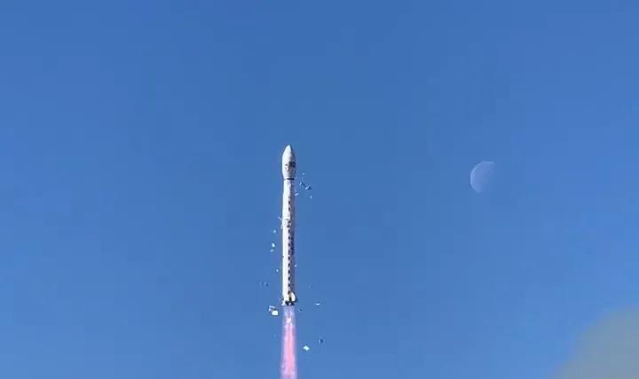
On December 26, the 5-meter optical satellite 02 satellite (Resource No. 1 02E satellite) and the 101 Middle School Science Popularization Small Satellite developed by the Fifth Academy of Aerospace Science and Technology Group (hereinafter referred to as the Fifth Academy) were successfully launched by the Long March 4C carrier rocket at the Taiyuan Satellite Launch Center. The Resource-1 02E satellite is the ninth satellite in the Series of Resource-1, which will carry out natural resource monitoring tasks, continue to provide panchromatic, multispectral, hyperspectral satellite images, and network with the Resource-1 02D satellite launched in 2019, forming China's medium-wide satellite and hyperspectral service satellite observation constellation. Compared with the Resource 1 02D satellite, the 02E satellite has a longer working life, and the satellite platform maneuverability and data downlink capability are higher. The whole star is equipped with a visible near-infrared camera and a hyperspectral camera, and a new long-wave infrared camera is added to enable all-day earth observation.
The 101 Middle School Science Popularization Small Satellite mainly provides a space science popularization and education practice platform for young people, and realizes the functions of auxiliary geography teaching, scientific and technological experiments and campus culture construction.

See a city at a glance
02E star configuration of visible near-infrared camera, the technical indicators are consistent with the 02D star, to ensure data continuity, stability, panchromatic resolution of 2.5 meters, multi-spectral resolution of 10 meters, can identify the typical spectral segment located between the visible light to the near-infrared wavelength range, distinguish the monitoring target shape, scale size and part of the color. In addition, this "eye" will automatically adjust the optimal imaging line of sight, and see the mountains and lakes with a radius of more than 100 kilometers. With the help of sunlight, this camera can keenly capture all changes in the monitoring target, achieve one-time full coverage of large and medium-sized cities, distinguish between various types of land use, and accurately present the size of various land use scales after long-term application, providing support for land use planning.
Schematic diagram of Resource 1 02E star imaging
All the information underground is known
Considering the monitoring needs of minerals and mining areas, the 02E star uses a hyperspectral camera with 166 spectral bands, which has the ability to finely identify and classify features. The camera can fully cover the visible light, near infrared and short-wave infrared wavelength range, and subdivided into 166 spectral channels, a shot can obtain 166 photos of different spectrum segments, accurately capture the spectral information reflected by various types of features, through inversion calculations to calculate the content and coverage of the monitoring target, after synthesis is a veritable "treasure map".
Activities are in full swing throughout the day
The long-wave infrared camera is the third "eye" added by the development team to the innovation of the 02E star, making the 02E star a "night walker" that can also work in the dark. The 02E star equipped with an infrared camera is capable of presenting thermal infrared images of the ground, making any production activity invisible under its monitoring.
Flexible and maneuverable to say shoot and shoot
The 3 cameras equipped with the 02E star give it the three major capabilities of "full vision, wide vision and perspective". At the same time, the development team also created a flexible "good body" for the satellite by upgrading the platform performance. The satellite adopts a three-axis stable control mode of ground orientation, has the ability to yaw calibration, greatly improves the attitude maneuverability, and can quickly adjust the attitude for emergency monitoring needs, aiming at the target "raise the camera, say shoot and shoot".
With the successful launch of the Resource No. 1 02E satellite, China's medium-resolution optical remote sensing satellite network operation has taken a step forward, serving land resources management, mineral resources exploration, geological disaster early warning, water quality monitoring and other fields, and helping China's economic and social development.
Text/Guangzhou Daily Xinhuacheng Reporter: Xiao Huanhuan Correspondent: Mother Country New
Photo / Guangzhou Daily , New Flower City Reporter: Xiao Huanhuan Correspondent : Home Country New
Video/Guangzhou Daily Xinhuacheng Reporter: Xiao Huanhuan Correspondent: Home Country New
Guangzhou Daily New Flower City Editor: Cai Lingyue