Tip: History to this day, who wins and who loses in the Samba War does not seem to be very important, what is important is that in this war both sides ended in a peaceful manner, and after the war, Ladakh still paid tribute to Tibet and is still China's inherent territory. As for us, paying attention to this war and this period of history is nothing more than to tell people that the tactics of the "flooded Seventh Army" on the Qinghai-Tibet Plateau and in Pangong Lake can also be achieved. On the Qinghai-Tibet Plateau, there are not only too many big rivers, but also Pangong Lake itself is a river.
The Flooded Seventh Army is a classic battle, in the Romance of the Three Kingdoms, Guan Yu stored water and then carried out a water attack. Cao Wei's seven armies were flooded by the flood. Yu Forbidden and the generals ascended to the water, a vast ocean, with nowhere to hide. He had to go up to the embankment with Pound and other generals to avoid the water. At this time, Guan Yu ordered his sailors to take a boat to violently attack the Cao army besieged by the big water, and shot arrows on the embankment where the Cao army avoided the water on the big boat, and the Cao army was killed and wounded and captured. In the embarrassing situation of the total annihilation of the army, Yu Ban was forced to surrender to Guan Yu, but Pound resisted tenaciously, and was finally captured, refused to surrender, and was killed by Guan Yu.
Can such a campaign be achieved on the Tibetan Plateau? During the Daoguang years of the Qing Dynasty, there were similar battles in the Samba War in which the Kashmiri samba tribe invaded Tibet, China. Let's start with Pangong Lake.
Pangong Lake, a lake on the Qinghai-Tibet Plateau in China, also known as Bangongcuo and Tsomu Angla Rinpoche, is located about 12 kilometers northwest of the county seat of Ritu County in the Ali region, with an average altitude of 4400 meters. The total area of the lake is 604 square kilometers. It runs in an east-west direction and is about 150 km long. The average north-south width is about 4 km, and the narrowest point is only 5 meters.

That is to say, Pangong Lake can also be called an east-west long river. Water sources mainly come from glaciers in the basin area. Today's data show that the Pangong Lake basin area is a tertiary watershed area with the lake as the main watershed and includes several small mountain lakes such as Zepcuo, Spangur Lake, and Sharda Lake. There are a total of 959 glaciers, which are divided into two regions, north and south. The main distribution areas of glaciers on the north shore of the lake are: Changlong River Basin, Doma River Basin and Inter-mountain Zepucuo Lake Basin Basin; the main distribution areas of glaciers on the south shore of lake are: Maca Tsangpo River Basin, and the basin of Spangur Lake and Sharda Lake in the mountain basin.
Therefore, Pangong Lake is a river-type lake, it is bounded by the center of Changlong Beach, it is divided into east and west two parts, Changlong Beach water depth is less than 1 meter, very narrow, when the dry season lake water is scarce, here will dry up to the bottom, played a role in blocking the lake into a whole, so that the nature of the lake changes, showing the magical characteristics of the east and west salt. Through the following chart, we can see very clearly that the Changlong River in Hubei has a small flow, while the Maka Tsangpo River in Hunan has a larger flow and is the main supply of water from Pangong Lake.
So many rivers merge into a lake, and this lake is a narrow channel-type lake, historically, people have not collectively referred to it as the Pangong River? Let's look at another picture.
On this map there are several key place names such as Chushule, the southern shore of Pangong Lake, Rechingou and Rechin Pass, and the blue lake above (north) is Pangongcuo Lake; the blue lake below (south) is Spangur Lake. This area is known in some historical sources as the Pangongluo region, with the Chushule region of Ladakh to the west. This area has steep slopes, dangerous terrain and a cold climate. The mountains are rocky, the grass is not raw, the air is thin, the roads are often blocked by wind and snow, and the people are inaccessible. Historically, the "Flooded Seventh Army" in the Battle of Semba took place in the Chushule region.
The specific period is 1841-1842.
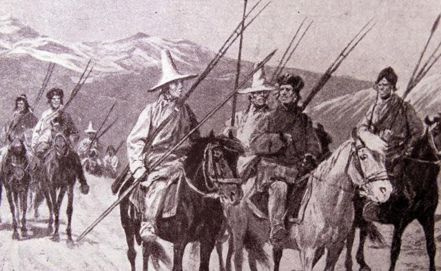
The two warring sides are the Samba army and the Chinese Tibetan Ali army and civilians.
"Sampa" is the Tibetan name for the Ruler of the Dougla tribe, one of the sub-tribes of the Sikhs in India.
In 1841, when Britain launched the First Opium War, the Samba army, mainly Douglas, invaded Tibet, and the war burned all the way to Puran, almost occupying the entire territory of Ali.
At that time, the Central Government of the Qing Dynasty was tired of coping with the crisis in the southeast and had no time to look west. In the face of the invasion of the Samba army, the minister stationed in Tibet and the local government of Tibet resolutely resisted, coordinated the dispatch, dispatched troops, correctly applied strategy and tactics, gave the invaders a heavy counterattack, fought bravely, fought several battles and several victories, the main force of Semba was annihilated in one fell swoop, and killed the leader Uthsel Singh, recovering all the occupied lands.
The following year, the Semba army again invaded on a large scale, and the local government of Tibet sent troops to attack the territory of Ladakh occupied by the Jammu royal family after the battle, and the Semba army requested peace, reached an armistice agreement, and issued a guarantee that it would never cause trouble.
The Douglas, who were living in a small state called Jammu in southwestern Kashmir ruled by Ranjit Singh, expanded into northwestern India in the 1840s to help this ethnic group gain control over Kashmir and place it under their guardianship. As a result, the spearhead of British aggression extended into Ladakh and the western section of the Himalayas.
Jammu is today a town in southwestern Kashmir, South Asia, located in the southern foothills of the Himalayas. The old city is in the north of Tahui River, with ancient palaces and old markets, etc.; the new city is in Henan, which was expanded in the 1970s. In 2001 the population was about 370,000. There are railways and roads to India and Pakistan. It is a local trade center and timber distribution center. There are also some silk weaving industries and small factories. Coal is produced nearby.
After the Samba War, the Military and People of Ali in Tibet eliminated the remnants of the enemy and made important contributions to the stability of the frontier and the relief of the country's worries about the western frontier. Some scholars today believe that in the next 40 years, the British army did not directly invade Tibet from India, Sikkim, Bhutan, and Nepal, which is directly related to tibet's victory in the war against the Samba invasion.
At that time, the number of troops on both sides of the war was about 3,000 on our side and about 6,000 on the enemy side. The last battle was fought in the Chushule region.
Chushule is also translated as Chushur, and the specific place of the battle is called Longyuma (also translated as Longwoma or Chuwo), where the two sides formed a confrontation situation, it is said that there was a river called Halong River at that time, that is, the place where the "Flooding of the Seventh Army" took place, but some people also call this river the Bangong River in historical records.
Today's people have difficulty in explaining the details of the "flooded Seventh Army" at that time, and can only rely on some vague historical materials to restore it, which is the statement of both sides after the war.
Our statement comes from the recitation of Meng Bao, then minister stationed in Tibet:
On July 27, the Samba thief Mu ba zhan led the crowd to the camp of Yu Wo, resisted the enemy with our soldiers, and engaged in battle for several days, and the general Mu Ba Zhan was annihilated, and more than 120 thieves were killed, and the thieves retreated more than twenty miles, only across the river from the place where Kaburun had camped. The thief secretly built a long embankment above the river and irrigated my camp downstream. Gaburundang moved his officers and men to a critical point in Gaofu and tried to resist. On the second day of the first month of August, a samba leader, Diewa, led the thieves to come and fight each other. Our soldiers tried their best to resist, and re-killed more than 230 thieves and two leaders, and did not allow the thief to enter the Tangut realm. The thief was defeated several times, so he sent the small leader Redon and the general Amizu to camp for peace. The meaning is obvious: our side won the battle, and the enemy secretly built a levee in the upper reaches of the river, and then released water to flood our camp. But even in this case, our side still rose up in resistance, not only defeating the enemy, but also forcing the enemy to come and ask for peace.
However, in the book "History of Jammu", the enemy's narrative is as follows:
After the enemy (referring to the Tibetan army) retreated into the barracks, Diwan surrounded the barracks. For eight days in a row, no fighting took place, except for small-scale contacts. The enemy barracks (The Camp of The Wowo) were so strong that the Douglas could do nothing about it... [Someone] told Divan that if the river was channeled into the plains by a certain road, the barracks would be submerged, and the besieged army would have to come out. Diwan immediately made a deployment and introduced the river into the plains. The river flowed toward the plain for three days, and the barracks were all flooded. The enemy tried to avoid the flood, but finally there was nothing he could do, the supplies and war equipment were all flooded, and the Dougla Legion was besieged outside. With no land to live in, no way to escape, they had no choice but to ask Divan to spare their lives. He also said: Diwan sent his men with a broad mind to appease them (the Tibetan army). All the officers of the Lhasa army came to Divan without weapons. Diwan treated them with courtesy, confiscated the weapons and implements of the besieged troops, and gave them a way out of the barracks... In short, Diwan achieved a complete victory over the Lhasa army. Finally, it is said that Divan did not make an effort to go to the areas he had conquered, but for reasons of his personal health, he returned to Ladakh after celebrating this great victory. Eventually, the Lhasa government sent people to seek peace and negotiate peace with Diwan.
It is also obvious that the enemy is saying that he defeated the Tibetan army by means of "flooding the Seventh Army," and not only magnanimously approved a "way of life" for the Tibetan army, but also accepted the peace negotiations of the Tibetan army.
The outcome of the negotiations was roughly as follows: the Semba army promised not to invade Tibet again; maintained tibet's inherent border with Ladakh; and Ladakh paid tribute to Tibet as usual. Regrettably, however, the Tibetan army's inability to drive the Semba army out of Ladakh at that time led to the summer of 1846 when the British unilaterally demarcated the eastern boundary of the State of Jammu and Kashmir and included Ladakh into Kashmir. This was not only not agreed by the Qing government at that time, but also by the later Nationalist government.
History to this day, the Samba War who wins and who loses does not seem to be very important, what is important is that in this war both sides ended in a peaceful way, and after the war, Ladakh still paid tribute to Tibet, which is still China's inherent territory. As for us, paying attention to this war and this period of history is nothing more than to tell people that the tactics of the "flooded Seventh Army" on the Qinghai-Tibet Plateau and in Pangong Lake can also be achieved. On the Qinghai-Tibet Plateau, there are not only too many big rivers, but also Pangong Lake itself is a river.
The pictures in this article are from the Internet, referring to Zhou Weizhou's "Several Issues Concerning the 19th Century Tibet and the Samba War" (Chinese Frontier History and Geography Research, No. 3, 2008) and other materials, thanks to the original author!
For more exciting content, come and follow the human geography of the west