This was originally a dividing line full of academic overtones, which was originally a name worshipped by the geography community, but now it is shared by the public along with the line he discovered.
In 1935, when he published a paper entitled "The Distribution of Chinese Mouths", he proposed that the "Yaohun-Tengchong Line" was the geographical dividing line between Chinese. But he only said the two endpoints of Yaohun and Tengchong, and did not draw this line on the drawings of the paper. It wasn't until 1989 that he worked with people to draw this line using the latest census data. The reason for this is probably because this line is not the academic focus of the paper.
Years later, this "Yaohun-Tengchong Line" has become known as the "Hu Huanyong Line". In the academic circle, it is recognized as the top dividing line of China's comprehensive national conditions with its scientific and stable, and has become another important national geographic boundary juxtaposed with the "Qinling-Huaihe Line" and the "Great Wall Line". Moreover, the first two lines follow natural mountains or artificial buildings, which can be traced, while the "Hu Huanyong Line" is not figurative, it is born out of thin air.
In society, this line has become a secret line, a tourist line, driving along the "Hu Huanyong Line" has become a journey that many people are fascinated by. Because the geographical forms of this line are complex, and the population density on both sides of this line is hugely different, the economic and social development is also quite disparate.
Over the years, the "Hu Huanyong Line" has grown in academic reputation because of its unimaginable stability. In 1935, the western part of this line accounted for 4% of the country's population; and using the 2010 census data, the proportion of the western population was roughly between 5.6% and 6.3% due to the different resolution accuracy, with little change.
As a result, the "Hu Huanyong Line" has worried many people because of its decades-long stubbornness. As a result, the discussion on whether the "Hu Huanyong Line" should be broken, whether it can be broken, and how to break it has gradually become more and more enthusiastic.
This seemingly "out-of-the-box" line is actually based on rigorous, boring, and long-term academic research. As a researcher, the fundamental task is to discover some regular things in the process of understanding the world. The essence of the "Hu Huanyong Line" is to find the most concise way to portray the spatial form of the Chinese, and then become a stable national and geographical demarcation line, which has a profound impact on the balanced development of the country, the construction of ecological civilization, national rejuvenation and national defense and security, and embodies the great application value.
This year marks the 120th anniversary of the birth of Mr. Hu Huanyong, and I would like to pay tribute to the master with this article.
Hu Huanyong in the 1930s

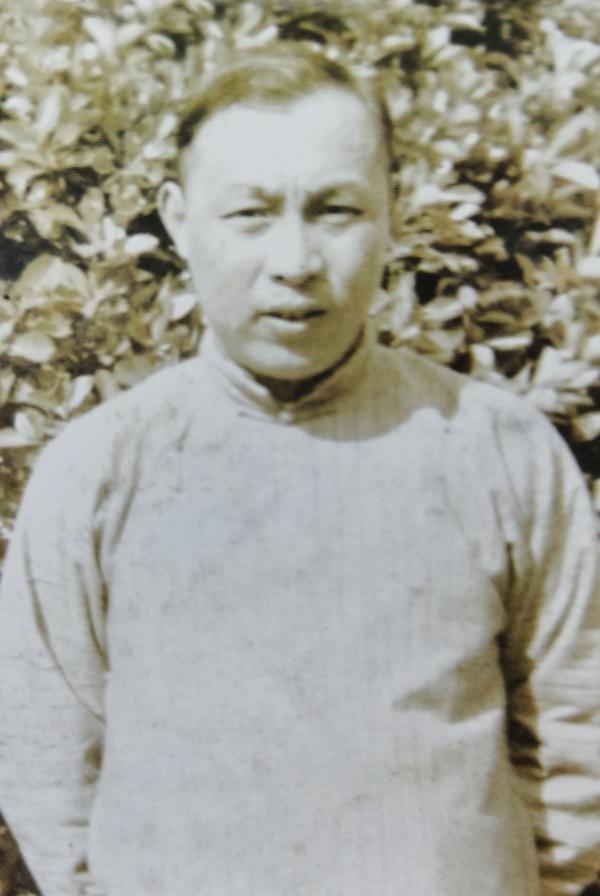
In his later years, Hu Huanyong
Master Archives
Hu Huanyong: Born in November 1901, Zi Xiaotang, a native of Yixing, Jiangsu Province. Geographer, geography educator, important founder of modern human geography and physical geography in China. He has successively served as the director of the Department of Geography of The Central University, the chairman of the Chinese Geographical Society, and the director and professor of the Institute of Population Research of East China Normal University. He proposed that the geographical distribution of Chinese mouth should be bounded by the "Yaohun-Tengchong Line", which was later known as the "Hu Huanyong Line". In April 1998, he died in Shanghai.
Interview guests
Ding Jinhong: Born in 1963, Lianshui, Jiangsu, graduated from the Department of Geography of Nanjing University with a bachelor's degree and a master's degree, and a doctorate from the Institute of Population Research of East China Normal University. He is currently a member of the National Committee of the Chinese People's Political Consultative Conference, the vice president of the Shanghai Population Society, the director and professor of the Institute of Population Research of East China Normal University, and the author of monographs such as "Population Spatial Processes" and "Theoretical Geography".
Hu Qizhong: Born in 1944, a native of Yixing, Jiangsu Province, the seventh son of Hu Huanyong. He graduated from Shanghai Chemical College in 1963, and in 1987, he was appointed deputy chief engineer of Shanghai Solvent Factory and was selected by the State Economic Commission to study at General Electric Company in the United States. In 1992, he received a special allowance from the State Council and was responsible for compiling the book "Polyoxymethylene Resin and Its Application".
margin
Gao Yuan: When did you come to study under Mr. Hu?
Ding Jinhong: My undergraduate and graduate students studied in the Geography Department of Nanjing University, and the Geography Department of Nanda University continued the vein of the former Central University, and Mr. Hu was not only the leader of geography of Central University, but also the leader of geography of all China. When I was in college, I felt the influence of the name Hu Huanyong in the field of geography.
In 1986, I graduated from graduate school with an interest in doing population geography research. At that time, knowing that Mr. Hu was at East China Normal University, I wrote him a letter talking about my thinking on land planning and other aspects, and I wondered if it was possible to study under his door. I soon received a reply from Mr. Hu, which I have kept.
Gao Yuan: What impressed you most about Mr. Hu's reply?
Ding Jinhong: First, he was very enthusiastic, he said that although he was old, he welcomed me to take his doctoral student; second, the old man's reply was written with a pen, and the handwriting was a little shaky, I think it was old after all. Later, I learned that because he had been writing for many years, his right hand could no longer write, and the letter was written with his right hand holding his left hand.
In fact, I still have a relationship with Mr. Hu, my master tutor is his graduate student when he was teaching at Central University, he is actually my "master ancestor", which is a special fate between me and Mr. Hu.
Gao Yuan: The first time I met Mr. Hu, what kind of person did you think he was?
Ding Jinhong: I remember that after the last course was taken, the invigilator told several of us that Mr. Hu lao wanted to see you. This surprised me, because the test results had not yet come out, and the tutor asked to meet, which is even more unimaginable today.
At that time, Mr. Hu was 85 years old, and with two or three academic assistants, he interviewed us at the East China Normal University Trade Union. During the exchange, Mr. Hu's thinking is very clear, he knows the trend of Chinese mouth, and there is no disorder in thinking and expression, indicating that his body is still OK. He kept asking questions to see if we were really interested, really wanted to study.
I also have a feeling that he is in a hurry, desperate for someone to follow him in the study of population geography. After the end of the Cultural Revolution, Mr. Hu recruited the first batch of doctoral students in 1984, and only one was recruited. The second year, for some reason, he stopped for a year, and by 1986 our class was his second enrollment, including me, and he recruited three at once.
Gao Yuan: Are the three of you his disciples?
Ding Jinhong: After we, Mr. Hu also recruited doctoral students. But he was getting older, and the later doctoral students were mainly brought by the deputy supervisor. It can be said that we are the last doctoral students he personally brought.
Takafumi: How did he teach you?
Ding Jinhong: Instead of starting classes systematically, Mr. Hu often asked us to go to his house and talk to us about academics in a rambling manner. We felt both honored and pressured to make a lot of preparations every time we went to my husband's house. The most he asks is what you think lately, what you've done lately, and if it doesn't meet his expectations, he tells us to hurry up.
At that time, Mr. Hu lived in shida village, and the small third room on the first floor had to live in their old couple, their young son Hu Qizhong and his wife and daughter, and a nanny. Every time we went, we talked in the small study, which was crowded.
In the late 1980s, Hu Huanyong was with a doctoral student, and Ding Jinhong was on the right
source
Gao Yuan: When you talk to Mr. Hu, does he often mention the "Hu Huanyong Line"?
Ding Jinhong: We will discuss this topic, but he will not emphasize the importance of this line in particular. He was a peaceful scholar who would not flaunt his academic achievements.
In 1935, Mr. Hu proposed a demographic geographical dividing line in his article "The Distribution of Chinese Mouths", called the "Yaohun-Tengchong Line". Until July 1984, when Professor Tian Xinyuan, a Chinese-American demographer, visited Mr. Hu in Shanghai, he proposed that the "Yaohun-Tengchong Line" had long gone beyond the scope of population geography and was applied to many areas that could be touched by human-land relations, and should be called "Hu Huanyong Line". This is the origin of the currently known "Hu Huanyong Line" title, which later appeared widely in the research literature, which is not common in the relatively humble oriental academic culture.
Gao Yuan: In your opinion, is it accidental or inevitable that Mr. Hu proposed this demographic geographical dividing line in 1935?
Ding Jinhong: This depends on the background of that year. In the early 20th century, China was shrouded in the shadow of the defeat of the Sino-Japanese War and the Gengzi reparations, and in addition to reflecting on the chronic diseases of the system and the cultural depression, the huge population was also considered to be "wronged creditors". Thus, the sharp contradiction between population and land became an important factor in explaining the national crisis.
At that time, many scholars advocated the relocation of the surplus population to the sparsely populated northwest region through large-scale reclamation to alleviate the country's overcrowding worries. After the fall of the northeast after the "9.18" incident in 1931, the northwest region became the only destination for domestic immigrants, and local officials and folk elites suggested that the area be reclaimed and the immigrants developed. However, at that time, the central and local governments were not active in the development of the northwest, and even the "Northwest Construction Committee" that was requested by many parties did not approve it.
Takafumi: But it is precisely this dilemma that makes population geography, which studies the relationship between man and land, come into being?
Ding Jinhong: Yes, at that time, many Chinese and foreign scholars began to study the geography of Chinese, and Zhu Kezhen and Weng Wenhao and others began to enlighten the geography of Chinese. In the early 1930s, Mr. Hu was the director of the Department of Geography at Chuo University, and he followed the path of his teacher Zhu Kezhen to study the problem of population distribution, more finely divided the population geography units, and produced township-scale population distribution maps in Jiangning, Jurong and other places in Jiangsu Province, and explained them with geographical elements such as terrain and soil. In 1935, he published "Population Density and Agricultural Production Areas in Anhui Province", which divided Anhui Province into four agricultural production areas: the dry grain area in northern Anhui, the rice area in central Anhui, the tea mountainous area in southern Anhui and western Anhui, and explained the population distribution accordingly.
On the basis of the geographical analysis of provincial and county populations, Mr. Hu is making and researching maps of the national population at county-level resolution. When he wrote The Distribution of Chinese Populations, the first challenge was the availability and reliability of population data. Mr. Hu tried to use the latest data from 1935, but the reality was that only the county-level statistics of six provinces, including Zhejiang and Shanxi, were complete. He spent great efforts to collect and calculate the population of various places through various channels, among which the data of 17 provinces such as Jiangsu and Anhui were taken from government reports, the data of municipalities directly under the central government and concessions were mainly taken from the "Statistical Monthly" and the British "Yearbook of Politicians"; the three provinces of Sichuan, Guizhou, and Fujian had to use postal statistics in 1925 due to the lack of recent data. In addition, he also used some sporadic data from the Declaration Yearbook and the English China Yearbook.
After a fine needle and a dense collation, Mr. Hu realized the complete consolidation of the first county-level statistical unit of Chinese mainland population data, and he himself proudly called it "the most complete statistics in the country".
Takafumi: The famous "Yaohun-Tengchong Line" was born?
Ding Jinhong: Mr. Hu correlated the county-level population with the land area and produced a population distribution point value map and a density grade map. He used a point to represent 20,000 people, dividing the county-level population density into 8 levels, intuitively reflecting the dense differences in population distribution.
He then analyzed the population density hierarchy against the physical geography attributes. For example, the first level of the densest population corresponds to the rice cultivation plain, the second level is the dryland alluvial plain, and the third level is the local plain along the river, and the lower level is the hill, mountain, plateau, etc., which establishes the population geographical analysis paradigm with terrain and climate as the conditions and grain production as the key intermediate variables.
After completing the population distribution map and the population density map, Mr. Hu keenly found that there is a linear outline of China's population density differences, which is the "Yaohun-Tengchong line". This line reflects the uneven pattern of Chinese distribution, and is a mutation line in the process of the gradient of Chinese density decreasing from southeast to northwest.
Gao Yuan: But why didn't Mr. Hu draw this line on the accompanying drawing of the article?
Ding Jinhong: It is true that he proposed this line in the text, but he did not actually draw this line, which is somewhat surprising. It was not until 1989 that Hu Huanyong and Wu Li used the 1982 census and 1985 demographic data to re-draw the distribution map and density map of the Chinese population, and implemented the "Yaohun-Tengchong Line" on the map.
According to our speculation, he did not directly draw it at that time, probably because the "Yinghun-Tengchong Line" was not the academic focus of the article "The Distribution of Chinese Mouths". But later, it became one of the most influential academic achievements in Chinese geography.
Hu Huanyong took a photo while studying at Nanjing Higher Normal School
In 1935, Hu Huanyong's masterpiece "The Distribution of Chinese Mouths" was published in the Journal of Geography
steady
Gao Yuan: From proposing this line to actually drawing this line, Mr. Hu spent a full 54 years. In a way, time has tested the scientific nature of this line?
Ding Jinhong: In fact, Mr. Hu's research on the distribution of Chinese mouths, especially the discovery of the "Yaohun-Tengchong Line", quickly attracted the attention of Chinese and foreign scholars. Mr. Hu himself recalled that when he visited the United States at the end of 1945, he found that his papers had been translated and printed in full by the American Geographical Society, and distributed to various parties along with the Geographical Review they issued. In 1948, an American scholar published a paper entitled "Pre-War Chinese: Distribution and Density", which systematically introduced Hu Huanyong's pioneering research on the distribution of Chinese populations.
In the 1950s, Ma Yinchu's "new population theory" caused great controversy, and population research became a sensitive issue. It was not until the release of the data from the third census in 1982 that the verification studies on the geographical distribution of Chinese populations and the "Yaohun-Tengchong Line" gradually became rich. Based on the census data, Mr. Hu himself calculated the proportion of population on both sides of this line and found that the proportion of population in the southeast region was slightly reduced from the original 96% to 94.4%, and the proportion of the population in the northwest increased from the original 4% to 5.6%, and the population density disparity between the two sides did not change substantially.
Gao Yuan: There is an academic term called "stubbornness", is it appropriate to describe the "Hu Huanyong line"?
Ding Jinhong: Indeed. In the 1990s, according to the 1990 census data, some scholars found that the population ratio in the east and west of the "Hu Huanyong Line" changed by only 1.8%.
2015 marks the 80th anniversary of the discovery of the Hu Huanyong Line, and I, along with other scholars, have used the 2010 census data to further verify it. Due to the different resolution accuracies and slightly different results, we found that the proportion of the population west of the "Hu HuanYong Line" was about 5.6% to 6.3%, only slightly higher than in 1990. This once again shows the stability, or stubbornness, of the "Hu Huanyong Line".
Gao Yuan: It has been almost 90 years since the "Hu Huanyong Line" was proposed, why is it still so stable?
Ding Jinhong: When Mr. Hu wrote "The Distribution of Chinese Mouths", he emphasized two factors: one is the terrain, and the other is the climate, especially the amount of rainfall. On the one hand, the "Hu Huanyong Line" is more consistent with the second and third step demarcation lines of the Chinese terrain; On the other hand, the "Hu HuanYong Line" is closer to the 400 mm equivalent rainfall line. This shows that the role of terrain and climatic conditions is macroscopic and accurate, and it is also comprehensively superimposed.
Moreover, the "Hu Huanyong Line" is located in the agricultural and pastoral staggered belt, the agricultural production methods on both sides of this line are significantly different, the southeast is dominated by farming operations, the northwest is dominated by animal husbandry, and the land production efficiency of farming operations is higher than that of animal husbandry, thus determining the difference in population carrying capacity. Looking further, the "Hu Huanyong Line" is the dividing line of China's agricultural production potential, that is, the dividing line of the primitive productive forces of terrestrial ecosystems.
In addition, Professor Ge Jianxiong believes that the "Hu Huanyong Line" did not exist from all times, but was basically fixed in the late Qing Dynasty, and its stability is historically staged or long-term or even eternal, which requires more exploration by natural sciences and social sciences.
Gao Yuan: Over the years, has anyone tried to challenge or adjust the "Hu Huanyong Line"?
Ding Jinhong: Some geographers have proposed that China's geographical dividing line should be the "Mohe-Tengchong Line" rather than the "Yaohun-Tengchong Line", and the Mohe River is about 500 kilometers northwest of Yaohun.
He did not explain the need for such an adjustment, which I speculate may have been due to two considerations. First, the "Mohe-Tengchong Line" divides the land into two parts with roughly equal area; second, Mohe is the northernmost county in China's latitude, which is more visually vertex significance.
Gao Yuan: What is Mr. Hu's attitude towards such changes?
Ding Jinhong: Of course, he disagreed, but he did not write an article to refute it. When I was studying for my doctorate, I once went to Mr. Hu's house as usual to take a class, and he mentioned that what does it mean to say that such a change is, and what is the particularity of Mohe?
In fact, such a modification has little impact on the status of the "Hu Huanyong Line". When Mr. Hu proposed this line, The territory of China was different from the present, and the significance of the apex of the Mohe River and the equalization of the "Mohe-Tengchong Line" were not established. What's more, after this adjustment, the proportion of the population on the northwest side has risen to 10%, and the geographical type of many places on the line has changed greatly, and it no longer has the significance of a geographical dividing line. So after a while, this "Mohe-Tengchong Line" was basically no longer mentioned.
From 1945 to 1947, Hu Huanyong visited the United States
hot
Gao Yuan: In the past, people were widely known as the "Qinling-Huaihe Line" and the "Great Wall Line". Now, from the perspective of social heat, the degree of discussion of the "Hu Huanyong line" has reached or even exceeded the first two. From the perspective of academic status, can these three lines be equally measured?
Ding Jinhong: I think that the "Hu Huanyong Line" has gradually established itself as the national geographic boundary.
The so-called national geographic demarcation refers to the domestic top regional demarcation line of larger countries. China's vast territory, complex and diverse geographical conditions, top geographical areas have a variety of customary divisions, such as the "Qinling-Huaihe Line" or "Yangtze River Line" to divide the south and north, the "Great Wall Line" to divide the Senegalese and Saiwai, the north-south combined provincial boundaries into the coastal, inland or east, central and western three major zones, and the terrain gap contour into high, medium and low steps.
The "Hu Huanyong Line" originates from the difference in population density in form, but in essence, it profoundly reveals the comprehensive differentiation pattern of China's natural, economic, human and other factors. From this line, it can be seen that the direct impact on population density is the human activity factor, including agricultural production methods, industrial transportation conditions, commercial agglomeration locations, etc., and hidden behind human activities are natural conditions such as topography, temperature precipitation, soil vegetation, etc. In the northwest area of the "Hu HuanYong Line", natural conditions, agricultural foundations, transportation conditions, and urban development are in strong contrast with those in the southeast, resulting in a relatively sparse population.
It can be confirmed that the "Hu Huanyong Line" is the top demarcation of China's comprehensive national conditions, and its recognition, scientificity and stability are increasingly demonstrated in the practice of national economic, social and ecological civilization construction, and are becoming another important national geographic boundary juxtaposed with the "Qinling-Huaihe Line" and the "Great Wall Line".
Gao Yuan: However, when the "Hu Huanyong Line" is increasingly becoming a market talk, is there a problem of chiseling and excessive extension?
Ding Jinhong: The "Hu Huanyong Line" relies on the natural geographical foundation of China, and many socio-economic and even cultural phenomena restricted by natural conditions will be more or less related to this line, which has led to a variety of complex extensions and explorations.
For example, some people think that this line distinguishes the macro regional differences in China's urban and rural development level, the southeast region is not only leading in urbanization, but also the level of rural development is significantly higher than that in the west; some people have found that the high outflow area and the high inflow area of the Chinese mouth are complementary in the southeast half of the line, and the low outflow area and the low inflow area are basically the same in the northwest half wall; some people have verified that the urbanization level on the southeast side of this line is negatively correlated with the environmental pollution situation, while the northwest side is positively correlated.
It is logical to extend the "Hu Huanyong Line" to aspects such as population migration and urbanization. But there are also some studies that extend to a wider range of fields, some that have yet to be verified, and some that are almost curious. Some people think that the "Hu Huanyong Line" is a dividing line for the evolution of China's family size, and the families on both sides are in the process of miniaturization, but the family size in the northwest shrinks faster; some people say that this line has the significance of dividing China's inbound tourism space, with many hot spots in the southeast and more cold spots in the northwest; others think that this line is the dividing line Chinese collectivist spirit.
Gao Yuan: Some bizarre over-extensions are actually consuming the "Hu Huanyong Line".
Ding Jinhong: The essence of the "Hu Huanyong Line" is the relationship between man and land, and the two dimensions of man and earth have sufficient malleability, which is illustrated by the increasingly popular extended research in recent years.
I believe that the current research should think more about the relationship between this line and the balanced development of the population, how the northwest region can increase development opportunities and enhance social welfare, and the new performance of this line in the post-industrial society and the era of big data. Only by scientifically, rigorously and pragmatically studying the new proposition of human-land relations can the "Hu Huanyong Line" better serve the cognition of national conditions and national construction.
And those so-called studies on the "Hu Huanyong Line" piercing and chiseling are inappropriate "academic consumption" of the "Hu Huanyong Line" and are not worth advocating.
family
Takafumi: Do you have seven brothers and sisters?
Hu Qizhong: Yes, I am the youngest, the seventh oldest. I was born in Chongqing in December 1944, during the War of Resistance Against Japanese Aggression, and central university temporarily moved to Chongqing. When I was born, my father was 43 years old, and he had been the provost of Chuo University, but I should have resigned from this position when I was born.
After the father's original wife died of illness, she left three sons. My mother is from Nanjing, but because my grandfather was in Xinjiang, she spent her teenage years in Tacheng. She returned to Nanjing with her family at the age of fifteen or sixteen, and was later admitted to the History Department of Central University, and after graduation, she was considered older and married to her father through introduction.
Takafumi: What is the relationship between parents?
Hu Qizhong: My mother was very kind, she and her father got married on the third day, and she slept with her swaddled third brother at night. When Central University moved to Chongqing, he did not take his mother and children with him, but took the students with him. On the eve of the Nanjing Massacre, my mother was lucky enough to take the old man and children to the westbound steamship.
Before the founding of New China, my father refused a ticket to Taiwan, and then went to the North China People's Revolutionary University to study, then to the Huaihuai Committee in Bengbu, Anhui Province, and then to Huaiyuan to organize the Huaihe River Water Conservancy College. Her mother was well educated, but she was a housewife all her life. Later, she told every daughter-in-law that you must be self-reliant and cannot afford not to work, which is the biggest regret in her life.
Gao Yuan: When did you come to East China Normal University?
Hu Qizhong: In 1950, his father went to work in the Huaihuai Committee of the Ministry of Water Resources, led a team from northern Anhui to northern Jiangsu to conduct field investigations, and completed the survey and measurement of the irrigation canal in northern Jiangsu. After its completion in 1952, the flood disaster of the Huai River was effectively curbed.
In 1953, he was transferred to the Department of Geography of East China Normal University to teach, and this time he also came to Shanghai first, and his mother came later. This has always been the case, and his mother has followed him in his father's footsteps. At that time, my eldest brother and second brother were very old, and the other brothers and sisters were all studying outside the school, so my mother only took me with me.
Gao Yuan: Mr. Hu was 52 years old when he came to East China Normal University, and he has not left since, how did he live at East China Normal University?
Hu Qizhong: It should be said that the school was good for my father. In terms of work, in 1957, East China Normal University founded the Population Geography Research Office, with my father as the director, which was the first population research institute in Chinese universities. After the Cultural Revolution, in 1981, the East China Normal University restored and rebuilt the Population Research Office, and my father was still the director, who was 80 years old at the time. In 1983, the school established the Institute of Population Research, and his father was the first director. He was allowed to retire in 1990, at the age of 89.
In terms of life, when his father first came, the school gave him three newly built bungalows. After a few years, we were put into the ground floor of a small bungalow with several rooms. During the Cultural Revolution, we moved into a 15-square-meter bungalow, which of course was small. In the 1980s, his father was given a small three-room apartment on the first floor, when Ding Jinhong often came to the house for classes. In 1990, the school gave my father a new house, although the area was only 100 square meters, but there were 5 rooms, and my old nanny also had a place to live.
Takafumi: When the old man got older, what habits did he have in his daily life?
Hu Qizhong: He reads books during the day, often reading original books. I remember that I accompanied him on a walk around the campus in the evening, and he always taught me that if you want to understand the frontiers of the discipline, you must read the original books, and you must know several major languages.
His requirement for his grandchildren is to have a dictionary for each person when doing homework, and not to borrow from each other. He paced the room, saw whose head was too low, and knocked on the table. He ate very simply, eating noodles in the morning and noon, eating a small snack at three or four o'clock in the afternoon, and not eating dinner.
Ding Jinhong: Every time I go, I feel that Mr. Hu is thinking about major issues that Chinese mouth every day. He was very diligent, and when he woke up in the morning, he wondered what to read, which was his way of life. Their family revolved around Mr. Hu, he was the center of the family, and if he wanted to read any books, others would quickly hand them to him. There was a time when a building was built next to his house, and the piling was very loud, and he would go to the union with a few books to read.
I can't imagine that when Mr. Hu was in his 80s, he often published papers, and every two years he would publish a monograph. And he wrote with his left hand, which is really a pity for time.
Takabuchi: How did the old man spend his last years?
Hu Qizhong: I remember one day, we suddenly found my father sitting on a wicker chair and rolling his eyes. My wife shouted and squeezed the person hard, and after a while, a breath finally came up. After that, my father's health deteriorated significantly, and he was admitted to Huadong Hospital not long after. After four years and one month in the hospital, when we finally fell into death, the doctor asked us if we should cut the trachea, and we said no, my father was 98 years old, don't add to the pain.
Ding Jinhong: After Mr. Hu was admitted to Huadong Hospital, I often went to see him because I had already stayed in school to work. He lived in a double ward, and in the same room was Mr. Yu Ling, a senior in Shanghai's literary circle. At first, he was in good health, could talk to me, and introduced me to Mr. Yu.
On April 30, 1998, all the teachers of our population institute went to Yangzhou for a spring tour, but I didn't go because I had been there. It was also providence, I thought I hadn't seen Mr. Hu for a while that day, and I should have gone. When they arrived at the hospital, Mr. and Mrs. Hu Qizhong were there, and they saw Mr. Hu lying on the hospital bed breathlessly, his face still covered with gauze, and he was unconscious.
As soon as I got home, I received a call from Hu Qizhong's wife, saying that my father was gone.
Hu Huanyong and his wife Gui Xiujun
change
Gao Yuan: Mr. Hu has been dead for more than 20 years, and for this magical "Hu Huanyong Line", the interest of all walks of life is getting stronger and stronger, many people want to drive a car, and some people want to hold a car rally. From a scientific point of view, do you think you should run?
Ding Jinhong: China has three national-level geographical demarcation lines, the "Qinling-Huaihe Line" and the "Great Wall Line" have strong specificity, while the "Hu Huanyong Line" is not specific enough, Mr. Hu only tells us two endpoints. The geographical form of this line is very complex, and it is very necessary to walk around it yourself.
I had this wish many years ago, but it hasn't been true until recently. From 2019 to 2020, I drove the whole way with my students.
Takafumi: Do you run in one go, or do you run in sections? In addition to looking at the topography, what else to focus on?
Ding Jinhong: We ran in sections, online for two months, and lasted for a year. The first section first went to Yaohun and then rented a car to run south, first running to the northeast; the second section ran north from Tengchong, finishing Yunnan and Sichuan; the third section was affected by the epidemic at the beginning of last year, and it was not until September that it ran through Shanxi, Shaanxi and other places.
We can't run entirely on the line because there is no road built along the "Hu Huan Yong Line", and there are volcanoes and seismic belts on the line. We were like sewing clothes, going back and forth along the line. The principle is to get as close as possible to the "Hu Huanyong Line", including the Hengduan Mountains and the Qinling Mountains.
Takafumi: What is the biggest lesson about running down this road?
Ding Jinhong: It should be said that we have personally confirmed the significance of the "Hu Huanyong Line" for the demarcation of National Geographic. On this line, some segments are obviously the geographical dividing line between north and south, and some segments are the geographical dividing line between east and west, which is not intuitively felt from the map.
We not only look at the topography, but also go to the homes, museums and so on of the people along the route. Because in essence, the "Hu Huanyong Line" is not only a physical and geographical dividing line, but also a deeper connotation of the relationship between man and land. I'm working on a book on this online relationship between people and places, and this journey has benefited me for the rest of my life.
Gao Yuan: Judging from Mr. Hu's life, his academic field is very wide, and the "Yaohun-Tengchong Line" is not even the focus of his academic paper. Why, after his death, is this line revered as the "Hu Huanyong Line" and seems to have become Mr. Hu's greatest academic legacy?
Ding Jinhong: Mr. Hu is a master in the field of literature and history, and has written a lot in his lifetime, but if you look at the actual influence, the "Hu Huanyong Line" can be said to be his most important academic achievement.
Since modern times in China, the contradictions between man and land have gradually become prominent. The population in the early Qing Dynasty was about 100 million, and by the end of the Qing Dynasty and the beginning of the People's Republic, it had grown to more than 400 million, known as the population miracle of the Qing Dynasty, and the contradiction between population variables and cultivated land constants was becoming increasingly acute. From Zhu Kezhen and Weng Wenhao to Hu Huanyong, they all closely linked land, agricultural products and population, and expressed deep concern about the national conditions of "the land is vast and the people are dense."
The great value of the "Hu Huanyong Line" is hidden in the logic of food and employment that are basically needed for human survival. Food is a resource that human beings cannot survive or lack, although food in modern society can be obtained from the market, but large-scale, long-distance food transportation is uneconomical, so the production capacity of food still has the strongest explanatory power for the macro distribution of the population. Employment is the key intermediate variable of population agglomeration in cities, and places with good farming conditions are often suitable for urban development, which is an important reason why the "Hu Huanyong Line" can still maintain stability in the process of industrialization.
Gao Yuan: In recent years, there has been more and more discussion about how to break through the "Hu Huanyong line", is this line really unbreakable?
Ding Jinhong: When Mr. Hu proposed this line in the mid-1930s, when the Chinese population was 458 million, geographers were already amazed at the peasants who operated small plots of land all over China. Today, the Chinese has exceeded 1.4 billion, the population has tripled, and the area of arable land has increased by only 56%.
The "Hu Huanyong Line" is an objective existence of geographical conditions, the boundary between dense population and sparseness, unfortunately it has also become the boundary between rich and poor, which is the reason why we hope to break through the "Hu Huanyong Line". However, this breakthrough should be aimed at giving the northwest region more development opportunities, especially strengthening the construction of infrastructure such as transportation, education and ecological protection, improving the investment environment, and ensuring the basic livelihood of the people, only in this way can the western region have a faster development speed and narrow the gap with the eastern region.
Gao Yuan: In your opinion, what is the core significance of breaking through the "Hu Huanyong Line"?
Ding Jinhong: Whether it is the social ethics of fair development or the emotional sustenance of helping remote people, we should implement an active policy of tilting toward the west. Because if you listen to the arrangements of the market and passively wait for the opportunities in the southeast region to overflow, it will be a long-term, large-scale economic cycle, and the northwest region cannot afford to wait.
We must also soberly see that the breakthrough of the "Hu Huanyong Line" should not only focus on the proportion of population. For the Northwest Territories, increasing population density is not necessarily a goal worth pursuing. At present, accounting for 6% of the country's population, it is not necessarily too small, it is no problem to go with nature and more and less, what is important is to make the people rich and make the ecological stability good.
Column Editor-in-Chief: Chen Shuyi Text Editor: Chen Shuyi Title Image Source: Provided by The Interviewee Photo Editor: Cao Liyuan
Source: Author: Gao Yuan