Qingbaijiang District belongs to Chengdu City, Sichuan Province, located in the northeast of Chengdu City, the geographical coordinates of east longitude 104 ° 9 ′ 37 " ~ 104 ° 29 ′ 31 ", north latitude 30 ° 39 ′ 33 " ~ 30 ° 55 ′ 0 ", east of Jintang County, south of Longquanyi District, west of Xindu District, north of Guanghan City, Sichuan Province. Qingbaijiang District covers an area of 378.94 square kilometers, with a permanent population of 406,700 (at the end of 2017)[1], has jurisdiction over 11 townships (streets), 124 administrative villages (communities), and has tourist attractions such as Phoenix Lake International Ecological Wetland Tourist Resort, Xinghua Village, Longmen Taohuashan, Huayuangou, Yihu Park, Jiazhen Park, etc., and has won the titles of "Top 10 Comprehensive Economic Strength of Counties in Sichuan Province", "Top 100 Comprehensive Strength Districts of China Municipal Districts", "National Ecological Zone" and so on. Qingbaijiang has a long history and profound cultural accumulation. In the Han Dynasty, there were already prototype market towns, and there was the Xiuchuan Academy, the highest ancient county-level academic institution in the province, which was the best preserved in the province. Located in the ancient town of Mimu, the site of the Eight Arrays of Drought is the place where Zhuge Liangjian, the chancellor of the Shu Han Dynasty, exercised the art of war and trained soldiers. In October 2018, Qingbaijiang District was ranked 70th in the top 100 districts with investment potential and 82nd in the top 100 districts in terms of comprehensive strength.
The name of the Qingbaijiang District is derived from the Qingbai River, a river that flows through the northern boundary.
In 1956, the Chengdu Railway Bureau set up a station in Mars Village north of Mimu Town, which was named "Qingbaijiang Station" because it was located on the bank of the Qingbai River. In 1958, Mimu Township established a people's commune, also named "Qingbaijiang People's Commune".
Qingbaijiang District
In 1956, the State Planning Commission and the State Construction Commission decided to build a Sichuan fertilizer factory in Jintang County, and the Sichuan Provincial Committee and the Provincial People's Committee of the CPC established the Jintang Industrial Zone in Datong, Huayan, and Mimu Townships. The provincial party committee plans to build a medium-industrial city in Sichuan Province here, because the old county town of Jintang is also planned, and it is proposed to be called Jintang City. In 1957, the state reduced capital construction, and the Industrial Zone Construction Committee was abolished, leaving only one construction project for the Sichuan Fertilizer Factory. The Sichuan Provincial Planning and Design Institute revised the original plan and formulated a plan to build a workers' town here based on the Sichuan Fertilizer Factory.
In March 1958, the party group of the Sichuan Fertilizer Factory of the CPC made a request to the Sichuan Provincial Party Committee and the Chengdu Municipal Party Committee on the establishment of a workers' town in the factory construction area, and suggested that "Qingbaijiang" be used as the name of the town. Please indicate: "The name of the town can be Qingbaijiang Town in Chengdu (because the factory is close to Qingbaijiang, it is easy to distinguish from the nearby field town, and it is also the name of the railway station. )” 。 Due to a pen mistake, the Qingbai River was written as Qingbai River.
The territory of Qingbaijiang District of Chengdu was originally under the jurisdiction of Xindu and Jintang Counties in Sichuan Province.
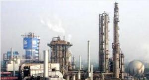
In 1956, the Sichuan Fertilizer Factory (now Sichuan Chemical Group Co., Ltd.), one of the major projects of the first five-year plan of the state, was determined to be built in Huayan Township, Jintang County (now the main urban area of Qingbaijiang District, Chengdu), and the Sichuan Provincial Committee set up the Sichuan Jintang Industrial Zone Construction Committee.

Qingbaijiang District(5)
In 1957, the state reduced the scale of capital construction, and of the 7 projects proposed in jintang industrial zone, only 1 project under construction of the Sichuan fertilizer plant was retained. In July of the same year, the Sichuan Provincial People's Committee abolished the Jintang Industrial Zone Construction Committee, and the construction of the Sichuan Fertilizer Factory was led by the Chengdu Municipal Committee of the Communist Party of China, and the local administrative work was mainly responsible for Jintang County.
In 1958, the first phase of the Sichuan Fertilizer Factory project entered the climax of civil construction, and the small nitrogen fertilizer demonstration plant and the Chengdu Iron and Steel Plant in Sichuan Province broke ground one after another, the number of employees and their families soared, and the problems of employees' lives and municipal management needed to be solved urgently. The party group at the sichuan fertilizer factory site has repeatedly reported to the Sichuan Provincial Party Committee and the Chengdu Municipal Committee of the Communist Party of China, and put forward opinions on the establishment of local political power organizations.
In January 1959, the Chengdu Municipal Committee of the Communist Party of China proposed to the Sichuan Provincial Committee of the Communist Party of China on the expansion of Chengdu's urban area, and some townships in Xindu, Jintang and other counties were placed under the jurisdiction of Chengdu.
In 1960, when Qingbaijiang District was established, it had jurisdiction over three people's communes of Huayan, Datong and Qingbaijiang (Mimu), which were divided into 29 administrative districts and 157 production teams.
In 1961, the three communes were divided into 37 production brigades and 288 production teams.
In 1962, the three communes were divided into 40 production brigades and 345 production teams. In 1966, the three communes were divided into 38 production brigades and 331 production teams.
In January 1981, 1 town (Chengxiang), 6 communes (Xiangfu, Xiushui, Yuhong, Yaodu, Rixin, Longwang) under the jurisdiction of Chengxiang District of Jintang County and 5 communes under the jurisdiction of Taiping District (Taiping, Fuhong, Hexing, Renhe, Yunding) were assigned to Qingbaijiang District. In November, the provincial government approved the establishment of Dawan Town, which has jurisdiction over 3 towns, 14 people's communes, 178 production brigades, and 1580 production teams.
In December 1983, Qingquan Town was established, with jurisdiction over 4 towns, 14 people's communes, 178 production brigades, and 1627 production teams.
In June 1985, the two townships of Mimu and Qingquan were abolished, and the subordinate village groups were subordinate to 2 towns, and the town management village system was implemented. The district administers 4 towns, 12 townships, 178 villages, and 1630 villager groups.
In 1990, the district had jurisdiction over 4 towns, 12 townships, 178 villages, 1628 villager groups, and 29 residents' committees and family committees in the town.
In 1995, Qingbaijiang abolished Jingfeng Township and built a new Datong Township, with the township people's government stationed in Xinjie, which had jurisdiction over the administrative area of the original Jingfeng Township.
In 1997, the six townships of Huayan, Xiushui, Xiangfu, Yaodu, Rixin and Hexing were abolished. The administrative area of the former Huayan Township was placed under the jurisdiction of Dawan Town. The People's Government of Dawan Town is stationed on Qingjiang Middle Road. The administrative area to which the original Xiushui Township belonged was placed under the jurisdiction of Chengxiang Town, and the people's government of Chengxiang Town was stationed in Chengxiang. The new Xiangfu Town was built, and the town people's government was stationed in Kangjiadu. It has jurisdiction over the administrative region of the former Xiangfu Township. Yaodu Town was newly built, and the town people's government was stationed in Yaojiadu, which had jurisdiction over the administrative area of the former Yaodu Township. Xinjian Rixin Town, the town people's government is stationed in Hongwadian, and has jurisdiction over the administrative area of the former Rixin Township. Newly built Hexing Town, the town people's government is stationed in Hexingchang, and has jurisdiction over the administrative area of the former Hexing Township.
In 1998, Huayan Town was newly established in Qingbaijiang District, and the People's Government of Huayan Town was stationed in Qingjiang Middle Road, with jurisdiction over the four neighborhood committees of Tuanjie Road, Qingjiang Road, Yihu Community and Qingjiang Middle Road demarcated by Dawan Town, the Chengdu Iron and Steel Manufacturers Committee and the administrative areas belonging to the six villages of Shunjiang, Hongyang, Hongfeng, Tongjing, Yudai and Yonghong.
On May 27, 2004, the four towns of Dawan, Huayan, Rixin and Hexing and the two townships of Yuhong and Genting were abolished. The administrative areas of the former Dawan and Huayan towns implemented a street office management system. The administrative area of the former Yuhong Township was merged into Chengxiang Town, and the people's government of Chengxiang Town was stationed in Chengxiang. The administrative area of the former Rixin Town was merged into Xiangfu Town, and the People's Government of Xiangfu Town was stationed in Kangjiadu. The administrative area of the former Hexing Town was merged into Longwang Town, and the People's Government of Longwang Town was stationed at the Longwang Temple. The administrative area of the former Genting Township was merged into Qingquan Town, and the People's Government of Qingquan Town was stationed in Liao Jiachang.
On May 10, 2005, the administrative areas of Xinyi, Shuangbai, Huangguo, Garden, Shipi and Changlin in Longwang Town, Qingbaijiang District, and Huilong Village and Golden Triangle Community in Loess Town, Longquanyi District, were transferred to the jurisdiction of Shibantan Town, Xindu District. The People's Government of Shibantan Town is stationed at No. 66, Dongfeng West Street, Shibantan Town.
Chengdu Qingbaijiang District is located in the northeast of Chengdu, located in the east longitude 104 ° 9 ′ 37 " ~ 104 ° 29 ′ 31 ", north latitude 30 ° 39 ′ 33 " ~ 30 ° 55 ′ 0 ", east of Jintang County, Sichuan Province, south of Chengdu Longquanyi District, west of Chengdu Xindu District, north of Guanghan City, Sichuan Province. The terrain of the district shows the trend from the northwest pingba to the southeast hilly mountainous area, with an east-west spacing of 31.6 kilometers and a north-south span of 28.4 kilometers; the highest altitude is 916 meters, and the lowest altitude is 451 meters. The area of Qingbaijiang District is 378.94 square kilometers. The data of Qingbaijiang District is derived from Baidu Map, and the final result is based on Baidu Map data.
landform
The terrain of the district shows the trend of the northwest flat dam to the southeast hilly mountainous area, and the district border has three kinds of terrain: flat dam, hilly and low mountain. The northwest is a plain, belonging to the Dujiangyan artesian irrigation area, with an altitude of 451 to 480 meters; the lowest point, Yuhongqiao, Chengxiang Town, is 45 liters above sea level. The central part is hilly, which belongs to the Irrigation of Dongfeng Canal, combined with irrigation area, with an altitude of 480 to 700 meters. The southeast is the low mountainous area of Longquan Mountain, with an altitude of 546 to 915 meters, and the highest point is the land of Renhe Township, with an altitude of 915 meters. The general topography of Qingbaijiang District is high in the southeast and low in the northwest; while the plain area is high in the north and west and low in the southeast.
water system
There are two major rivers in the area, the Qingbai River and the Bihe River, which are actually the two main streams of the Dujiangyan Canal system.
Qingbai River
The Qingbai River is a secondary tributary of the Tuojiang River, the water source comes from the MinJiang River, the upper section is the Puyang River, through the Dujiangyan hub Pubai Gate, to the east, to the Pengxian Changshou Bridge is called the Qingbai River; then to the east, flows through Xindu County, to the district of Zhujiawan, along the northwest edge of Mimu, on the right bank of the Namim River, separated from the Mapeng Weir, and then flowed to Guanghan Xiangyangchang, and then flowed to Zhao Town, into the Tuo River.
Adjacent to the river
The Bihe River is a tertiary tributary of the Tuojiang River, the water source comes from the MinJiang River, the upper section is the Baitiao River, which is diverted through the Pubai Gate of the Dujiangyan Hub, and flows southeast to the Shidi Weir in PiXian County. From the new capital Shaojia Temple into the district, it flows through Xiangfu, Rixin, Xiushui, Yaodu, Yuhong and other townships, in Xiangfu Township Kangjiadu on the left bank of the Nayang fork river water, in Rixin Township Solitaire Village on the right bank of the Naxi River water, in Xiushui Township along the Tuo Village on the left bank of the Naxiuchuan River and Changliu River, flowing to Zhao Town, into the Tuo River. The length of the district is 17.5 km, the average width of the river is 155 m, the water depth is 3.5 m, the specific drop is 1.32 ‰, the flood capacity is 800 cubic meters per second, and the exceptionally large flood is 2000 cubic meters per second.
Qingbaijiang District is located in the inland subtropical humid monsoon climate zone, with four distinct seasons. The average annual temperature is 14.9 ~ 16.7 °C, the annual frost-free period is 273 ~ 279 days, the average annual precipitation is 925.4 mm, and the average annual sunshine is 1239.1 hours.
land resources
The total land area of Qingbaijiang District is 378.56 square kilometers (37856 hectares), of which 30576.97 hectares (80.77%) are agricultural land, 6396.09 hectares are construction land, accounting for 16.90%; and unused land is 882.49 hectares, accounting for 2.33%. Among the agricultural land, 15529 hectares of arable land, accounting for 50.79%, the garden land is 3219.03 hectares, accounting for 10.53%, the forest land is 3447.77 hectares, accounting for 11.27%, and other agricultural land is 8381.17 hectares, accounting for 27.41%. Among the construction land, the urban and industrial and mining land is 2589. 07 hectares, accounting for 40.48% of the construction land; rural residential area land 3188.2 hectares, accounting for 49.85% of the construction land; 611.61 hectares of transportation land, accounting for 9.56% of the construction land; water conservancy facilities 7.21 hectares, accounting for 0.11% of the construction land. Among the unused land, other land use is 651.68 hectares, accounting for 73.85% of the unused land.
mineral resources
The mineral resources of Qingbaijiang District are mainly distributed in mountainous areas and shallow hilly areas, and there are 4 types of 10 kinds of proven mineral resources, including 7 kinds of mineral resources of 3 categories with certain resource reserves, 16 mineral deposits, and 73 mine sites. The main minerals are natural gas, shale, sandstone, clay, gravel, etc., of which natural gas is mainly distributed in Fuhong Township, Qingquan Town, Longwang Town. The natural gas layer in the territory belongs to the same gas layer as Luodai Town and Xindu District in Longquanyi District, with a depth of 1000 to 2000 meters, a cumulative proven geological reserve of 50 billion cubic meters, and a recoverable amount of 50 billion cubic meters. The natural gas in each gas field has excellent quality, with a methane content of 95% and does not contain hydrogen sulfide. Deep oil and gas exploration and development below 2000 meters has great potential, with proven prospective reserves of 120 billion cubic meters。 peat. It is mainly distributed in Xiangfu Town and Yaodu Town on both sides of the Bihe River and Xijiang River. Strip of stone sandstone. Mainly distributed in The low mountainous areas of Renhe Township and Qingquan Town, there are 8 proven resources, with reserves of 3.1899 million cubic meters and prospective reserves of 10 million cubic meters. Sandy clay mine for molds. It is mainly distributed in the area of Mopan Mountain in Chengxiang Town, with a resource area of 15.60 square kilometers and unproven reserves. Brick with shale. Mainly distributed in the low mountain areas of Qingquan Town and Fuhong Township and other hilly areas, a total of 6 places with proven certain resources have been proven, with reserves of 1.38 million cubic meters and long-term reserves of 30 million cubic meters. River gravel. It is mainly distributed in Mimu Town, Xiangfu Town, Yaodu Town and Chengxiang Town on both sides of the Qingbai River and bihe river. Only the sand and gravel reserves of the river channel are 223,500 cubic meters, and the prospective reserves are more than 2 million cubic meters.
forest resources
The forestry land in Qingbaijiang District is 8643.7 hectares, of which 8490.7 hectares are forested land (specifically 3676.7 hectares of forest stand, 2971.9 hectares of economic forest, and 1842.1 hectares of bamboo forest); 112.3 hectares of sparse forest land; 10.7 hectares of shrub woodland; and 30 hectares of nursery land. The four-sided tree covers an area of 4057.1 hectares, and the forest coverage rate is 33.23%. The forest area is 376,231.7 cubic meters, and the miscellaneous bamboo is 58,930 tons. The ancient trees in the district include: yellow kudzu tree, cypress tree, luohan pine, ginkgo biloba, large-leaf elm, yellow wood, soap pod, citrus aurantium, camphor, tea tree, cycad, wu zi and so on.
population
At the end of 1949, the total number of households in Qingbaijiang District was 38,666, and the total population was 170401 people. After the founding of New China, the people lived and worked in peace and contentment, the medical and health conditions gradually improved, the mortality rate decreased year by year, and the natural changes in the population of the region underwent great changes.
At the end of 1960, the total number of households in Qingbaijiang District reached 47,484, and the total population was 215609, of which 119,370 were males and 96,239 were females. There were 2,670 births in that year, with a birth rate of 12.34 per thousand; 7,362 people died during the year, with a mortality rate of 34.03 per thousand. At that time, it was in a period of serious difficulties in the national economy, and the natural population growth rate in the region was negative 21.69 ‰.
At the beginning of 1981, the total number of households in Qingbaijiang District reached 78,005, and the total population was 348796 people, an average of 4.47 people per household. Of the total population, 179498 males accounted for 51.46 per cent and females 169298, or 48.54 per cent. The sex ratio is 106.20 (the same as 100 for women). Of the total population, the agricultural population 293178, accounting for 84.05% of the total population, and the non-agricultural population is 55618, accounting for 15.95% of the total population. In 1981, there were 5490 births in Qingbaijiang District, the birth rate was 15.67 ‰, the number of deaths in the year was 2223, the population mortality rate was 6.35 ‰, the natural population growth rate was 9.33 ‰, and the population density in that year was 896 people per square kilometer.
At the end of 1990, the total number of households in Qingbaijiang District reached 105723, and the total population 374879 people, with an average of 3.55 people per household. Of the total population, 195192 males accounted for 52.07 per cent and females 179687, or 47.93 per cent, with a sex ratio of 108.63 per cent. Among the total number of households, 86,013 were agricultural households, accounting for 81.36%, and 19,710 were non-agricultural households, accounting for 18.64%. Of the total population, the agricultural population 304994, accounting for 81.36%, and the non-agricultural population 69,885, accounting for 18.64%. In 1990, there were 4,740 births, a birth rate of 12.69 per thousand, a 2,491 deaths during the year, a mortality rate of 6.67 per thousand, a natural population growth rate of 6.02 per thousand, and a population density of 956 persons per square kilometre at the end of the year.
Between 1950 and 1975, except for the low birth rate from 1959 to 1961, the rest of the year was between 21.59 per thousand and 49.75 per thousand. The population during this period was a high birth rate, low mortality, and high natural growth. In 1976, family planning was fully implemented in the region, and the high natural growth of the population was gradually controlled. The birth rate of the population in Qingbaijiang District gradually decreased from 24.1 ‰ in 1975 to 12.69 ‰ in 1990, realizing the modern population reproduction type with low birth, low death and low natural growth.
From 1949 to 1990, qingbaijiang District had a total population of 258539 births, 106143 deaths, 152396 natural growth population, 52,082 mechanical growth population, and a total population growth of 204478 people.
At the end of 2012, the registered population of Qingbaijiang District was 413,400, a decrease of 0.04 million over the previous year. The birth rate is 8.15 per thousand, the mortality rate is 13.7 per thousand, and the mechanical growth rate is 2.9 per thousand.
In 2017, the population of the whole district was 4772, with a birth rate of 11.34 ‰; the death population was 4274 people, the population mortality rate was 10.15 ‰; and the natural population growth rate was 3.82 ‰. At the end of the year, the permanent population was 406,700, of which the urban population was 222,300 and the rural population was 184,400. The urbanization rate of the permanent population was 54.65%, an increase of 1.55 percentage points over the previous year. [1]
ethnic group
There are 26 ethnic minorities in Qingbaijiang, mainly distributed in Mimu Town, Chengxiang Town, Hongyang Street and Dawan Street, mainly Hui, which is the largest Hui mass settlement in western Sichuan, and other minorities such as Tujia, Yi, Tibetan, Manchu, Miao, Zhuang, Mongolian, Bai, Tu, Dong, Yao, Dai, Hani and other minorities, which are distributed in a scattered form.