Twenty-six years ago, I went to Japan for the first time and landed at Kansai International Airport, which was celebrating its opening anniversary. I still vividly remember the rectangular artificial island overlooking the tranquil blue sea of Osaka Bay through the porthole, shining the light of the future world under the warm sunshine of early winter, and the powerful shock to the young traveler at that time - at that moment, he seemed to be as a Child who soared into the blue sky and came to the fantasy country of the robot cat!
Nowadays, when I go to Osaka, I will not think of Astro Boy and robot cats, I will always choose the porthole position on the left side, and after flying over Kyushu, there will be an elegant landscape of mountains and seas in front of me: the mountains are like dai, extending to the sky; the blue sea is like satin, quietly paved, and occasionally the ferry passes by, pulling out a long radial trajectory. Fantastic landscapes follow you all the way to the artificial island.
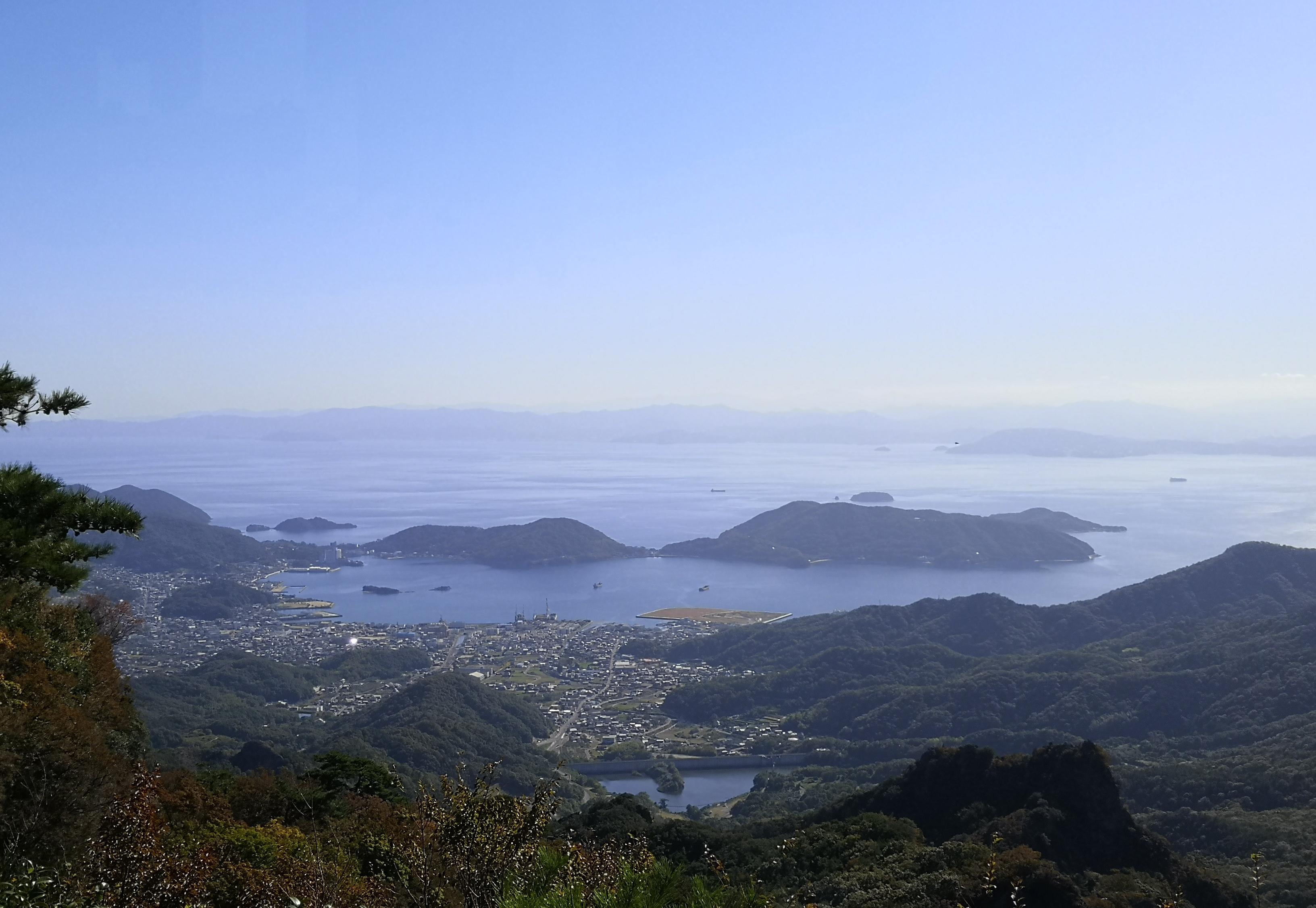
From Dodo Island overlooking the Seto Inland Sea (Photo / Wang Zaida)
<h3>Li Hongzhang was sad</h3>
No matter which city you fly from in the north, Guangzhou, and Shenzhen, your flight to Osaka will pass through this sea of tranquility: the Seto Inland Sea.
As the name suggests, the Seto Inland Sea is a sea surrounded by land. It is bordered to the north by the Chinese part of Honshu Island (a Japanese place name referring to the western part of Honshu Island), to the east is honshu's largest peninsula, the Kii Peninsula, to the south is Shikoku Island, the smallest of Japan's four islands, and to the west is Kyushu Island. The Seto Inland Sea covers an area of nearly 20,000 square kilometers, roughly close to Kawanishi Bazi, where Chengdu is located.
Geologically, it was originally a depression between Honshu, Kyushu, and Shikoku, and during the Ice Age the Japanese archipelago was connected to each other, and connected to Eurasia to the west through the Korean Peninsula and to the north through Sakhalin Island to form a land bridge. The ancestors of the Yamato people, the Jomon people and the Yayoi people, migrated from Eurasia to settle here, and early Japanese civilization sprouted in the Yamato region of the Kii Peninsula in the eastern part of the basin. About 10,000 years ago, the Quaternary glaciers melted, sea levels rose, and seawater poured into the basin, cutting off the three islands and forming today's Seto Inland Sea. In a sense, the Seto Inland Sea can be thought of as a large Thousand Island Lake. It is precisely because of the calm wind and waves here that kansai international airport can be built on an artificial island reclaimed from the sea.

Kansai International Airport (Courtesy photo/ Wang Zaitian)
The Seto Inland Sea is located between the three islands, so it has three exits. The first exit leads west to the Sea of Japan, the Kanmon Strait between Honshu and Kyushu, whose narrowest point is only 600 meters and has been The key to Japan's land and sea since ancient times. In 1864, the Japanese army of choshu domain of the "Emperor Zunyi" shelled the combined fleet of Britain, France, the Netherlands and the United States here, preventing European merchant ships and warships from entering the Seto Inland Sea.
The southern side of the Kanmon Strait is Kitakyushu City, and the north side is Shimonoseki City. Shimonoseki has an older name that is more familiar: Maguan– this is the place where Li Hongzhang was wounded and sad, and it was here that Taiwan was ceded to Japan by him signing the Treaty of Maguan on behalf of the Qing government. After nearly a month of negotiations — assassination — healing — negotiations, Li Hongzhang vowed never to return to Japan's territory for the rest of his life. A year later, he traveled around the world as a first-class minister of the Chincha, and finally crossed the Pacific Ocean to return to China, and when he changed ships through the port of Yokohama, he took a wooden board between the two passenger ships and stepped on it, and finally did not break his oath.
The other two exits lead south to the Pacific Ocean, to the east is the Kii Waterway between Shikoku and the Kii Peninsula, which is the most important passage between ancient Japan and the outside world, Osaka Bay is located at the northeast end of the Kii Waterway, where the landing can be along the Sanyo Way, Yamato Street two ancient roads to the ancient capital of Kyoto, Nara; to the west is the Shikoku and Kyushu Bungo Waterway, which was the gateway to the Sea during the Pacific War, and was also a key water for U.S. submarines to repeatedly probe and try to enter the Seto Inland Sea.
The Reason the Bungo Waterway is so important is that the home port of the Combined Fleet is located in Kure Port in Hiroshima Bay on the northern shore of the Seto Inland Sea, which once housed the largest naval shipyard in Asia and remains the second largest base of the Japan Maritime Self-Defense Force. On the small island opposite Kure Harbor, there was once the Edajima Naval Academy, which was once called the world's three major naval academies together with the Royal Naval College of Britain and the United States Naval Academy, and was the alma mater of many chief officers of the Imperial Japanese Navy. The purpose of the US military dropping the first atomic bomb on Hiroshima was to strike the Kure Port Naval Base and its surrounding military industrial facilities and destroy the Japanese Navy's combat strength, and the Bungo Waterway was precisely the fastest passage for the Japanese Navy to go to the Pacific after departing from Kure Port.
Red bricks of the Edajima Naval Academy were transported from Britain (Courtesy photo/ Wang Zaitian)
<h3>The concept of impermanence is "vortex tide"</h3>
As a sea route connecting the three islands, the Seto Inland Sea can also be understood as a super grand canal that runs through the southwestern part of the Japanese archipelago.
With the exception of the Kansai region to the northeast, the Seto Inland Sea coast was originally an economically backward agricultural region with no raw materials and energy, nor a decent market digestion capacity. After World War II, the Setouchi Industrial Belt was built on the basis of shipping, and the processing trade was vigorously developed, and raw materials were transported through the "Grand Canal" and finished products, thus becoming a new industrial belt of great importance in Japan.
The transportation of goods in the Setouchi Industrial Belt is mainly through the east-west Seto Inland Sea to achieve convenient and inexpensive water transportation, while the movement of people requires the construction of a north-south passenger transport corridor on the sea. On May 11, 1955, the ferry Azumo Maru, which runs through the Seto Inland Sea, sank near Ongi Island due to fog and a freighter, killing 168 people, including 100 elementary and junior high school students on a school trip. The tragedy prompted the Japanese government to vigorously promote the construction of local road transportation facilities. After 40 years of efforts, Japan, the "infrastructure maniac" at that time, relied on the many islands in the Seto Inland Sea to build a network of honshu four-country liaison bridges consisting of three sets of cross-sea bridges, which conveniently connected the north and south shores by road and rail.
Location Map of Seto Inland Sea and Surrounding Prefectures (Southern Weekend Infographic)
The Ōmeimun Bridge-Akashi Bridge is located at the entrance to the eastern section of the Seto Inland Sea, which stretches across Awaji Island, Japan's ninth largest island, connected by the Ōmeito Bridge to Tokushima Prefecture in Shikoku, and the Akashi Bridge connects Honshu's Hyogo Prefecture. Akashi Bridge is a landmark building in the Hanshin area, and there are many people who hear about it. Let's talk about the Damingmen Bridge, which is relatively little known to the Chinese people.
Location Map of Damingmen Bridge-Akashi Bridge (Southern Weekend Data Map)
Naruto is a small town at the northeastern tip of Tokushima Prefecture. Tokushima' ancient name, Awa, is famous for its Awa Dance Carnival, The Great Stasis Valley, and the Naruto Vortex, which is right in Naruto and under the Otomon Bridge.
Completed in 1985, the Great Naruto Bridge is 1.6 km long and spans the Naruto Strait. As mentioned earlier, the Naruto Strait and the Akashi Strait on both sides of Awaji Island are the two passages from the Kii Waterway to the Seto Inland Sea, and every day at high tide, the seawater that comes from the Pacific Ocean enters the Seto Inland Sea, and at low tide, due to the special hydrological conditions inside and outside the Naruto Strait, the strait is only 1.4 kilometers wide, while the water level difference between the Seto Inland Sea and the Kii Waterway is as high as 1.5 meters, and the "massive" tide needs to flow south through this throat channel back to the ocean under the action of gravity, resulting in a rapid current of 20 kilometers per hour. Ranked third in the world. This tide breaks into the middle of the Naruto Strait and hits the relatively slow tides on both sides of the strait, forming large and small whirlpools, which the Japanese call "vortex tides", attracting geography enthusiasts around the world to pinch the daily low tide time to feast their eyes.
Whirlpool under the Great Mingmen Bridge (Southern Weekend Infographic)
There are two piers on the northwest side of the Ōmeimon Bridge, where visitors can take a large boat or small boat to the Narumon Strait for viewing. I was riding in a small motorboat, although the larger boat was bumpy, but it was light and flexible, and could be observed closely; while the large ship turned slowly, and the whirlpool took only a few tens of seconds from generation to dissipation, and it was too late to get close, so it could only stop at a distance to observe. Entering the Naruto Strait by motorboat from the north side, you can clearly feel the drop, as if passing through a rapids shoal. This is due to the fact that the depth of the sea in the Naruto Strait is only 90 meters, while the seto inland sea on the north side is 200 meters deep, which is equivalent to the Setouchi Basin encountering a gap in Naruto, the sea water is slightly delayed in front of the gap, and then accelerates out, rushing down, forming countless whirlpools under the Ōrumon Bridge, they do not have a certain position, and they are born and die, and then turn into foam.
The Japanese people who love to see cherry blossoms falling must also love to see this silent and impermanent "whirlpool"!
Hiroshi Utagawa redraws naruto whirlpool (Southern Weekend infographic)
<h3>Ride across the sea bridge</h3>
The other two sets of bridges in the Seto Inland Sea, one is the Setouchi Island Wakaido that connects imabari city in Ehime Prefecture of Shikoku with Oido City in Hiroshima Prefecture, Honshu Prefecture, which is a chain of highway bridges spanning six islands, reminiscent of the Zhoushan Cross-Sea Bridge that spans five islands on the coast of the East China Sea. The 70-kilometer-long Shimabo SeaWay is notable for its cycling trails, which are a mecca for cyclists to ride between the sea and the sky. Cycling through the Seto Inland Sea takes about 5 to 10 hours, and there are 13 bicycle rental and return points on each island along the way, so you can return the car at any time if you don't want to ride the whole distance, and then take the bus back to the mainland.
Bicycle-only bridge on the Wakaido in Setouchi Island (Southern Weekend Infographic)
Another set of bridges across the sea is the Seto Bridge between Sakaide City, Kagawa Prefecture, Shikoku, and Kurashiki City, Okayama Prefecture, Honshu. Consisting of two cable-stayed bridges spanning five islands, three suspension bridges and a truss bridge, it is the longest railway and road dual-purpose bridge in the world, through which the railway network of Shikoku is connected to Honshu.
I took an express train from Matsuyama in northwestern Shikoku to Okayama honshu, which consisted of 8 cars, with carriages 1-5 going to Okayama and carriages 6-8 going to Takamatsu in Shikoku, splitting off at Utazin Station on the southwest side of the Seto Bridge and going to each journey. Since the Nitetsu free seat ticket does not specify a seat, passengers need to determine which cars to sit in to their destination, and if they go to Takamatsu by mistake, they will have to re-buy the ticket and wait for the next train to correct it. This practice must have been learned from the railway big brother Britain, which is very suitable for countries with developed road networks, not too large passenger flows, but still need to maintain a certain frequency of departures, and there is no need for a populous country like China.
Seto Bridge (Southern Weekend Infographic)
Okayama is a famous city on the northern shore of the Seto Inland Sea, from which you can take a ferry to the large and small islands scattered in the inland sea. I boarded a ferry bound for Xiaodou Island, and there were carriage seats around the cabin, and the central area was carpeted for passengers to sit on their feet. I walked up the empty deck, looked out over the wind of the hunting sea, and followed the ferry from the northern shore of the Seto Inland Sea to the heart of the sea. The seagulls, which have been accustomed to following fishing boats for food for thousands of years, soar along with the ferry, and to me it seems to me that they are frozen in the air, and their eyebrows are clearly visible; the sunset gradually falls behind Toshima, painting a golden outline of the island of art, famous for its teardrop-shaped art museums...
Wang Zaitian