The "Peak Mission" Everest Expedition Glacier and Pollutants Group recently completed the measurement of 14.68 square kilometers of everest East Rongbuk Glacier and collected 150 kilograms of snow samples at an altitude of 6500 meters. This measurement will construct a high-precision digital three-dimensional model of the Everest East Rongbu Glacier.
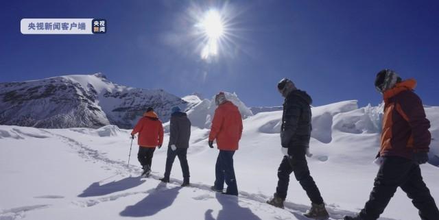
On the afternoon of May 9, the glacier and pollutant team participating in the "Peak Mission" Everest expedition arrived safely from the 6350-meter camp to the Everest base camp.

Kang Shichang, vice president of the Northwest Institute of Eco-Environment and Resources of the Chinese Academy of Sciences: This time we collected a snow pit sample at an altitude of 6500 meters above sea level at the mouth of the East Rongbu Glacier, and the total number of snow pit samples is 1.6 meters (depth).
These very high-altitude snow samples are mainly used for the study of isotopes of mercury, sulfur and black carbon, as well as microorganisms, to understand the impact of pollutant emissions in the surrounding areas on Mount Everest and even the Tibetan Plateau.
Kang Shichang, vice president of the Northwest Institute of Eco-Environment and Resources of the Chinese Academy of Sciences: Why does a snow pit pick so many samples? This is because many new technologies now require a large number of samples, which must be processed to reflect the modern climate and environment of the Everest region.
Over the course of nine days, the expedition team also used 3D laser scanners and radar thickness gauges to make high-precision measurements of the 14.68 square kilometers of the East Rongbu Glacier on Mount Everest.
Kang Shichang, vice president of the Northwest Institute of Eco-Environment and Resources of the Chinese Academy of Sciences: Especially for the observation of the surface morphology of this glacier, its resolution is very high, covering the 14 square kilometers of the East Rongbu Glacier. Our horizontal resolution can reach 3 to 10 centimeters and vertical resolutions can reach 10 centimeters, so this is the first time this year that we have conducted a comprehensive physical examination of the middle and upper reaches of the East Rongbu Glacier.
The expedition team members will also use these first-hand information to establish a high-precision digital three-dimensional model of the East Rongbu Glacier through special software analysis.
Kang Shichang, vice president of the Northwest Institute of Eco-Environment and Resources, Chinese Academy of Sciences: This glacier elevation model, its resolution is very high, we can verify and verify the current remote sensing data, develop new parameters, and then analyze the early remote sensing data, so that we can get the changes in our East Rongbu Glacier. At the same time, the changes in glaciers in the entire Himalayan region are analyzed according to these parameters reflected.
According to experts, next, they will also go to the Ali region of southeast Tibet and western Tibet to collect ice samples and observe glaciers.
Source: CCTV News