#今冬拉尼娜发生已成定局 #
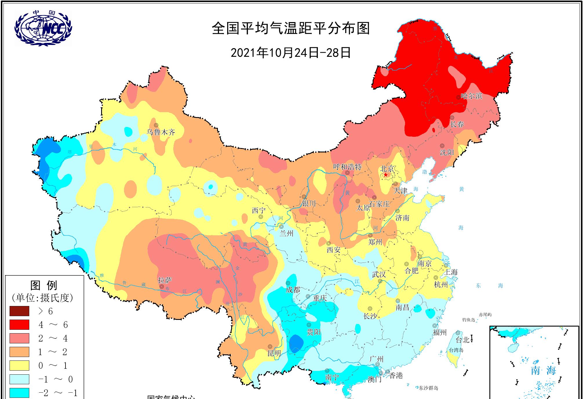
In the past two days, the cold air in the central and eastern regions of our country has stopped, and the return of sunlight has made many places in the central and eastern parts of our country heat up rapidly, especially in the north, and recently it has been warm and melting, and even the smoggy haze breeds under calm weather. Monitoring data from the National Climate Center of the China Meteorological Administration shows that in the last five days (October 24 to October 28), the temperature in most parts of northern China has rapidly reversed to high, and many places in the northeast are significantly higher.
However, atmospheric circulation at mid- and high latitudes is changing, and supercomputer forecasts point out that from October 30, the strong blocking high pressure in Eastern Europe has developed rapidly, becoming a strong disturbance that pokes into the westerly wind belt of Eurasia, so that the Arctic vortex is poked down and moved into Siberia, causing a large number of severe cold air masses to accumulate in Siberia, and the supercomputer's prediction map will accumulate a large number of purple cold air masses in Siberia in early November.

For our country, the cold air mass accumulated in the region is undoubtedly like a basin of ice water hanging over our country, and it will fall down if it is not careful - the bad news is that the supercomputer's prediction also points out that with the cooperation of circulation conditions, the large number of cold air masses that have accumulated will eventually go south in large quantities and pour into most of the central and eastern parts of the country. According to this forecast, this will be the first cold wave since the second half of the year.
The forecast of the Central Meteorological Observatory also pointed out the existence of this large-scale cold air in early November, and the Central Meteorological Observatory currently tentatively designated it as a stronger cold air, believing that from November 4, there will be strong cold air affecting the northern part of Xinjiang and the eastern part of the northwest region; from November 6 to 7, the cold air will move east to affect most of the central and eastern regions. Affected by it, parts of northern Xinjiang, the eastern part of the northwest region, northern North China and northeast China have small to moderate snow (rain) or sleet, and local heavy snow or blizzard; there is light to moderate rain in parts of jiangnan, south China and the eastern part of southwest China; most of the above areas have 4 to 6 northerly winds, gusts of 7 to 8 degrees, the temperature will drop by 4 to 8 degrees, and the cooling range in some areas can reach 10 to 12 degrees! For example, in the forecast of Urumqi in Xinjiang, we have seen a significant cooling trend in the later period, and the maximum temperature will directly drop from about 10 degrees to about 0 degrees.
Regardless of whether this cold air will become the next cold wave, the possibility of it going south to affect most of our country is indeed gradually increasing, and after the recent widespread calm weather, the weather situation in November may become fierce and turbulent again.