Nathula, which means "the place where the wind and snow are greatest" in Tibetan.
Within a few miles of the road on its left and right sides, there are two tall snow-capped mountains, zelila mountain and Zora mountain.
In recent years, under the new development form of the frontier, the two snowy mountains have modern highways directly leading to the mountain passes, and the grasslands in the areas where they are located, the transportation is convenient, which is conducive to the grazing and guarding of the border by the residents of the frontier.
The mountain pass, at an altitude of about 4500 meters, is the main passageway of the southern route of the ancient "Silk Road". Yadong County is the largest and most important commercial port city that has arisen as a result of this trade route. Various commodities were transferred eastward to Tibet and the interior of the mainland; westward to Sikkim, all over India.
The Nathu La Pass is also an important customs clearance route for Indians on their pilgrimage route to and from Tibet. Every year, a large number of Indian pilgrims make pilgrimages to the sacred mountain of Kailash and the sacred lake of Mapang Yongcuo in mainland Tibet.
Naiduila is now the most convenient and well-conditioned main land trade route between China and India, and there are more exchanges of business and trade personnel from April to October every year. More than 90% of Sino-Indian trade is carried by sea. Once the Nathu la Pass is taken, the distance from Lhasa via Yadong to the Indian Ocean port such as Kolkata can be shortened to about 1200 kilometers, which is quite conducive to the opening up of the western part of the mainland.
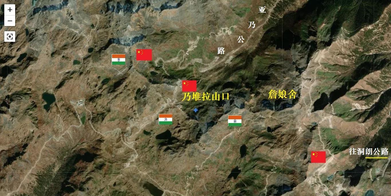
Satellite view of Nathu La Pass (the following two photos)

The following pictures are from Baidu Encyclopedia, Ali Travel, network information (invasion and deletion)
Kailash
Holy Lake Ma pang Yong Tso and Kailash
(Thank you for reading, reprinting is prohibited)