Surface mine slope deformation monitoring technology
Since the stability of the slope of the open pit mine is an important factor in production safety, the slope deformation monitoring of the open pit mine is an important means to effectively predict the landslide. With the continuous advancement of monitoring technology, the accuracy of monitoring equipment is getting higher and higher, and the ability to predict landslides has also been greatly improved. This paper mainly discusses the significance, work content and data analysis method of slope deformation monitoring in open pit mines.
The significance of slope deformation monitoring in open pit mines
In the slope of the open pit mine, the main object of study is the natural rock mass, which not only has significant discontinuities, non-uniformity and anisotropy, but also is subject to ground stress and groundwater, which makes its natural state very complicated. Large slope excavation disturbs the ground stress (initial stress) field under natural conditions. A reasonable computational model requires a true reflection of the physical and mechanical properties of the rock mass, as well as the rock mass properties during the release and redistribution of ground stress.
Starting from the slope design of the open pit mine, for the slope project, on the one hand, under the premise of designing to make full use of mineral resources, we strive to steepen the slope angle, reduce the amount of rock stripping, and save infrastructure investment; On the other hand, avoiding improperly steep slope corners may lead to the destruction of slopes, increase the cost of reinforcement and treatment of slopes, and even endanger the safety of mine production, bringing unnecessary loss of life and property to enterprises and employees.
Slope stability analysis is the core of slope research, the purpose is to use advanced research methods and system science methods optimization, under the premise of ensuring the safety of the slope, to seek less rock stripping and large mining, as well as landslide treatment and remediation engineering low cost, mine-related benefits of the slope design scheme. Through the data management of slope deformation observation, slope deformation monitoring information query and information addition can be carried out, and seamlessly linked with the existing information system of the mine, so as to manage the slope safety of large mines and ensure the safe production of open-pit mines.
Surface mine slope deformation monitoring work content
First, collect and sort out basic information
The main basic information includes: mining engineering geological data and related maps, such as geological exploration reports of mineral deposits, hydrogeology and engineering geological data; The form of slope presence and combination, the current situation of stope production and the information of related production status; The basic situation of the slope, the observation data of the rock mass on the slope, etc. The collation of basic data mainly refers to the classification and collation of the collected data and the comparison with the previous data to determine whether it meets the needs of the current monitoring work.
Second, slope on-site testing
Slope on-site testing mainly includes the following:
Each parameter of the slope. Such as the structure of the slope, the thickness of the coverage map, the aspect length, the slope height, the width of various platforms, various slopes and so on.
Observation of slope rock mass structure and slope displacement. Rock mass structure mainly refers to the structural surface of faults and larger joints. It is required to draw the position of the structural surface at the slope and record the relevant parameters. Slope displacement observation refers to the use of simple instruments or equipment to detect the displacement rules and instabilities of slope rock masses.
Overall observation of the slope. The main check is whether there are any illegal mining behaviors on the slopes, such as umbrella eaves, hollows, yinshan ridges and other illegal mining data drawn into sketches.
Third, slope monitoring data analysis
Comprehensive analysis of on-site monitoring data includes three aspects:
1. According to the engineering geological data and the on-site investigation and observation of the on-site exposed slope rock mass and structural data, the method of rock mass structure analysis, and the mathematical model and the comprehensive engineering parameter analogy method are used for analysis and calculation.
2. According to the parameters of the measured slope on the spot, determine whether it meets the requirements according to the relevant provisions of the state.
3. Determine the main factors affecting slope stability, the influence of slope parameters on slope stability, the impact of the main structure on slope stability, and the impact of illegal mining on slope stability on the mining work surface.
Different forms of slope instability show different characteristics in the displacement and time relationship of slopes, mainly different stages of rapid development. Tensile rock avalanches, characterized by sudden, shear landslides, need to undergo a large displacement of development process, sharp development time is longer. The analysis of the displacement of the anthropogenic slope and the relationship between time is aimed at providing a basis for engineering measures. That is, reasonable flexible support and rigid permanent support are selected to make the slope enter an artificial stable state; For the analysis of the relationship between the displacement and time of the natural slope, the purpose is to provide the theoretical basis for the treatment, or the alarm time of the site slope instability.

4. Slope stability assessment
According to the test data and analysis conclusions, the conclusion that the detected slope is a stable slope or an unstable slope is drawn. According to the test results, the problems existing in the slope of the mine, especially for the unstable slope, should be pointed out where the problem is and the cause of instability, and the corresponding treatment measures and rectification requirements should be proposed.
Data analysis method for slope deformation monitoring of open pit mine
1. Qualitative analysis method
Mainly through engineering geological survey, the main factors affecting the stability of the slope, the possible deformation and failure methods and the mechanical mechanism of instability are analyzed, and the genesis and evolution history of the deformed geological body are analyzed, so as to give a qualitative explanation and explanation of the stability status of the evaluated slope and its possible development trend. Its advantage is that it can comprehensively consider a variety of factors affecting slope stability, and the main methods are paradigm reasoning, expert system and schematic method.
As the main method of data analysis and the main tool of quantitative analysis, mathematical monitoring model has been widely used in open pit mine slopes. Engineers can use the monitoring model to quantitatively describe the change of the monitored state, in a certain case, can reveal the quantitative relationship between the state quantity and the influencing factors, but also with the help of the model for inversion analysis, and the prediction on the monitoring model has become the most widely used prediction method.
It is precisely because the monitoring model can effectively serve almost all safety monitoring purposes, it has become an indispensable part of in-depth analysis of monitoring data, and it is also the focus of in-depth research.
Qualitative analysis usually includes: basic characteristic value statistics on the main measurement information representative of the measured data, for example, calculating the maximum value, minimum value and related time of a certain period of time (a certain area), mean, range, sample variance, etc.; Conduct comparative analysis, such as comparing the new monitoring value with the historical measurement value of the same condition, comparing it with the historical maximum, minimum value and average value, comparing it with the recent value, comparing it with the value of the nearby measurement point, comparing it with the value of the relevant project, etc.;
The measured value change curve and the corresponding curve of the relevant measurement items are plotted, and the state of the monitored body is preliminarily qualitatively identified on the basis of these, and the authenticity of the measured value can be examined, and the obvious unreasonable data caused by instrument failure, observation error and other factors can be identified.
2. Quantitative analysis
Quantitative analysis needs to start from mechanics, mathematics and other aspects, from a quantitative point of view, more in-depth and detailed disclosure of the information contained in the data, describe the internal laws, prediction, evaluation and inversion, quantitative methods mainly have limit equilibrium method and numerical method two categories.
2.1. Limit balance method
The limit balancing method, assuming that the slope is destroyed along a certain shape sliding surface, is calculated in two dimensions according to the principle of mechanical equilibrium. The stability of the three-dimensional slope depends on the complex spatial distribution of terrain, formation, geotechnical parameters and groundwater and other factors, because these spatial distribution information is difficult to process in the general slope three-dimensional stability analysis program, but through giS (geographic information system) can provide a general platform to process these complex spatial information.
GiS can convert all slope-related data into GIS raster data Therefore, the 3D stability analysis model of the slope based on the column element can be analyzed using the GIS raster dataset. The advantage of the limit balance method is that the slip resistance and sliding force of the slope and its stability number are simply and clearly given; The disadvantage is that the force deformation and displacement of the rock mass are not considered.
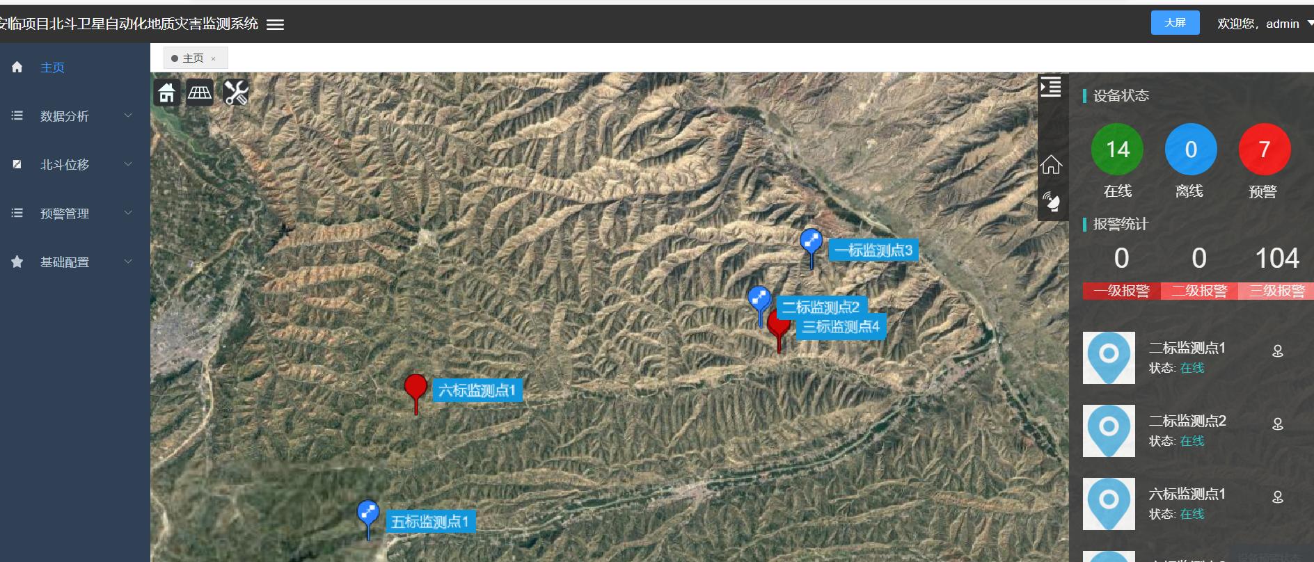
Beijing Tianji Technology - Slope Displacement Monitoring System adopts GNSS automatic monitoring method to conduct real-time automatic monitoring of surface displacement, and its working principle is: each GNSS monitoring point and reference point receiver receives GNSS signal in real time, and sends it to the control center in real time through the data communication network, and the control center server GNSS Beidou data processing software TJ-Cloud real-time difference decomposition calculates the three-dimensional coordinates of each monitoring point, and the data analysis software obtains the real-time three-dimensional coordinates of each monitoring point. The amount of change in the monitoring point is obtained by comparing with the initial coordinates, and the analysis software alarms according to the pre-set warning value.
2.2. Phase space reconstruction
Phase space reconstruction is really just looking at only one of these components. It is processed as a new dimension at some fixed time delay point. That is, the delay value is treated as the new coordinate. They determine a point in a multidimensional state space. Repeating this process and measuring each amount of delay relative to different times can produce many of these points. These points form a trajectory in high-dimensional space, called a pseudo-phase diagram (pseudo-phase trajectory). If the reconstruction is correct, the reconstructed phase space has the same geometric and information properties as the actual dynamical system.
Everyone is searching: intelligent piling positioning system, intelligent compaction monitoring system, intelligent paving system, mixing station quality supervision system, intelligent inclinometer, intelligent surface settlement monitoring instrument, groundwater level monitoring system, mine early warning monitoring system, highway slope monitoring system, tailings reservoir monitoring system, digital management platform,