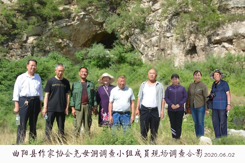
Author: Zhang Jiancheng
In order to find the source of Chinese civilization, excavate the profound national cultural heritage, enhance the cultural self-confidence of the Chinese nation, and serve the great rejuvenation of our modern country, we in Quyang County Writers Association organized a special investigation team to conduct in-depth investigations of the "Yaomu Cave" and its related situations according to relevant literature and folklore, and reported as follows:
First, the geographical environment and specific location
Quyang County has a superior geographical environment, the Taihang Mountains start from the north bank of the Yellow River, go north along the western edge of the North China Great Plain, and then turn to the north edge of the North China Great Plain and go east to The Mentougou and Xishan area of Beijing. In this tortuous process, a big arm bend is formed, and Quyang County is located in the depth of this big arm bend, so that the leeward wind is towards the sun, and the unique "Sun of Qushan Mountain" is a treasure of feng shui, hence the name.
The land of Quyang was developed earlier, according to Sima Qian's "History of the Zhao Shijia": King Wuling of Zhao "cut down Zhongshan for ten years and joined forces in Quyang", at least in the Warring States period more than 2300 years ago, there were already cities and pools, which were bound to choke the throat of mountains and rivers, and have always been a place where soldiers must fight. One is the hometown of Lin Xiangru, an outstanding military figure of the early Han Dynasty, and other great figures in the history of the mainland, such as Lin Xiangru and Li Zuoche, an outstanding military figure of the early Han Dynasty; the other, it has created three major material civilizations such as Quyang stone carving, Quyang Ding porcelain, and Quyang Beiyue Temple, thus becoming famous at home and abroad, and leading the chinese scientific and technological trend for a long time.
Quyang County has a total area of 1,084 square kilometers, about two-thirds of the northwest is hilly and shallow mountainous, and the southeastern third is plain, known as "six mountains, one water and three fields". At present, it administers 18 townships, 367 administrative villages, and has a population of 650,000. The county seat is 200 kilometers from Beijing in the north, 190 kilometers from Tianjin in the east, 130 kilometers from Xiong'an New Area in the east, and 70 kilometers from Shijiazhuang in the south. Jingkun (Zhangshi), Baofu, Qugang and Laiqu expressways pass through the border, and the traffic is very convenient.
The area around Lingshan Town in the north of Quyang County is a small basin, and there is a column of mountains north of the line from lingshan village and Pangjiawa village to Tieling north village in the central part, collectively known as Xiangyan Mountain. Lingshan Village and its neighboring Xingzigou Village to the west and Zhufengling Mountains north of Yebei Village are collectively called Lingshan Mountain.
"Chronicle of Quyang County" (Xinhua Publishing House, October 1998 edition) said: "Lingshan Town, founded in the Spring and Autumn Period, the village site is located in the south of a hill named Lingshan, originally known as Lingshan Dian. It is said that there are mausoleums at the foot of the nearby mountains, which evolved from the mausoleums. "Folk generations have passed down, and the "mausoleum" in it is the "Yaomu Mausoleum".
See also "Quyang County Chronicle": "Apricot Ditch, 1.3 kilometers away from the government station of Lingshan Town, built a village in the Yuan Dynasty, and there were original apricot trees in the ditch next to the village. It was once called Qingdugou. "It means that the village of Xingzigou is located at the mouth of the apricot ditch, and it is named after the apricot tree in the ditch. Among them, "once called Qingdugou" should be derived from the "New Chronicle of Quyang County" compiled by Liu Shijun of Quyang Zhi County during the Qing Dynasty and Kangxi Dynasty. According to the book, the "Lingshan Society" administers the village of "Qingdugou", but the road does not have the name of the village of "Xingzigou". Compared with the harmonic relationship between the two, the name of the so-called "Xingzigou" village today is derived from the previous "Qingdugou", which is enough to prove that the local area must have been closely related to the word "Qingdu" for a long time.

We all know that "Qingdu" is the name of the mother of the ancient emperor, Emperor Yao. Based on the principle that every place name adhered to by toponymy is based on a certain humanistic society, we have investigated the local association situation in depth, and neither from a natural point of view nor from the humanistic tradition has found a concept corresponding to the meaning of the words "Qing" and "Du", or even "Qingdu". Thus not also drawing counter-evidence, completely ruling out the possibility of this Qingdugou being named due to other conditions!
In addition, the highest peak at the end of the ravine, Qingdu Zhai, is also commonly known as the Great North Village because of the direction relationship, and the specific object of this investigation, Yaomu Cave, can provide strong evidence for the meaning of the name "Qingdugou".
Qingdugou is about 2 kilometers long, with hills on both sides, running in a west-north-south-east direction, and the upper section of the property belongs to Yebei Village in the west. Roughly about 200 meters or so at the end of this ravine, there is a natural grotto cave near the bottom of the ditch on the west side of the mountain, namely Yaomu Cave.
2. Geological environment
The Xiangyan Mountain area is deep and magnificent, and the famous peaks are Lotus Mountain, Xiangyan Pavilion Mountain, Mozi Mountain and so on. In particular, the natural landscape of Ge'ergou under xiangyan Pavilion Mountain is quite extraordinary, Quyang County originally had "eight ancient scenery", only the place has two, one is the "dripping wind string", the other is the "Xiangshi Bell"; and there are many cultural landscapes such as the "Jia Dao Cave" where the famous Tang Dynasty poet Jia Dao lived in seclusion, and the Prince Temple, which is rumored to be the prince of the late Shang Dynasty - Jizi Dong, who was temporarily avoided before going to Korea.
There are two main rivers that cross the Xiangyan Mountains, one is the Tongtian River flowing through the east side of Lotus Mountain, and the other is the Sanhui River flowing through the east side of Mozi Mountain. The two rivers meet in the southeast of beizhen village downstream, and then still call the Tongtian River and enter the Tang River in the east. Since the confluence of the Tang River and the Tongtian River is now built, the West Ocean Reservoir is now built, which is directly injected into the West Ocean Reservoir.
The two channels that cross the Xiangyan Mountain have a common strange phenomenon, the original flow of the river, once it flows through lotus mountain and Mozi Mountain, the surface bed of the downstream section of the river is completely dried up, and the river water all seeps into the ground, and only when there is a flash flood, it forms a flood on the ground. Therefore, people say that there must be underground caves in the area, or underground rivers. Two of the rivers re-emerge from a large pond in the southeast of Beizhen Village, 4 km south-east of Lingshan Town, and then flow southeast.
Shui Ma Cao is also a famous and unique landscape, and there are moving myths and legends.
Qingdugou turns east over a mountain beam, which is now a famous tourist attraction in Quyang County - Lingshan Julong Cave. Julong Cave was originally called Flower Cave, the cave body is like a long dragon, and the landscape in the cave has a dragon form, hence the name. Specifically, it is divided into three major sections: one is the ancient cave of the ape man, the second is the Hall of The Dragon, and the third is the underground labyrinth. At present, the development area is 40,000 square meters, about 2,000 meters long, with more than 100 scenic spots and more than 1,000 specific landscapes.
According to expert research, the ape-man ancient cave has multiple layers of accumulation layers left over from human activities, and the farthest layer is more than 30,000 years old. Proof that the site must have been a place where our ancestors in the early days were regularly active and inhabited.
According to its promotional materials, the ancient ape man ruins and natural landscapes are integrated and integrated into one scenic spot, and the domestic Weiling Mountain Julong Cave is particularly valuable. In addition, as far as the entire northern region of the mainland is concerned, this cave landscape is among the best in terms of volume and aesthetics. For various reasons, although the cultural heritage is so magnificent, it has not been able to upgrade the tourism level, and now it is only AAA level, which is a big pity!
Among them, the Dragon Gathering Hall and the underground labyrinth are naturally formed, typical limestone karst landforms, winding paths, thousands of twists and turns, caves and caves, not only magnificent scenes, but also the details are extremely elegant, like a fairy tale world.
Lingshan Julong Cave is now found to be a total of four floors, the landscape developed is only the first and second floors, and the third and fourth floors have yet to be developed.
Third, yaomu cave is in a shaped state
The east side of Qingdugou is a ridge-like mountain, and the top and west sides have the highest peak, Qingdu Village, which descends from north to south one after another, in order of Yangping Village, Camel Bank, And Godson Bank. Legend has it that in Qingdu Village and Yangping Village, cottages were once built and gathered in green forests. The current landforms of Yangpingzhai and the eastern part of Qingduzhai are all different, because Yangpingzhai has built a cement factory in recent years and quarried rough.
The mountain on the west side is undulating in the shape of a platform, and below the Qingdu Village are large platforms and small platforms.
Yaomu Cave is located on a steep cliff at the bottom of the east side of the peak of the Great Platform, about 3 meters from the bottom of the ditch, and can be accessed through a platform. The mouth of the cave is half-moon-shaped, curved and lower, and in general includes a spacious outer hole and five branch holes, the outer cave is 8 meters high, 7.8 meters wide and 9.6 meters deep, protruding from the center of the front wall as a heart, and slightly near the top of the middle, there is a high relief standing female statue, 92 cm high and 43 cm wide. It is a work of the Northern Wei Dynasty, and the prototype is Yaomu Qingdu. Corresponding to the statue, a rock protrudes from the bottom of the bottom of the cave entrance, like a natural altar, not very regular.
The statue is simple and thick, with beautiful eyebrows, and the left arm is bent to seem to hold a baby, close to the front chest. However, there are obvious modern chisel marks around the statue.
According to local elders, the statue originally had no eyes, and although the face was dignified, it was also a rough outline. Because in the last years of the Qing Dynasty, there were cultural relics thieves who took aim at this statue, intending to chisel it down and sell it as a whole. Unexpectedly, after he had just chiseled out a deep depression around him, Yao Mu suddenly appeared, her eyes were shining, and even the traces of their carvings were emitted with golden light, thus scaring the thieves away, so that they were blessed by misfortune, and the statue of Yao Mu added backlight from then on.
The branches of Yaomu Cave, except for the downward one, which is about 10 meters deep and is now buried, are roughly evenly divided in the remaining directions of the outer cave, as follows:
The southward branch cave, 10 meters deep, 5 meters high, 1.6 meters wide, is slightly tapered in general, the bottom slopes upwards from the outside to the inside, and the opening is about 1 meter higher than the bottom of the outer cave;
The branch cave extending to the southwest is 10 meters deep, 7.5 meters high, 4 meters wide, the body shape is also conical, the overall inclination from the outside to the inside is slightly greater than the front hole, and the hole is slightly higher than the bottom of the outer hole;
The branch cave extending westward is basically the same as the ground of the outer cave, 12 meters deep, 8.5 meters high, 3.5 meters wide, the overall bull-shaped shape, the end is bent south by about 2 meters, and there is a secondary branch hole at the bend, about 4 meters above the ground, on its south side, with a diameter of about 0.7 meters, and then there is a set of holes about 2 meters deep, inclined downwards, the mouth of the cave is 0.5 meters, only one person can climb in, this cave is called the retreat cave, which is rumored to be the retreat site of Yao Mu's year;
The base of the branch cave extending to the north is also roughly equal to the outer hole, 11.2 meters deep, 18 meters high, and 4.2 meters wide, the top is narrow in the shape of a "human" shape, and at the extreme, there is still a hole with a diameter of about 0.2 meters, and its depth is unknown.
There are still obvious traces of long-term water intrusion and purification inside Yaomu Cave, and the stone is the same as that of Lingshan Julong Cave, which is calcareous limestone and has a gray stain layer, which is obviously an early human remains.
According to locals, there was a mature lava landscape in the early Yaomu Cave, which no longer exists, and only a variety of images developed into relief forms are preserved on the surface of the cave. Because the cave is a blind cave, and the winter is warm and the summer is cool, although the landscape is inferior to the Julong Cave, it is more suitable as a habitat for human life.
In the early last century, the bottom of the ditch outside yaomu cave often flowed with stream water, and now the pebbles formed by the water erosion can be seen in the past. The east bank is now a barren terrace, and it is said that at the beginning of this century, there are still remnants of stone mortars, stone mortars, stone mill plates, etc., which are no longer known.
In addition, there are several small holes near Yaomu Cave, of which a small hole descending hundreds of meters to the south, the mouth of the cave is about 40 centimeters, the locals say that in the early years, someone climbed into it in the summer, because the cool breeze whizzed, and it was pitch black, very scared, quickly climbed out, did not know the depth, and then no one dared to go in. However, before the 1950s, it was common to say that foxes were seen nearby.
Then there is the godson bank is a cliff tens of meters wide, hundreds of meters high, located at the mouth of the Qingdu Ditch, also based on the factors that Yao Mu lived here, the specific name of the origin is detailed below.
Fourth, the background of the era in which Yaomu lived in Yaomu Cave
According to the mainstream view held by the ethnic historian He Guangyue's "History of Yanhuangyuanliu" and the archaeologist Zou Heng's "Trying to Talk About Tang Yao's Clan" and other texts, Emperor Yao was originally from Tang County and Wangdu in present-day Hebei Province, because the Dongyi clan was becoming increasingly powerful at that time, and Tang Yao, as the leader of the tribal alliance, in order to avoid direct conflict with it, led his troops to migrate westward, first going south to Tang, crossing Jingxing along the Tuotuo River, passing through Taiyuan, and then entering Pingyang. Among them, it involves the problem of not passing through Quyang, and on its migration route, unless it passes through Dingzhou, it is bound to pass through Quyang.
Combined with the "Shang Shu Yao Dian" said that "when Yao was in trouble", together with the "Huanyu Tongzhi", "Jin Chengshuo Shuoluo" and other classical roughly the same records, it proves that the flooding during the Yao Emperor period is basically conclusive, so that there will be an early historical legend of "Dayu Zhishui".
Combining the above two factors, the current Dingzhou area was roughly a piece of Zeguo at that time, so Emperor Yao and his people would inevitably bypass the ferocious floods of the lower reaches of the Tang River and the Dasha River, and go west through the north of Quyang to Xingtang.
Nowadays, Tang County, and the two counties of Shunping in the east, are all competing for the cultural business card of "Emperor Yao's Hometown", and do not know that Emperor Yao is a big living person, and there were no political distinctions such as Tang County and Shunping at that time, so the so-called Tang Dynasty at that time, or even the area of Quyang, was also included. Moreover, there are still some places in Shanxi Province that are now proclaimed "the hometown of Emperor Yao".
Specific to Yao Mu's origin, now they basically agree with the saying of Wangdu, but in the same way, Yao Mu cannot grow old in a fixed place. According to the living conditions at that time, most people still mainly used natural caves. The reason for this is based on the fact that the flood is flooded, man-made buildings are still rudimentary, completely incapable of flood resistance, and people must choose strong caves to live in order to survive.
In this harsh natural phenomenon, all the caves in the vicinity will inevitably be occupied by people, so Yaomu has every reason to go west to Quyang to temporarily take shelter, so she chose the current "Yaomu Cave" to settle down. First, it is leeward to the sun, and there are streams of springs to drink in front; second, the size of the cave is also very suitable for small groups to live. Choosing such a cave to inhabit, or even for the rest of your life, should be ideal.
In this case, even after the flood waters receded, would it be necessary for Yao Mu to return to her original home, which was either a mud swamp or a tidal flat? At the same time, there is also the gradually stronger Dongyi Clan's Western Disturbance, and it becomes more natural for Yao Mu to live here permanently.
Then, when Emperor Yao led the clan west into the Jin Dynasty through the vicinity of Lingshan, he was bound to take him with him to see his mother. When he met his mother, Yao's mother turned around and sent him to the mouth of the ditch, and said goodbye under the cliff on the east side, and told him to be cautious and do more good things for the people. Thus the story was passed down, and the cliff there was the name "Godson Shore". To say that the "shore" in the name is not called "cliff", it is due to the habit of Quyang dialect, there is no concept of "cliff", generally "cliff" is called "shore".