Tsunami Clouds – This is an optical illusion that creates a delicate wave scene as fast-moving clouds in the atmosphere pile up on thick, slower-moving clouds.
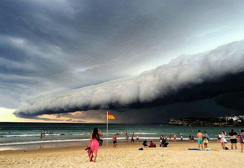
Roller clouds – are horizontal tube-shaped clouds that usually herald the arrival of a storm and, rarely, at the end of a storm.

Waterfall Cloud – This is a mighty, fast, swift and turbulent cloud.
Pod clouds – also known as flying saucer clouds, are shaped like flying saucers and are often mistaken for alien spacecraft or UFOs.
Thunderstorms – Cumulonimbus clouds that produce thunderstorms are called thunderstorms.
Luminous clouds – are luminous and transparent wavy clouds that appear high in the high latitudes of the Earth during the deep twilight period
Seismic clouds - a kind of cloud that indicates earthquakes in the classification of clouds in non-meteorology, is still relatively superficial in international research, and there is no common view so far.
A flag-shaped cloud is a type of precipitation that falls from a cloud but evaporates before it reaches the ground.
Milky clouds – are milky cumulus clouds formed beneath cumulonimbus clouds, and when the cooler air in the downdraft meets the warmer air in the updraft, they form a milky cloud in the shape of a bag.
Wave clouds – a peculiar cloud. It can form micro-wavy peak-like clouds that separate the Antarctic from the Indo-Australian continental plate. Over the island of Amsterdam in the southern Indian Ocean, such wavy clouds were once photographed.