Before the Winter Olympics snow event, weather personnel will check the slopes with a handheld snow temperature snow-like observatory shaped like a temperature gun. However, they are not trying to take the body temperature of the slopes, the instrument can automatically identify the snow surface.
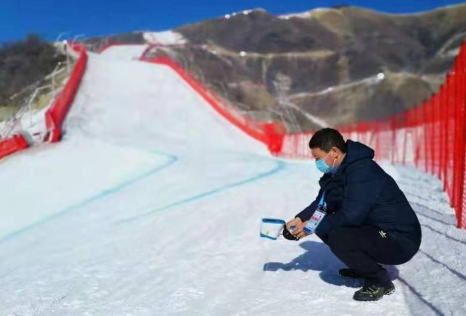
Under outdoor conditions, due to meteorological factors such as temperature and wind speed, the surface of snow will take on different forms. In the Winter Olympics ski jumping, alpine skiing and other snow sports competition, different snow surface temperatures and states will make athletes have different feelings, directly affecting the performance of racing competition.
The handheld snow temperature snow observation instrument designed by the 23 Aerospace New Meteorological Company of the Second Academy of Aerospace Science and Industry of China realizes that the snow surface information can be obtained by raising the hand. The instrument is equipped with a variety of high-precision sensors such as infrared temperature measurement, area array laser ranging, intelligent image, ambient light sensing, etc., which can automatically identify four kinds of snow forms: powdery snow, shell snow, ice snow and slurry snow, and detect the real-time temperature of snow.

The three-dimensional vision of structured light in the intelligent image sensor of the snow temperature snow-like observer is the secret of the instrument's ability to identify snow-like shapes autonomously. The principle is to project the encoded optical pattern on the snow surface to be measured, combine the pattern distortion with the ranging information, calculate the plane and depth information of the detection area, and construct the three-dimensional shape of the snow surface. Through feature analysis and modeling through artificial intelligence technology, the traits of the object to be measured can be identified. The instrument also supports Bluetooth and 5G communication, real-time positioning, online map recall coordinate data, can generate data messages and capture images with one click to meet the needs of refined observation on the field.
Photo courtesy of 23 Institutes of China Aerospace Science and Industry
Source Beijing Daily Client | Reporter Liu Suya
Edited by Wang Qiong
Process Editor Liu Weili