Video loading...
↑ Click to watch the video
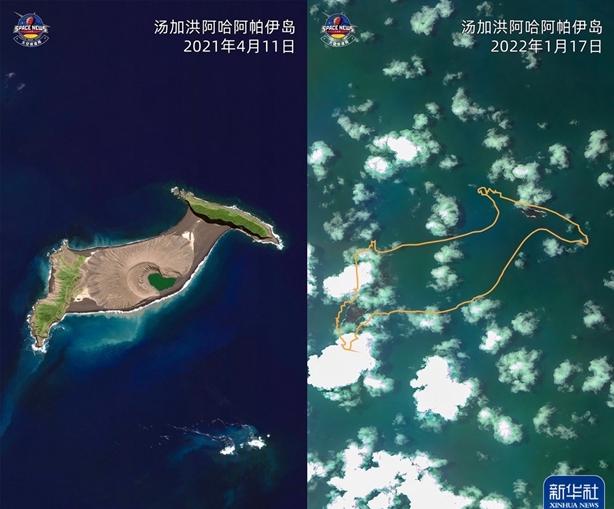
The submarine volcano of Hong Aha Apai Island in the South Pacific island nation of Tonga erupted violently on January 14 and 15. Multinational experts believe that this may be the world's largest submarine volcanic eruption in 30 years.
From the satellite cloud map, the topography of the island has changed dramatically before and after the volcanic eruption.
This is what Hon Aha Apay Island once looked like — a photo taken by New Zealand volcanologist Shane Cronin during a november 2015 expedition to the island. ↓

↑ The green estuary is the crater of the island, located in the middle of the island. (Go to the satellite image to see, very clear)
According to the analysis of a number of experts in Australia and New Zealand, the tsunami caused by the submarine volcanic eruption is huge, and the volcanic ash will have different degrees of impact on the surrounding atmosphere, ocean currents, fresh water, agriculture and people's health, and the specific situation needs to be further evaluated.
Photo courtesy of: China Meteorological Administration Xinhua News Agency Satellite News Laboratory
Shane Kronen Guo Lei
Coordinator: Wu Wei
Editors: Wu Jingdan, Pan Siwei, Qi Xiaoyi, Du Juanjuan
Video: Qi Xiaoyi
Xinhua News Agency Photography Department Satellite News Laboratory co-produced
Xinhua News Agency's international communication integration platform