At noon on December 13, some netizens noticed strange clouds outside the window during the flight - photos taken by netizens show that when flying over the south, the light and thin clouds and the cloudless area are "clearly separated", with clear and sharp boundaries, which is quite special. In fact, in addition to looking at it from the air, netizens in many places today do see similar clouds with clear edges from the ground, which clearly separate the sky.
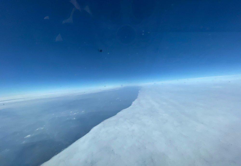
Today's cloud in the south, from Weibo netizen @ runway 01 can take off
Then some netizens will ask: What kind of weather is this? Is the weather going to get worse? This situation is called yin and yang days, and from the satellite cloud map, you can actually see the strange clouds in the southern region of china today. On the high-definition visible light satellite cloud map at noon today, it can be noted that there are large areas of low clouds in the southwest region of China, most of which have clear boundaries, and these boundaries have formed a "yin and yang day" with clear boundaries on the ground.

Does that mean that the rain in the south is about to begin? Yin and yang days are actually the humidity fronts produced by the upheaval of local humidity, which is the product of the confrontation of local dry and humid air masses, and the air masses with greater humidity form thin clouds. In these two days, after the cold air went south, the low-altitude water vapor and cold air masses in the southwest region of China today confronted each other, thus forming a clear boundary in many places, resulting in a yin-yang sky landscape.
From the current point of view, the next subtropical high pressure in the western Pacific Ocean has strengthened, in this case, warm and humid water vapor will also be pulled by the subtropical high pressure to strengthen again. According to the forecast of the supercomputer, by December 15, the low-middle and low altitudes in the south of China will blow a large-scale southerly wind, which is the result of the large-scale northward movement of marine water vapor.
In this way, the conditions for widespread rain in the south of our country will once again appear. The forecast of the Central Meteorological Observatory believes that starting from December 15, most of the eastern part of the Qinghai-Tibet Plateau in the south of China will have a wide range of rainy weather, especially on December 16, the rainy range in the southern region of China will reach the largest in the near future, from the yunnan-Guichuan-Chongqing in the west to the Jiangsu, Zhejiang, Shanghai, and Anhui in the east, it will be fully shrouded in rain, and the southern coastal Guangxi Guangdong Fujian is no exception this time, and more than ten provinces in the south will have rainfall. However, the intensity of this rainfall is not large, more than a dozen provinces will basically be dominated by light rain, for the recent rainfall in Fujian, Guangxi, Guangdong and other places, this rain is actually a good thing.